Unrestricted Use
Public Domain
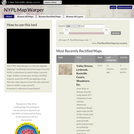
The NYPL Map Warper is a tool for digitally aligning ("rectifying") historical maps from the NYPL's collections to match today's precise maps. Visitors can browse already rectified maps or assist the NYPL by aligning a map. Please reference the tutorial video to learn how to begin warping maps. Over 20,000 digital maps are available for rectification. Maps range from 1544 to 1980 in their date of creation, and range geographically from the international to neighborhood maps of New York City.
- Subject:
- Physical Geography
- Physical Science
- Material Type:
- Diagram/Illustration
- Interactive
- Provider:
- New York Public Library
- Provider Set:
- New York Public Library Map Warper
- Date Added:
- 01/01/2012