Updating search results...

Search Resources

216 Results

View
Selected filters:
  • tectonics
2004 Asian Earthquake and Tsunami Disaster Project
Conditional Remix & Share Permitted
CC BY-NC-SA
Rating
0.0 stars

This is a problem-based learning (PBL) group jigsaw activity. The scenario is:
Students are employees of a unit of the United Nations responsible for coordinating disaster relief after a major disaster (the 2004 Asian Earthquake and Tsunami) occurs. The agency needs to understand the situation in each country so that it can coordinate the work of various governments and nongovernmental organizations (NGOs) working in the affected area.

Students are divided into Expert Groups (related to academic specialties such as Economics, Medicine, Political Science, Earth Science, etc.) and spend several days researching their topics. Students are then reassigned to one of seven or eight Country Groups, based on the countries most affected by the disaster. Each country group needs someone representing each expert group. In the scenario, these groups correspond to task forces that must determine what the situation is in each country and try to assess the current need for international assistance.

Students research their country, using internet resources, especially the CIA World Factbook and ReliefWeb, the information coordination website of the United Nations. At a large-group roundtable discussion, each group presents what it has found about its assigned country. As a final product, each student writes an individual report summarizing findings and making recommendations for disaster assistance.

(Note: this resource was added to OER Commons as part of a batch upload of over 2,200 records. If you notice an issue with the quality of the metadata, please let us know by using the 'report' button and we will flag it for consideration.)
Subject:
Biology
Life Science
Oceanography
Physical Science
Material Type:
Activity/Lab
Homework/Assignment
Provider:
Science Education Resource Center (SERC) at Carleton College
Provider Set:
Teach the Earth
Author:
Char Bezanson
Date Added:
08/30/2020
Active Tectonics Field Trip
Conditional Remix & Share Permitted
CC BY-NC-SA
Rating
0.0 stars

By far most field trips in structural geology and regional tectonics do NOT take place in large urban centers with a trip focus on mitigation of hazards. What is described here is an example of the instructional and learning opportunities associated with active tectonic examination of large population centers.

ACTIVE TECTONICS, HAZARDS, ACTIVE TECTONICS AND SOCIETY, URBAN GEOLOGY, EARTHQUAKES

(Note: this resource was added to OER Commons as part of a batch upload of over 2,200 records. If you notice an issue with the quality of the metadata, please let us know by using the 'report' button and we will flag it for consideration.)
Subject:
Biology
Life Science
Physical Science
Physics
Material Type:
Activity/Lab
Provider:
Science Education Resource Center (SERC) at Carleton College
Provider Set:
Teach the Earth
Author:
George Davis, University of Arizona
Date Added:
09/01/2019
Advanced steronet -finding rotation axes
Conditional Remix & Share Permitted
CC BY-NC-SA
Rating
0.0 stars

Using stereonets to find rotation axes of tilted planes. Paleomagnetic vectors used as indicators of rotations of dikes and planes.

(Note: this resource was added to OER Commons as part of a batch upload of over 2,200 records. If you notice an issue with the quality of the metadata, please let us know by using the 'report' button and we will flag it for consideration.)
Subject:
Biology
Life Science
Mathematics
Measurement and Data
Material Type:
Activity/Lab
Provider:
Science Education Resource Center (SERC) at Carleton College
Provider Set:
Teach the Earth
Author:
Steve Hurst
Date Added:
08/29/2019
Applying Lessons Learned to the Volcanic Risk at Mt. Rainier
Conditional Remix & Share Permitted
CC BY-NC-SA
Rating
0.0 stars

In this jigsaw-method activity on subduction zone volcanism, students apply lessons learned from four historic eruptions to the volcanic hazards associated with Mt. Rainier in the Pacific Northwest.

(Note: this resource was added to OER Commons as part of a batch upload of over 2,200 records. If you notice an issue with the quality of the metadata, please let us know by using the 'report' button and we will flag it for consideration.)

Subject:
Biology
Career and Technical Education
Environmental Studies
Geology
Geoscience
Life Science
Physical Science
Material Type:
Activity/Lab
Provider:
Science Education Resource Center (SERC) at Carleton College
Provider Set:
Teach the Earth
Author:
Laurel Goodell
Date Added:
09/28/2022
Architectural Construction and Computation
Conditional Remix & Share Permitted
CC BY-NC-SA
Rating
0.0 stars

This class investigates the use of computers in architectural design and construction. It begins with a pre-prepared design computer model, which is used for testing and process investigation in construction. It then explores the process of construction from all sides of the practice: detail design, structural design, and both legal and computational issues.

Subject:
Applied Science
Architecture and Design
Engineering
Material Type:
Full Course
Provider Set:
MIT OpenCourseWare
Author:
Sass, Lawrence
Turkel, Joel
Date Added:
09/01/2005
Architectural Design: Intentions
Conditional Remix & Share Permitted
CC BY-NC-SA
Rating
0.0 stars

This is the second undergraduate design studio. It introduces a full range of architectural ideas and issues through drawing exercises, analyses of precedents, and explored design methods. Students will develop design skills by conceptualizing and representing architectural ideas and making aesthetic judgments about building design. Discussions regarding architecture’s role in mediating culture, nature and technology will help develop the students’ architectural vocabulary.

Subject:
Applied Science
Architecture and Design
Material Type:
Full Course
Provider Set:
MIT OpenCourseWare
Author:
Lukez, Paul
Date Added:
02/01/2004
Architectural Design, Level III: A Student Center for MIT
Conditional Remix & Share Permitted
CC BY-NC-SA
Rating
0.0 stars

This studio will investigate the social, programmatic, tectonic and phenomenological performance and character of a student gathering place on the MIT campus. Whether it is simply for socializing or for more specific events, the student gathering place will serve as a refuge from the vigorous educational environment of the Institute, and it will reinforce a critical sense of “place” through the almost logical organization of its program. The place will foster a casual discovery of “being”: a reflection upon the student’s own existence based upon participation in group events and an intellectual attitude toward acting. To create a space that inspires, rather than imposes: such a discovery is the foremost challenge of this studio.

Subject:
Applied Science
Architecture and Design
Material Type:
Full Course
Provider Set:
MIT OpenCourseWare
Author:
Domeyko, Fernando
Date Added:
09/01/2004
Architectural Design, Level II: Material Essence: The Glass House
Conditional Remix & Share Permitted
CC BY-NC-SA
Rating
0.0 stars

The theme that unites the Level II studios in the fall semester is a focus upon the ‘making of architecture and built form’ as a tectonic, technical and materially driven endeavor. It is a design investigation that is rooted in a larger culture of materiality and the associated phenomena, but a study of the language and production of built form as an integrated response to the conceptual proposition of the project. The studio will look to works of architecture where the material tectonic and its resultant technology or fabrication become instrumental to the realization of the ideas, in whatever form they may take. This becomes the ‘art of technology’ – suggesting a level of innovation and creative manipulation as part of the design process to transform material into a composition of beauty and poetry as well as environmental control. In this regard the studio will look to the works and design processes of a number of architects including Shigeru Ban, Peter Zumthor, Herzog and deMeuron, Kazuyo Sejima, Richard Horden, Rick Joy and Glenn Murcutt among others.

Subject:
Applied Science
Architecture and Design
Material Type:
Full Course
Provider Set:
MIT OpenCourseWare
Author:
Scott, Andrew
Date Added:
09/01/2003
Architectural Design, Level II: Material and Tectonic Transformations: The Herreshoff Museum
Conditional Remix & Share Permitted
CC BY-NC-SA
Rating
0.0 stars

This semester students are asked to transform the Hereshoff Museum in Bristol, Rhode Island, through processes of erasure and addition. Hereshoff Manufacturing was recognized as one of the premier builders of America’s Cup racing boats between 1890’s and 1930’s. The studio, however, is about more than the program. It is about land, water, and wind and the search for expressing materially and tectonically the relationships between these principle conditions. That is, where the land is primarily about stasis (docking, anchoring and referencing our locus), water’s fluidity holds the latent promise of movement and freedom. Movement is activated by wind, allowing for negotiating the relationship between water and land.

Subject:
Applied Science
Architecture and Design
Material Type:
Full Course
Provider Set:
MIT OpenCourseWare
Author:
Lukez, Paul
Date Added:
09/01/2003
Architectural Design, Level II: New Orleans Studio
Conditional Remix & Share Permitted
CC BY-NC-SA
Rating
0.0 stars

The project for this studio is to design a demonstration project for a site near the French Quarter in New Orleans. The objectives of the project are the following:

To design more intense housing, community, educational and commercial facilities in four to six story buildings.
To explore the “space between” buildings as a way of designing and shaping objects.
To design at three scales - dwelling, cluster and overall.
To design dwellings where the owners may be able to help build and gain a skill for employment.
To provide/design facilities that can help the residents to gain education and skills.

Subject:
Applied Science
Architecture and Design
Material Type:
Full Course
Provider Set:
MIT OpenCourseWare
Author:
Wampler, Jan
Date Added:
02/01/2006
Architecture Design, Level II: Cuba Studio
Conditional Remix & Share Permitted
CC BY-NC-SA
Rating
0.0 stars

This architectural studio will have one main project for the semester: to explore the issues surrounding the redesign of an area in Havana, Cuba. It is a typical area about the size of a Law of Indies block that presently has a mix of housing, work, and shopping, in buildings that need to be replaced and others that need to be rehabilitated. There is also vacant land, and buildings that are unused. Part of the blocks front on the Malecon, the street next to the water. The other edge fronts onto a typical neighborhood. The intention is to study the culture through an understanding of one area of Havana and then design an “echo” in architectural form. The design will include public space as well as a mix of buildings: some new, some rehabilitated.

Subject:
Anthropology
Applied Science
Architecture and Design
Social Science
Material Type:
Full Course
Provider Set:
MIT OpenCourseWare
Author:
Wampler, Jan
Date Added:
02/01/2004
Architecture Studio: Building in Landscapes
Conditional Remix & Share Permitted
CC BY-NC-SA
Rating
0.0 stars

This subject introduces skills needed to build within a landscape establishing continuities between the built and natural world. Students learn to build appropriately through analysis of landscape and climate for a chosen site, and to conceptualize design decisions through drawings and models.
This class was taught concurrently with course 4.125A. Some of the assignments are the same, some are different, and the sites for the final project are different. But since they were taught in tandem, it would be useful to look at both together.

Subject:
Applied Science
Architecture and Design
Material Type:
Full Course
Provider Set:
MIT OpenCourseWare
Author:
Wampler, Jan
Date Added:
09/01/2005
Architecture Studio: Building in Landscapes
Conditional Remix & Share Permitted
CC BY-NC-SA
Rating
0.0 stars

This subject introduces skills needed to build within a landscape establishing continuities between the built and natural world. Students learn to build appropriately through analysis of landscape and climate for a chosen site, and to conceptualize design decisions through drawings and models.
This class was taught concurrently with 4.125B. Some of the assignments are the same, some are different, and the sites for the final project are different. But since they were taught in tandem, it would be useful to look at both together.

Subject:
Applied Science
Architecture and Design
Material Type:
Full Course
Provider Set:
MIT OpenCourseWare
Author:
Joslin, Alan
Date Added:
09/01/2005
Architecture Studio: Intentions
Conditional Remix & Share Permitted
CC BY-NC-SA
Rating
0.0 stars

This is the second undergraduate design studio. It introduces a full range of architectural ideas and issues through drawing exercises, analyses of precedents, and explored design methods. Students will develop design skills by conceptualizing and representing architectural ideas and making aesthetic judgments about building design. Discussions regarding architecture’s role in mediating culture, nature and technology will help develop the students’ architectural vocabulary.

Subject:
Applied Science
Architecture and Design
Material Type:
Full Course
Provider Set:
MIT OpenCourseWare
Author:
Turkel, Joel
Date Added:
02/01/2005
Assesing the angle of subduction using GeoMapApp
Conditional Remix & Share Permitted
CC BY-NC-SA
Rating
0.0 stars

This activity has students determine the angle of subduction using GeoMapApp. Students use datasets available within GeoMapApp to examine the influence of the age of oceanic lithosphere and convergence rate on the angle of subduction. These datasets include: earthquakes (depth, magnitude, etc), subduction interface (based on earthquake data), convergence rate, and age of oceanic lithosphere.

(Note: this resource was added to OER Commons as part of a batch upload of over 2,200 records. If you notice an issue with the quality of the metadata, please let us know by using the 'report' button and we will flag it for consideration.)
Subject:
Biology
Life Science
Physical Science
Physics
Material Type:
Activity/Lab
Provider:
Science Education Resource Center (SERC) at Carleton College
Provider Set:
Teach the Earth
Author:
Rory McFadden
Date Added:
09/01/2020
Beartooth Highway Field Trip and Activities
Conditional Remix & Share Permitted
CC BY-NC-SA
Rating
0.0 stars

During the course of the day, students examine the high-grade metasupracrustal rocks, related gneisses, and the late Archean granitoids and mafic dikes. We have prepared a number of exercises that might be done with classes at different levels. Depending on the background and preparation of your class you might want to emphasize different learning skills specific to the class level: observation, interpretation, integration (i.e. multiple lines of evidence focused on a given problem), and synthesis (i.e. relationship to the "big picture", drawing from the corpus of geologic knowledge). We have also prepared a compilation of our key scientific results, but these are under seal and we'd like you to do the exercises first as if you were students before taking a look at the supporting evidence.

(Note: this resource was added to OER Commons as part of a batch upload of over 2,200 records. If you notice an issue with the quality of the metadata, please let us know by using the 'report' button and we will flag it for consideration.)
Subject:
Biology
Life Science
Material Type:
Activity/Lab
Provider:
Science Education Resource Center (SERC) at Carleton College
Provider Set:
Teach the Earth
Author:
Dave Mogk
Date Added:
08/29/2019
Beijing Urban Design Studio
Conditional Remix & Share Permitted
CC BY-NC-SA
Rating
0.0 stars

This is the 20th anniversary of the Beijing Urban Design Studio, which is a joint program between the MIT and Tsinghua University Schools of Architecture and Planning. The goal of the studio is to foster international cooperation through the undertaking of a joint urban design and planning initiative in the city of Beijing involving important, often controversial, sites and projects. Since 1995, almost 250 MIT and Tsinghua University students and faculty have participated in this annual studio, making it one of the most successful and enduring international academic programs between China and the U.S. It has received the Irwin Sizer Award from MIT for outstanding innovation in education. The studio takes place over five weeks in June and July including several weeks in residence at Tsinghua University and two brief study tours to locations and projects that inform the work. It will include 18-20 MIT and 10-15 Tsinghua Architecture and Planning students. The Beijing City Planning Institute, responsible for strategic planning in the city, participates in the studio as the client.

Subject:
Applied Science
Architecture and Design
Economics
Political Science
Social Science
Material Type:
Full Course
Provider Set:
MIT OpenCourseWare
Author:
Chang, Yung
Du, Juan
Frenchman, Dennis
Wampler, Jan
Zegras, Pericles
Date Added:
06/01/2006
Binary eutectic in-class exercise (Di-An)
Conditional Remix & Share Permitted
CC BY-NC-SA
Rating
0.0 stars

In this activity students work through a binary eutectic phase diagram in small groups and try to determine a set of generalizations that explain the behavior of such systems (e.g., "the first liquid produced upon heating is always the eutectic composition").

(Note: this resource was added to OER Commons as part of a batch upload of over 2,200 records. If you notice an issue with the quality of the metadata, please let us know by using the 'report' button and we will flag it for consideration.)
Subject:
Biology
Chemistry
Life Science
Physical Science
Physics
Material Type:
Activity/Lab
Data Set
Lesson Plan
Provider:
Science Education Resource Center (SERC) at Carleton College
Provider Set:
Teach the Earth
Author:
Allen Glazner
Date Added:
09/05/2019
Cenozoic Volcanic History of the Western U.S.
Conditional Remix & Share Permitted
CC BY-NC-SA
Rating
0.0 stars

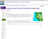
In this activity, students view a Quicktime video animation based on data from the North American Volcanic and Intrusive Rock Database (NAVDAT) to learn about the history of volcanism in the western U.S. during the last 65 million years. Students are guided through the complex data-rich animation with a series of instructions and study questions which highlight time-space-composition relationships and link to plate tectonics.

(Note: this resource was added to OER Commons as part of a batch upload of over 2,200 records. If you notice an issue with the quality of the metadata, please let us know by using the 'report' button and we will flag it for consideration.)
Subject:
Biology
Geology
Life Science
Physical Science
Material Type:
Activity/Lab
Data Set
Lesson Plan
Provider:
Science Education Resource Center (SERC) at Carleton College
Provider Set:
Teach the Earth
Author:
Kent Ratajeski
Date Added:
12/10/2020
Characterizing Plate Boundaries
Conditional Remix & Share Permitted
CC BY-NC-SA
Rating
0.0 stars

To prepare for this exercise students read about the processes that operate at plate boundaries and how they are related to the distinct patterns of seismicity, volcanism, surface elevations (e.g., ridges versus trenches), and seafloor ages characteristic of different boundary types. During the week the assignment is available online, students have access to:
(1) an index map that locates three boundaries they are to study; and
(2) four maps from Sawyer's Discovering Plate Boundaries website that provide the data mentioned above.Â

Student tasks are to:Â
(1) document patterns in each type of data along the three targeted boundaries; andÂ
(2) use these observations in conjunction with their understandings of the processes that operate along different types of boundaries to decide whether each of the targeted sites is most likely to be a divergent, convergent, or shear boundary.Â

This activity gives students practice in map reading, interpreting the likely tectonic setting of a boundary by pulling together constraints from several types of data, and collaborating with their classmates in an online environment. The activity also provides a foundation for understanding a wide range of phenomena that are discussed later in the semester in the context of plate tectonic processes.
Modifications on this activity from the community

Show More
Show LessContributed by Tom Hickson
I also use a version of Dale Sawyer's Discovering Plate Boundaries exercise in an online course. I used the basic idea of this activity and moved in onto Canvas, our LMS. Here is my adaptation of the activity, with maps and examples, illustrating how I have implemented it:

Description of the assignment: Student handout, ONLINE_ Characterizing Plate Boundaries (adapted).pdf (Acrobat (PDF) 166kB Feb19 21)
Answer sheet for students to record observations and interpretations: Target Boundaries: Student answer sheet (Acrobat (PDF) 1MB Feb19 21)
World map with Target Boundaries (Acrobat (PDF) 483kB Feb19 21)

Maps of the "target boundaries" -- my selected areas of focus for the exercise:


Example map, Boundary 3

Provenance: Thomas A. Hickson, University of St. Thomas
Reuse: This item is offered under a Creative Commons Attribution-NonCommercial-ShareAlike license http://creativecommons.org/licenses/by-nc-sa/3.0/ You may reuse this item for non-commercial purposes as long as you provide attribution and offer any derivative works under a similar license.


Example map, Boundary 2

Provenance: Thomas A. Hickson, University of St. Thomas
Reuse: This item is offered under a Creative Commons Attribution-NonCommercial-ShareAlike license http://creativecommons.org/licenses/by-nc-sa/3.0/ You may reuse this item for non-commercial purposes as long as you provide attribution and offer any derivative works under a similar license.


Map example, boundary 1

Provenance: Thomas A. Hickson, University of St. Thomas
Reuse: This item is offered under a Creative Commons Attribution-NonCommercial-ShareAlike license http://creativecommons.org/licenses/by-nc-sa/3.0/ You may reuse this item for non-commercial purposes as long as you provide attribution and offer any derivative works under a similar license.

Teaching Tips
Adaptations that allow this activity to be successful in an online environment
Sawyer's Discovering Plate Boundaries is a jigsaw exercise in which students collaboratively develop an empirical classification of plate boundaries by first studying an individual data set (e.g., seismicity) and then working as part of a multidisciplinary team to develop a composite classification for the boundaries of a single plate using several types of data. In order for the classification to be truly empirical, students are not introduced to the "traditional" classification of plate boundaries till the end of the exercise.Â

In adapting this assignment to the online environment I have:

(1) asked students to prepare by becoming familiar with the standard classification of plate boundaries and the processes that operate at them;Â
(2) limited their work to three targeted boundaries of different types; andÂ
(3) provided guidance about which features to look for in the each data set. I have found that these modifications help online students, who often work alone "on their own schedules", to avoid getting "lost" and frustrated with the assignment and to compensate for the lack of collaborative input they would receive in a classroom setting.

Elements of this activity that are most effective
The success of this exercise is really seems to depend on how well a student follows the directions. If a student learns about the geologic differences among plate boundaries, makes careful observations, and thoughtfully compares his or her observations to the expected patterns he or she typically does quite well based on answers to the follow-up questions. If, on the other hand, a student simply looks up the types of the targeted boundaries on a map and then attempts to "back out" the observations that he or she thinks should fit, the result is often inconsistency and a poor score on the questions. (I can often tell which approach a student is taking based on the queries they post to the discussion board, but rarely seem to be able to get those who are trying to work backwards through the assignment to change direction.)
Recommendations for other faculty adapting this activity to their own course:
To date my experience developing an engaging online exercise to help students learn the principles of plate tectonics has only been partly successful. I think that having such an exercise is critical, however, because this topic provides the framework for so much of what we learn in the geosciences. Based on my efforts to adapt elements of Discovering Plate Boundaries to an online environment I would offer three recommendations.

(1) Provide examples. Confronted with an unfamiliar map students are sometimes confused when asked to decide if seafloor age, for example, is uniform or variable along the length of a boundary. Showing them what you mean using snapshots from a map can often clear questions like this up quickly. Similarly, for written work a single example that gives them a clear sense of "what you're looking for" and can often head off a lot of questions.
(2) Choose the boundaries you ask students to study carefully. The scarcity of documented volcanism along a mid-ocean ridge or the burial of seafloor age belts by sediment along a trench can result in student observations that are correct, but problematic for correctly assessing the nature of a boundary.
(3) Stay on top of student questions and comments, and be prepared to make well-publicized "mid-course corrections" if something you thought was clear turns out to be misunderstood. These minor corrections happen naturally in face-to-face classes but can require real diligence to catch and correct in the online environment.

(Note: this resource was added to OER Commons as part of a batch upload of over 2,200 records. If you notice an issue with the quality of the metadata, please let us know by using the 'report' button and we will flag it for consideration.)
Subject:
Biology
Life Science
Material Type:
Activity/Lab
Provider:
Science Education Resource Center (SERC) at Carleton College
Provider Set:
Teach the Earth
Author:
Bill Hirt
Date Added:
02/19/2021