Updating search results...

Search Resources

59 Results

View
Selected filters:
  • hurricanes
Atmospheric and Ocean Circulations
Conditional Remix & Share Permitted
CC BY-NC-SA
Rating
0.0 stars

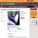
In this course, we will look at many important aspects of the circulation of the atmosphere and ocean, from length scales of meters to thousands of km and time scales ranging from seconds to years. We will assume familiarity with concepts covered in course 12.003 (Physics of the Fluid Earth). In the early stages of the present course, we will make somewhat greater use of math than did 12.003, but the math we will use is no more than that encountered in elementary electromagnetic field theory, for example. The focus of the course is on the physics of the phenomena which we will discuss.

Subject:
Atmospheric Science
Oceanography
Physical Science
Material Type:
Full Course
Provider:
MIT
Provider Set:
MIT OpenCourseWare
Author:
Plumb, R.
Date Added:
02/01/2004
Atmospheric and Ocean Circulations
Conditional Remix & Share Permitted
CC BY-NC-SA
Rating
0.0 stars

In this course, we will look at many important aspects of the circulation of the atmosphere and ocean, from length scales of meters to thousands of km and time scales ranging from seconds to years. We will assume familiarity with concepts covered in course 12.003 (Physics of the Fluid Earth). In the early stages of the present course, we will make somewhat greater use of math than did 12.003, but the math we will use is no more than that encountered in elementary electromagnetic field theory, for example. The focus of the course is on the physics of the phenomena which we will discuss.

Subject:
Atmospheric Science
Physical Science
Material Type:
Full Course
Provider Set:
MIT OpenCourseWare
Author:
Plumb, R.
Date Added:
02/01/2004
Bomb Cyclones - They're Explosive!
Conditional Remix & Share Permitted
CC BY-NC-SA
Rating
0.0 stars

Storms can have devastating impacts on coastal communities. Typically, tropical storms like hurricanes get the most attention, but there are other types of storms that occur at more northern latitudes that can be just as destructive. For example, in January of 2018, Winter Storm Grayson caused more than 300,000 power outages and $1.1 billion in damage, and resulted in 22 confirmed casualties along the eastern seaboard. In this module, students will learn how barometric pressure changes during a storm, analyze the effect of storms on oceanographic variables, classify a storm as a bomb cyclone, and compare a bomb cyclone to a hurricane. Ultimately students will use their quantitative reasoning skills to manipulate and visualize data during storms in the northeastern United States.

(Note: this resource was added to OER Commons as part of a batch upload of over 2,200 records. If you notice an issue with the quality of the metadata, please let us know by using the 'report' button and we will flag it for consideration.)

Subject:
Biology
Career and Technical Education
Environmental Studies
Geology
Life Science
Mathematics
Measurement and Data
Oceanography
Physical Science
Statistics and Probability
Material Type:
Activity/Lab
Provider:
Science Education Resource Center (SERC) at Carleton College
Provider Set:
Teach the Earth
Author:
Jacqui Jenkins-Degan, Marine Technology Program, Cape Fear Community College
Date Added:
09/19/2022
Climate Change and Atlantic Hurricanes: A GIS Inquiry
Conditional Remix & Share Permitted
CC BY-NC-SA
Rating
0.0 stars

Students are asked to make a general hypothesis about whether Atlantic hurricane have been changing over time in response to recent climate change. It is expected that at an introductory level with only the most basic background instruction, students will focus on numbers, locations, or intensities of hurricanes. Example hypotheses might be

The numbers of hurricanes are increasing (or decreasing)
Hurricanes are becoming more intense
Hurricanes are forming in new locations
Hurricane season is lengthening

They are then asked to develop more pointed questions that they can test. Some example questions for each hypothesis are given below:

Hypothesis 1 might lead to questions like "More hurricanes (or tropical storms) are forming each year" or "More hurricanes are striking land each year."
Hypothesis 2 might lead to questions such as "The maximum wind speed for hurricanes is increasing" or "The minimum barometric pressure is decreasing."
Hypothesis 3 might lead to questions like "Hurricanes are forming further north."
Hypothesis 4 might lead to questions such as "Hurricanes are forming earlier and later."

To answer these questions would require students to understand some background about hurricanes, like how many typically occur in the past (which leads to questions about data collection and observing hurricanes), how hurricane intensity is measured, or at what latitudes hurricanes typically form.

Then they are given a table or map data (derived from NOAA GIS data of hurricane tracks and intensity) to test their hypotheses.

The results of their inquiries and data collection will be shared with the class as parts of small groups initially, and will culminate as a small group presentation.

(Note: this resource was added to OER Commons as part of a batch upload of over 2,200 records. If you notice an issue with the quality of the metadata, please let us know by using the 'report' button and we will flag it for consideration.)
Subject:
Applied Science
Biology
Environmental Science
Life Science
Mathematics
Measurement and Data
Oceanography
Physical Science
Material Type:
Activity/Lab
Provider:
Science Education Resource Center (SERC) at Carleton College
Provider Set:
Teach the Earth
Author:
Chris Van de Ven
Date Added:
08/24/2019
Climate Kids: El Niño Quiets Monster Storms
Read the Fine Print
Rating
0.0 stars

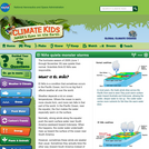
The brief introduction to El Niño presented in this article also offers insights into its role during the quiet 2009 hurricane season. This article is part of the Climate Kids website, a NASA education resource featuring articles, videos, images and games focused on the science of climate change.

Subject:
Atmospheric Science
Ecology
Forestry and Agriculture
Geoscience
History
History, Law, Politics
Life Science
Oceanography
Physical Science
Material Type:
Lecture
Provider:
NASA
Provider Set:
NASA Wavelength
Date Added:
11/05/2014
Confirmation of the IPCC Prediction re: Increased Storminess
Conditional Remix & Share Permitted
CC BY-NC-SA
Rating
0.0 stars

This activity represents a culmination project for this unit by means of which students can assess whether the IPCC prediction of increased storminess as an outcome of global warming survives testing. For the previous three weeks students will have conducted several inquiry-based group activities designed to introduce and reinforce fundamental meteorology/climatology concepts. In this 2-day project, students access online AVHRR SST imagery, as well as tabulated numeric data regarding historical North American tropical cyclones, import data into Excel for interpretation and analysis, and submit two group reports.

(Note: this resource was added to OER Commons as part of a batch upload of over 2,200 records. If you notice an issue with the quality of the metadata, please let us know by using the 'report' button and we will flag it for consideration.)
Subject:
Applied Science
Biology
Environmental Science
Life Science
Mathematics
Measurement and Data
Oceanography
Physical Science
Statistics and Probability
Material Type:
Activity/Lab
Provider:
Science Education Resource Center (SERC) at Carleton College
Provider Set:
Teach the Earth
Author:
Robert Kuhlman
Date Added:
08/21/2020
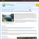
Consequences of Climate Change: Lessons about Water Availability and Extreme Weather
Conditional Remix & Share Permitted
CC BY-SA
Rating
0.0 stars

This article from the free online magazine Beyond Weather and the Water Cycle provides appropriate science lessons for Grades K-5. The focus is on acquainting young learners with climate-change concepts that are not too complex for their grade level and will not frighten them. In each issue, the magazine develops articles around one of the seven essential principles of climate science. The author believes early lessons about water availability and extreme weather events will prepare students for complex climate concepts they will encounter in later grades.

Subject:
Ecology
Education
Forestry and Agriculture
Geoscience
Life Science
Mathematics
Physical Science
Physics
Space Science
Material Type:
Lesson Plan
Teaching/Learning Strategy
Provider:
Ohio State University College of Education and Human Ecology
Provider Set:
Beyond Weather and the Water Cycle
Author:
Jessica Fries-Gaither
National Science Foundation
Date Added:
05/30/2012
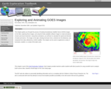
Earth Exploration Toolbook Chapter: Exploring and Animating GOES Images
Conditional Remix & Share Permitted
CC BY-NC-SA
Rating
0.0 stars

DATA: GOES Weather Images. TOOL: ImageJ. SUMMARY: Transform a time series of GOES images into an animation. Plot a storm track and determine storm speed.

(Note: this resource was added to OER Commons as part of a batch upload of over 2,200 records. If you notice an issue with the quality of the metadata, please let us know by using the 'report' button and we will flag it for consideration.)
Subject:
Atmospheric Science
Biology
Life Science
Physical Science
Material Type:
Activity/Lab
Data Set
Diagram/Illustration
Interactive
Lesson Plan
Provider:
Science Education Resource Center (SERC) at Carleton College
Provider Set:
Teach the Earth
Author:
Nick Haddad
Date Added:
04/13/2021
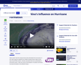
Earth System: El Niños Influence on Hurricane Formation
Read the Fine Print
Educational Use
Rating
0.0 stars

This video segment adapted from NASA's Goddard Space Flight Center explains how hurricanes develop and why there are fewer hurricanes in the Atlantic Ocean in strong El Niño years.

Subject:
Atmospheric Science
Physical Science
Material Type:
Diagram/Illustration
Lecture
Provider:
PBS LearningMedia
Provider Set:
PBS Learning Media: Multimedia Resources for the Classroom and Professional Development
Author:
National Science Foundation
WGBH Educational Foundation
Date Added:
12/17/2005
Essential Principle 7: Correlation to Standards and Curriculum Connections
Conditional Remix & Share Permitted
CC BY-SA
Rating
0.0 stars

This article identifies age-appropriate national science education content standards and curriculum connections for introducing complex concepts contained in Principle 7 of the Essential Principles of Climate Sciences. The principle describes consequences of climate changes on Earth systems and human lives. The content standards will help teachers determine appropriate topics for their students. A number of resources from the online magazine Beyond Weather and the Water Cycle are highlighted for their connection to the science curriculum in the early grades. In addition, the article identifies common misconceptions about weather and the water cycle often held by students.

Subject:
Ecology
Education
Forestry and Agriculture
Geoscience
Life Science
Mathematics
Physical Science
Physics
Space Science
Material Type:
Teaching/Learning Strategy
Provider:
Ohio State University College of Education and Human Ecology
Provider Set:
Beyond Weather and the Water Cycle
Author:
Kimberly Lightle
National Science Foundation
Date Added:
05/30/2012
Forecasting Lake Effect Snow in Lake Superior region
Conditional Remix & Share Permitted
CC BY-NC-SA
Rating
0.0 stars

This exercise is designed to present the realistic problems of forecasting weather. Lake effect snows are hard to forecast because they depend on information that isn't part of the regular set of information and involve some pretty specific things that integrate the location of the site with surrounding environment. Even places close by can get totally different forecasts. When you have a regional forecast, it doesn't really address lake effect snows, unless the forecaster really focuses. So the exercise aims to show the value of broad critical thinking in meteorology, and it is very dramatic, because the difference between 36 inches and whiteout and clear blue sky is undeniable. The exercise comes when students are 8 weeks into the class. The class is an AMS based class, which has already been described well in this workshop by Julie Snow from Slippery Rock. Our class is given in the fall semester and lake effect snow starts in October and is quite an issue in forecasts until April. The skills of a forecaster are tested, and you cannot use forecasts from nearby areas reliably. Finally, we live in a fantastic snow belt, so lake effect snow happens a lot. In a good year we get over 300 inches of snow, mostly at times that places nearby do not. You can drive to Houghton in the bright sun and be met by a wall of very active blizzard just a few miles out of town.

There are some excellent tutorials available from COMET, and outreach of the National Weather Service. I use one done by Greg Byrd, which is available online or in a power point format. There are a number of things that must be learned before forecasting. These include some fluid dynamics of plumes, latent heat, remote sensing, upper air mapping, and the use of models. We cannot cover all them completely. I try to introduce all these things and give people entry points into the juicy parts of these topics, but do not expect students to understand completely. One thing you can spend a long time on are the satellite images. Here is one, just to whet your interest: http://serc.carleton.edu/details/images/13586.html


I have the students make a list of the critical parameters they think might be needed for a successful lake effect forecast. This is a challenge to prepare, but the idea is to include things that are even marginally useful and to collect data to see what is most important. We get a list of parameters like this:


850 mb wind direction
850 mb temperature
Lake Superior surface temperature
fetch length
opposing bay?
Inversion layer height
topographic lift factor
wind shear evidence
upstream lake
upstream moisture factor
snow/ice cover issues


This list is pretty good, but deliberately not complete, and we encourage students to add other things they think might be important. The next step is to find where you can get this information. I have web data sources for most (see below), and some of them are interrelated. You can do this exercise for any site around Lake Superior or probably many other lakes as well. For specific sites, the fetch length, upstream lake and opposing bay information are obtainable directly from the wind direction if you have a good map (Google Earth). So a spreadsheet for parameters related to wind direction can be prepared in advance and these parameters can be immediately available from the wind direction. Nonetheless the issue of sources for all this stuff must be addressed in an effort that spans several hours. The use of models is needed to look into the future where possible.

Once students know what they are looking for and how to find it, the exercise starts its data collection. Every day or every 6 or 12 hours beginning when conditions get close to "LES favorable" students collect information on these LES predictors. They also make LES forecasts for each period and include that information in the spreadsheet. The next day the real snowfall data is added to the spreadsheet, and this can be used as validation data for the forecast. This data collection needs to be done for several weeks (November and December in my case, usually a good time for LES).

The data analysis is the most challenging part. Spreadsheet plots which test the sensitivity of various parameters singly and together are possible. There is a lot of sophistication possible if there is enough LES to analyze. Overall, results should be a good experience with imperfect data addressed to a real-time problem. Models and real data, remote sensing, and balloons are all integrated and there are quite obvious weaknesses.

On the final day of class student groups will compete by doing forecasting which employs the LES techniques. This might reflect the most recent snow event. A more important element of this submission will be their evaluation of LES prediction parameters. Not only do we consider the actual forecast, but we discuss which parameters were successful? Which are inconclusive? What suggestions for improved forecasts are possible from the experience? The format of this will be short presentations with time for discussion.

(Note: this resource was added to OER Commons as part of a batch upload of over 2,200 records. If you notice an issue with the quality of the metadata, please let us know by using the 'report' button and we will flag it for consideration.)
Subject:
Applied Science
Atmospheric Science
Biology
Environmental Science
Life Science
Mathematics
Measurement and Data
Physical Science
Material Type:
Activity/Lab
Provider:
Science Education Resource Center (SERC) at Carleton College
Provider Set:
Teach the Earth
Author:
Bill Rose
Date Added:
08/24/2019
GPM: Hurricanes Beyond the Tropics
Read the Fine Print
Rating
0.0 stars

When New England was hit by Tropical Storm Irene in 2011, there was not a satellite monitoring tropical storms that far north; the Tropical Rainfall Measuring Mission (TRMM) was operating in a band between the 35-degree latitudes. The Global Precipitation Measurement (GPM) mission will change that. GPM will build upon TRMM's capacity by examining a larger swath of Earth with instruments that are more advanced and more sensitive. This video introduces the GPM satellite, its instruments and their capabilities.

Subject:
Atmospheric Science
Geoscience
Physical Science
Material Type:
Lecture
Provider:
NASA
Provider Set:
NASA Wavelength
Date Added:
11/05/2014
Global Cityscope - Disaster Planning and Post-Disaster Rebuilding and Recovery
Conditional Remix & Share Permitted
CC BY-NC-SA
Rating
0.0 stars

This class is designed to expose you to the cycles of disasters, the roots of emergency planning in the U.S., how to understand and map vulnerabilities, and expose you to the disaster planning in different contexts, including in developing countries.

Subject:
Applied Science
Atmospheric Science
Career and Technical Education
Engineering
Environmental Science
Environmental Studies
Physical Science
Social Science
Material Type:
Full Course
Provider:
MIT
Provider Set:
MIT OpenCourseWare
Author:
Abbanat, Cherie Miot
Date Added:
02/01/2017
Global Cityscope - Disaster Planning and Post-Disaster Rebuilding and Recovery
Conditional Remix & Share Permitted
CC BY-NC-SA
Rating
0.0 stars

This class is designed to expose you to the cycles of disasters, the roots of emergency planning in the U.S., how to understand and map vulnerabilities, and expose you to the disaster planning in different contexts, including in developing countries.

Subject:
Applied Science
Career and Technical Education
Engineering
Environmental Science
Environmental Studies
Social Science
Material Type:
Full Course
Provider:
MIT
Provider Set:
MIT OpenCourseWare
Author:
Abbanat, Cherie Miot
Date Added:
02/01/2017
Hurricane Investigation
Conditional Remix & Share Permitted
CC BY-NC-SA
Rating
0.0 stars

Students will be required to answer a series of simple questions for this assignment based on material covered in lecture. This assignment also allows students the experience of searching a website for more specific information about hurricane statistics that are not covered in lecture. Hurricane Katrina will be discussed in lecture. Students will see where Katrina falls relative to other major hurricanes while answering the questions.

(Note: this resource was added to OER Commons as part of a batch upload of over 2,200 records. If you notice an issue with the quality of the metadata, please let us know by using the 'report' button and we will flag it for consideration.)
Subject:
Applied Science
Atmospheric Science
Biology
Environmental Science
Life Science
Mathematics
Measurement and Data
Physical Science
Material Type:
Activity/Lab
Homework/Assignment
Provider:
Science Education Resource Center (SERC) at Carleton College
Provider Set:
Teach the Earth
Author:
Melinda Huff
Date Added:
11/24/2020
Hurricane Tracking
Conditional Remix & Share Permitted
CC BY-NC-SA
Rating
0.0 stars

This homework assignment is given in the first two weeks of class. Students receive one or two lectures that cover the topics of atmospheric layers, temperature and pressure profiles, concepts of atmospheric mass and pressure and measuring (i.e. dropsonde) instrumentation. At the beginning of each lecture I briefly show them the tropical update from the NOAA National Hurricane Center web site; if there is an active storm, I show where I go to get more info, such as the projected storm track and storm history (for example, from Intellicast Hurricane Tracking). Then, for this assignment, I reintroduce them to these hurricane information web sites and demonstrate how to find the historical data on tropical storms (such as from the Unisys Hurricane Data Archive), and how to copy and paste text data into word and/or excel, as a tab- or space-delimited file. I point out some problem areas with this data-grabbing method, such as headers that get lost from their associated data column or date information that may not format as dates.
I then hand out the assignment, which asks them to:

Find data on a current or recent (this year) tropical system, provide the name and year of the storm and the reference web site, and plot the wind speed and pressure variables against time. Students should label the axes and give a descriptive title to the chart.
Describe what they notice in the graphed data and if it seems believable (this allows students to decide if they have done the task correctly by using their understanding of the data).
Predict what will happen if the storm a) intensifies or b) weakens.
I then provide another data set (of any long-duration tropical storm that formed, weakened and later re-intensified) and ask them to go through the same process of plotting and interpretation.
I tell them that some future climate predictions are for more storms with lower central pressures and ask which of the two charts best represents that future scenario, and why.

(Note: this resource was added to OER Commons as part of a batch upload of over 2,200 records. If you notice an issue with the quality of the metadata, please let us know by using the 'report' button and we will flag it for consideration.)
Subject:
Applied Science
Atmospheric Science
Biology
Environmental Science
Life Science
Mathematics
Measurement and Data
Physical Science
Material Type:
Activity/Lab
Homework/Assignment
Provider:
Science Education Resource Center (SERC) at Carleton College
Provider Set:
Teach the Earth
Author:
Lisa Doner
Date Added:
11/24/2020
Hurricane and Severe Storm Lenticular
Read the Fine Print
Rating
0.0 stars

This resource is a 4 x 6" lenticular card on NASA's HS3 (Hurricane and Severe Storm Sentinel) aircraft mission, which will overfly tropical storms and hurricanes using NASA's Global Hawk Unmanned Aircraft Systems (UAS) in the Northern Atlantic, Caribbean, and Gulf of Mexico. These flights will improve our understanding of the processes that lead to the development of intense hurricanes. The mission will take place for one-month periods during the 2012, 2013, and 2014 Atlantic Basin hurricane seasons.

Subject:
Applied Science
Atmospheric Science
Engineering
Geoscience
Physical Science
Technology
Material Type:
Lecture
Provider:
NASA
Provider Set:
NASA Wavelength
Date Added:
11/05/2014
Hurricanes and Climate Change Educator Guide
Conditional Remix & Share Permitted
CC BY-NC-SA
Rating
0.0 stars

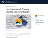
Hurricanes are a fact of life for millions of Americans each year, and billions more people around the world. What is a hurricane, and how can we prepare for them? Through a model and student-level data, students explore the factors influencing storm frequency and intensity. They also consider the language of storms, as well as steps to resilience. This guide is an extension of the TILclimate episode "TIL about hurricanes."

Subject:
Atmospheric Science
Physical Science
Material Type:
Lesson Plan
Provider:
MIT
Provider Set:
TILclimate Educator Hub
Date Added:
11/18/2022
Introduction to Texas Hurricanes
Conditional Remix & Share Permitted
CC BY-NC-SA
Rating
0.0 stars

Students graph data from 20th century hurricanes that affected the state of Texas. Along the way they answer questions that ask them to interpret what they see represented on the graphs.

(Note: this resource was added to OER Commons as part of a batch upload of over 2,200 records. If you notice an issue with the quality of the metadata, please let us know by using the 'report' button and we will flag it for consideration.)
Subject:
Biology
Geoscience
Life Science
Mathematics
Measurement and Data
Physical Science
Statistics and Probability
Material Type:
Activity/Lab
Provider:
Science Education Resource Center (SERC) at Carleton College
Provider Set:
Teach the Earth
Author:
Oney Fitzpatrick, Jim Jordan, and Jim Westgate - Lamar University, Beaumont, TX
Date Added:
08/23/2019