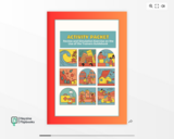
The activity packet is part of a trainers guide developed primarily for the use of the Local DRRM.
- Subject:
- Education
- Higher Education
- Material Type:
- Assessment
- Author:
- JB Salcedo
- Date Added:
- 09/08/2024

The activity packet is part of a trainers guide developed primarily for the use of the Local DRRM.
This short film uses graphics to provide an introduction to the physical causes of earthquakes, and to explore how the way we build and manage our cities determines their vulnerability to a seismic strike.
It was created with the UK GCSE and A' Level curricula in mind.

An interactive illustration about the Chernobyl Disaster which covers when and where did it occur, about the power plant, the death toll, the series of events, causes, compensation to the people, impact on people and environment, legislation passed on nuclear power plants and waste disposal in power plants, safety precautions passed after the disaster and the present scenario in Chernobyl and the areas around the reactor. It was made using the Mindomo app

Student groups are given captioned photographs of the Chernobyl Nuclear Power Plant facility and surrounding towns taken before and 28 years after the 1986 disaster. Based on the captions and clues in the images, they arrange them in sequential order. While viewing the completed sequence of images, students reflect on what it might have been like to be there, and ask themselves: what were people thinking, doing and saying at each point? This activity assists students in gaining an understanding of how devastating nuclear meltdowns can be, which underscores the importance of responsible engineering. It is recommended that this activity be conducted before the associated lesson, Nuclear Energy through a Virtual Field Trip.
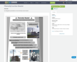
An infographic presentation on the chernobyl nuclear disaster
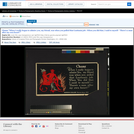
Poster showing a devil seated with his arm around the shoulders of Kaiser Wilhelm II, a devil-like figure who is holding a bloody sword; the Kaiser has a gloomy look on his face even though he is being praised by the devil. Barron Collier patriotic series No. 2.

City to City, as a class, will jump into the complexity of planning in New Orleans, a post-disaster city. City-to-City will ask how a post-disaster city grapple with its ideas of identity, what it is, who it represents, and how it projects its sense of self to residences, businesses, tourists, and to the outside world. In considering its people, how do city planners think about who lives where and why? At the same time, how can city planners celebrate a city’s history and its culture and how can these elements be woven into reconstruction? Students will travel from Cambridge to New Orleans over Spring Break to meet and consult with their alumni clients, and continue to work on projects.
When something is destroyed, does that actually help the economy by creating construction jobs? Do disasters like fires, floods, earthquakes, tornados, or tsunamis actually stimulate job growth? Only if people were planning to light their money on fire before having to spend it on reconstruction! This is what economists call the Broken Window Fallacy.
Looking for engaging content for your economics courses? The Institute for Humane Studies has curated this collection of educational resources to help economics professors enrich their curriculum. Find videos, interactive games, reading lists, and more on everything from opportunity costs to trade policy. This collection is updated frequently with new content, so watch this space!


This course introduces the theory and the practice of engineering ethics using a multi-disciplinary and cross-cultural approach. Theory includes ethics and philosophy of engineering. Historical cases are taken primarily from the scholarly literatures on engineering ethics, and hypothetical cases are written by students. Each student will write a story by selecting an ancestor or mythic hero as a substitute for a character in a historical case. Students will compare these cases and recommend action.
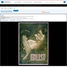
Poster showing a woman, a passenger from the Lusitania, submerged in water cradling an infant in her arms. Title from item. Issued by The Boston Public Safety Committee. Forms part of: Willard and Dorothy Straight Collection. Exhibited: American Treasures of the Library of Congress, 1998.
Students explore the impact of changing river volumes and different floodplain terrain in experimental trials with table top-sized riverbed models. The models are made using modeling clay in aluminum baking pans placed on a slight incline. Water added "upstream" at different flow rates and to different riverbed configurations simulates different potential flood conditions. Students study flood dynamics as they modify the riverbed with blockages or levees to simulate real-world scenarios.

Geo-information has proven to be extremely helpful in many aspects of risk and disaster management: locational and situational awareness, monitoring of hazards, damage detection, sharing of information, defining vulnerability areas, etc. This course aims to provide knowledge on risk and disaster management activities, demonstrate use of geo-information technologies in emergency response, outline current challenges and motivate young geo-specialist to seek for advanced solutions. The course is organised as lectures and practicals. The practicals will be in the form of group assignments. Some excursions and guest lectures will be organised as well.
This article is about the latest remake of Jules Verne's popular 144-year-old novel Journey to the Center of the Earth that also provides links to the American Geologic Institute's (AIG) Educator Guide for using the movie (Journey to the Center of the Earth 3D) to interest students in geology and earth science.

In the past 100 years deaths from natural disasters have decreased by more than half, despite a more than 4-fold population growth during the same time. What is it that we have learnt?
Get transcript for video here: https://www.oercommons.org/courseware/module/58789/overview
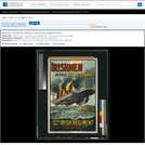
Poster showing the Lusitania in flames and sinking, with people in the water and lifeboats in the foreground. Title from item. Wt. P. 110 - 7,500. 5/'15.
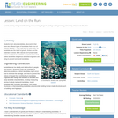
Students learn about landslides, discovering that there are different types of landslides that occur at different speeds from very slow to very quick. All landslides are the result of gravity, friction and the materials involved. Both natural and human-made factors contribute to landslides. Students learn what makes landslides dangerous and what engineers are doing to prevent and avoid landslides.
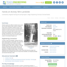
Students explore how different materials (sand, gravel, lava rock) with different water contents on different slopes result in landslides of different severity. They measure the severity by how far the landslide debris extends into model houses placed in the flood plain. This activity is a small-scale model of a debris chute currently being used by engineers and scientists to study landslide characteristics. Much of this activity setup is the same as for the Survive That Tsunami activity in Lesson 5 of the Natural Disasters unit.
Students are introduced to our planet's structure and its dynamic system of natural forces through an examination of the natural hazards of earthquakes, volcanoes, landslides, tsunamis, floods and tornados, as well as avalanches, fires, hurricanes and thunderstorms. They see how these natural events become disasters when they impact people, and how engineers help to make people safe from them. Students begin by learning about the structure of the Earth; they create clay models showing the Earth's layers, see a continental drift demo, calculate drift over time, and make fault models. They learn how earthquakes happen; they investigate the integrity of structural designs using model seismographs. Using toothpicks and mini-marshmallows, they create and test structures in a simulated earthquake on a tray of Jell-O. Students learn about the causes, composition and types of volcanoes, and watch and measure a class mock eruption demo, observing the phases that change a mountain's shape. Students learn that the different types of landslides are all are the result of gravity, friction and the materials involved. Using a small-scale model of a debris chute, they explore how landslides start in response to variables in material, slope and water content. Students learn about tsunamis, discovering what causes them and makes them so dangerous. Using a table-top-sized tsunami generator, they test how model structures of different material types fare in devastating waves. Students learn about the causes of floods, their benefits and potential for disaster. Using riverbed models made of clay in baking pans, students simulate the impact of different river volumes, floodplain terrain and levee designs in experimental trials. They learn about the basic characteristics, damage and occurrence of tornadoes, examining them closely by creating water vortices in soda bottles. They complete mock engineering analyses of tornado damage, analyze and graph US tornado damage data, and draw and present structure designs intended to withstand high winds.