Updating search results...

Search Resources

13 Results

View
Selected filters:
Antarctica's Ice on the Move
Read the Fine Print
Rating
0.0 stars

This activity is part of the Antarctica's Climate Secrets flexhibit. Students learn about and create models of glaciers and ice sheets, ice shelves, icebergs and sea ice.

Subject:
Physical Science
Material Type:
Activity/Lab
Provider:
CLEAN: Climate Literacy and Energy Awareness Network
Provider Set:
CLEAN: Climate Literacy and Energy Awareness Network
Author:
Andrill
LuAnn Dahlman
Date Added:
10/27/2014
Charting Temperature Changes
Unrestricted Use
CC BY
Rating
0.0 stars

In this activity, students chart temperature changes over time in Antarctica's paleoclimate history by reading rock cores. Students use their data to create an interactive display illustrating how Antarctica's climate timeline can be interpreted from ANDRILL rock cores.

Subject:
Physical Science
Material Type:
Activity/Lab
Provider:
CLEAN: Climate Literacy and Energy Awareness Network
Provider Set:
CLEAN: Climate Literacy and Energy Awareness Network
Author:
Antarctica's Climate Secrets: Project Andrill
LuAnn Dahlman
Date Added:
06/19/2012
Dead Diatoms Do Tell Tales
Read the Fine Print
Rating
0.0 stars

The students get to be climate detectives as they make a model of sediment cores using different kinds of glass beads and sand. They learn how to examine the types, numbers, and conditions of diatom skeletons in the model sediment cores and tell something about the hypothetical paleoclimate that existed when they were deposited.

Subject:
Geoscience
History
History, Law, Politics
Physical Science
Material Type:
Activity/Lab
Provider:
CLEAN: Climate Literacy and Energy Awareness Network
Provider Set:
CLEAN: Climate Literacy and Energy Awareness Network
Author:
ANDRILL
LuAnn Dahlman
Date Added:
10/27/2014
Earth Exploration Toolbook Chapter: Creating Custom Map Images of Earth and Other Worlds
Conditional Remix & Share Permitted
CC BY-NC-SA
Rating
0.0 stars

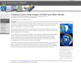
DATA: Planetary images and geodesy data. TOOL: UNAVCO's Jules Verne Voyager Map Server. SUMMARY: Generate maps of Earth or any of 19 other planets and moons. Save and import images into presentations or reports.

(Note: this resource was added to OER Commons as part of a batch upload of over 2,200 records. If you notice an issue with the quality of the metadata, please let us know by using the 'report' button and we will flag it for consideration.)

Subject:
Biology
Life Science
Mathematics
Measurement and Data
Material Type:
Activity/Lab
Data Set
Interactive
Lesson Plan
Provider:
Science Education Resource Center (SERC) at Carleton College
Provider Set:
Teach the Earth
Author:
Lou Estey
LuAnn Dahlman
Date Added:
12/11/2020
Earth Exploration Toolbook Chapter: Measuring Distance and Area in Satellite Images
Conditional Remix & Share Permitted
CC BY-NC-SA
Rating
0.0 stars

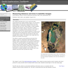
DATA: MODIS Imagery. TOOL: ImageJ. SUMMARY: Examine images of the Aral Sea from 1973 through 2003. Use image analysis software to measure changes in the width and area of the freshwater lake over time.

(Note: this resource was added to OER Commons as part of a batch upload of over 2,200 records. If you notice an issue with the quality of the metadata, please let us know by using the 'report' button and we will flag it for consideration.)

Subject:
Applied Science
Biology
Chemistry
Geoscience
History
History, Law, Politics
Hydrology
Life Science
Physical Science
Space Science
Technology
Material Type:
Activity/Lab
Data Set
Diagram/Illustration
Interactive
Lesson Plan
Provider:
Science Education Resource Center (SERC) at Carleton College
Provider Set:
Teach the Earth
Author:
LuAnn Dahlman
Date Added:
12/03/2019
Evidence of Ice Free Seas
Unrestricted Use
CC BY
Rating
0.0 stars

In this activity, students make a model sea floor sediment core using two types of buttons to represent fossil diatoms. They then compare the numbers of diatom fossils in the sediment at different depths to determine whether the seas were free of ice while the diatoms were alive.

Subject:
Physical Science
Material Type:
Activity/Lab
Provider:
CLEAN: Climate Literacy and Energy Awareness Network
Provider Set:
CLEAN: Climate Literacy and Energy Awareness Network
Author:
ANDRILL
LuAnn Dahlman
Date Added:
06/19/2012
How Does Melting Ice Affect Sea Level?
Unrestricted Use
CC BY
Rating
0.0 stars

Students investigate how sea levels might rise when ice sheets and ice caps melt. By constructing a pair of models, students can observe the effects of ice melt in two different situations.

Subject:
Oceanography
Physical Science
Material Type:
Activity/Lab
Provider:
CLEAN: Climate Literacy and Energy Awareness Network
Provider Set:
CLEAN: Climate Literacy and Energy Awareness Network
Author:
ANDRILL
LuAnn Dahlman
Date Added:
06/19/2012
Normal Climate Patterns
Unrestricted Use
CC BY
Rating
0.0 stars

This activity develops students' understanding of climate by having them make in-depth examinations of historical climate patterns using both graphical and map image formats rather than presenting a general definition of climate. Students explore local climate in order to inform a pen pal what type of weather to expect during an upcoming visit. Students generate and explore a variety of graphs, charts, and map images and interpret them to develop an understanding of climate.

Subject:
Applied Science
Environmental Science
Hydrology
Physical Science
Physics
Material Type:
Activity/Lab
Provider:
CLEAN: Climate Literacy and Energy Awareness Network
Provider Set:
CLEAN: Climate Literacy and Energy Awareness Network
Author:
Betsy Youngman
Earthlabs from TERC
LuAnn Dahlman
Date Added:
06/19/2012
Reading Antarctica's Rock Cores
Read the Fine Print
Rating
0.0 stars

In this activity, students learn about the tools and methods paleoclimatologists use to reconstruct past climates. In constructing sediment cores themselves, students will achieve a very good understanding of the sedimentological interpretation of past climates that scientists can draw from cores.

Subject:
Geoscience
History
History, Law, Politics
Physical Science
Material Type:
Activity/Lab
Provider:
CLEAN: Climate Literacy and Energy Awareness Network
Provider Set:
CLEAN: Climate Literacy and Energy Awareness Network
Author:
Andrill
LuAnn Dahlman
Date Added:
10/27/2014
Stacking up the Atmosphere
Unrestricted Use
CC BY
Rating
0.0 stars

In this hands-on activity, participants learn the characteristics of the five layers of the atmosphere and make illustrations to represent them. They roll the drawings and place them in clear plastic cylinders, and then stack the cylinders to make a model column of the atmosphere.

Subject:
Physical Science
Material Type:
Activity/Lab
Provider:
CLEAN: Climate Literacy and Energy Awareness Network
Provider Set:
CLEAN: Climate Literacy and Energy Awareness Network
Author:
ANDRILL- University of Nebraska
Betsy Youngman
Jean Pennycook
Louise Huffman
LuAnn Dahlman
Date Added:
06/19/2012
Using Data to Identify Hot Spots and Predict Bleaching Events
Unrestricted Use
CC BY
Rating
0.0 stars

In this EarthLabs activity, learners explore the concepts of coral bleaching, bleaching hot spots and degree-heating weeks. Using data products from NOAA's Coral Reef Watch, students identify bleaching hot spots and degree-heating weeks around the globe as well as in the Florida Keys' Sombrero Reef to determine the impact higher-than-normal sea surface temperatures have on coral reefs.

Subject:
Applied Science
Biology
Ecology
Environmental Science
Life Science
Physical Science
Material Type:
Activity/Lab
Provider:
CLEAN: Climate Literacy and Energy Awareness Network
Provider Set:
CLEAN: Climate Literacy and Energy Awareness Network
Author:
Erin Bardar
LuAnn Dahlman
TERC, EarthLabs Project
Date Added:
06/19/2012
Visualizing Carbon Pathways
Read the Fine Print
Educational Use
Rating
0.0 stars

This activity introduces students to visualization capabilities available through NASA's Earth Observatory, global map collection, NASA NEO and ImageJ. Using these tools, students build several animations of satellite data that illustrate carbon pathways through the Earth system.

Subject:
Biology
Career and Technical Education
Chemistry
Environmental Studies
Geology
Life Science
Physical Science
Material Type:
Activity/Lab
Provider:
CLEAN: Climate Literacy and Energy Awareness Network
Provider Set:
CLEAN: Climate Literacy and Energy Awareness Network
Author:
Ali Whitmer
Betsy Youngman
Bruce Caron
David Herring
Earth Exploration Toolbook
LuAnn Dahlman
Ray Tschillard
Date Added:
05/15/2012
What if the Ice Shelves Melted?
Unrestricted Use
CC BY
Rating
0.0 stars

This activity is a hands-on guided inquiry activity designed to highlight the role of an ice shelf on slowing the movement of continental ice sheets in Antarctica. Students build a model of Antarctica and both continental glaciers and ice shelves using paper models of the land and slime for glaciers and ice. Students use their model to explore the impact of recent and potential ice shelf melting and break-up.

Subject:
Physical Science
Material Type:
Activity/Lab
Provider:
CLEAN: Climate Literacy and Energy Awareness Network
Provider Set:
CLEAN: Climate Literacy and Energy Awareness Network
Author:
ANDRILL
LuAnn Dahlman
Date Added:
06/19/2012