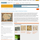
From the earliest days of settlement and migration, the people of North America have relied on maps and mapping to understand their environment and place within it. Maps have helped Americans prospect investments, comprehend war, and plan leisure in places unknown. As Americans have used maps to explore the U.S., capitalize on its resources, and displace its Native peoples, maps have shaped American cultural ideas about travel, place, and ownership. This exhibit explores the cultural and historic impact of mapping through four specific moments in American history: migration along the Oregon Trail, the rise of the lumber industry, the Civil War, and the popularization of the automobile and individual tourism. It concludes with a look at maps in the age of computers, the Internet, and beyond. These moments demonstrate the influence maps have had over how Americans imagine, exploit, and interact with national geographies and local places. This exhibition was created as part of the DPLAs Digital Curation Program by the following students in Professor Helene Williams's capstone course at the Information School at the University of Washington: Greg Bem, Kili Bergau, Emily Felt, and Jessica Blanchard. Additional revisions and selections made by Greg Bem.
- Subject:
- History
- U.S. History
- Material Type:
- Diagram/Illustration
- Primary Source
- Unit of Study
- Provider:
- Digital Public Library of America
- Provider Set:
- DPLA Exhibitions
- Author:
- Emily Felt
- Greg Bem
- Jessica Blanchard
- Kili Bergau
- Date Added:
- 09/01/2014
