Updating search results...

Search Resources

4256 Results

View
Selected filters:
  • geoscience
Earthquake resistant design
Conditional Remix & Share Permitted
CC BY-NC-SA
Rating
0.0 stars

After having learned about earthquakes in class, through readings and earlier lab assignments, students (in groups of two) are asked to design and construct (using balsa wood, string, paper and glue) a three-story building designed to minimize the effects of shear-wave vibrations that occur during an earthquake. The students are required to research the design concepts on their own and most of the construction work occurs outside of the regular laboratory period. The structures are tested for strength a week before the earthquake occurs - can they support the required load for each floor? On earthquake day, the buildings a tested for a "design earthquake" and then each group is given the opportunity to see how "large" and earthquake their structure can withstand - both in terms of frequency and amplitude variations. In addition to building the structure, each team has to submit a paper reflecting on why they designed and built the structure the way they did.

(Note: this resource was added to OER Commons as part of a batch upload of over 2,200 records. If you notice an issue with the quality of the metadata, please let us know by using the 'report' button and we will flag it for consideration.)

Subject:
Biology
Life Science
Material Type:
Activity/Lab
Homework/Assignment
Provider:
Science Education Resource Center (SERC) at Carleton College
Provider Set:
Teach the Earth
Author:
Lawrence L. Malinconico
Date Added:
08/21/2019
Earthquakes
Read the Fine Print
Rating
0.0 stars

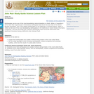
This lesson on earthquakes is based on naturalist John Muir's experiences with two significant earthquakes, the 1872 earthquake on the east side of the Sierra Nevada Mountains, and the Great San Francisco Earthquake of 1906. Students will learn to explain that earthquakes are sudden motions along breaks in the crust called faults, and list the major geologic events including earthquakes, volcanic eruptions and mountain building, which are the result of crustal plate motions. A downloadable, printable version (PDF) of the lesson plan is available.

Subject:
Astronomy
Chemistry
Geology
Geoscience
Physical Science
Physics
Space Science
Material Type:
Interactive
Lesson Plan
Provider:
UCAR Staff
Provider Set:
Earthquake Education Environment (E3)
Date Added:
11/02/2014
Earthquakes
Conditional Remix & Share Permitted
CC BY-NC-SA
Rating
0.0 stars

For this exercise we meet in a computer lab and students access the IRIS Earthquake Browser to download geospatial information of earthquakes. Students use the GEON Integrated Data Viewer (IDV) to explore the location of earthquake zones and their 3-dimensional characteristics. Students compare the earthquake characteristics of subduction zones, mid-oceanic ridges, and transform faults. This leads into a discussion of plate tectonics.

(Note: this resource was added to OER Commons as part of a batch upload of over 2,200 records. If you notice an issue with the quality of the metadata, please let us know by using the 'report' button and we will flag it for consideration.)

Subject:
Biology
Life Science
Material Type:
Activity/Lab
Data Set
Interactive
Provider:
Science Education Resource Center (SERC) at Carleton College
Provider Set:
Teach the Earth
Author:
Achim Herrmann
Date Added:
04/04/2021
Earthquakes: Los Angeles
Read the Fine Print
Educational Use
Rating
0.0 stars

In this video segment adapted from NOVA, animations are used to show how the hills around Los Angeles were formed by earthquakes at small thrust faults that extend outward from the larger San Andreas fault.

Subject:
Astronomy
Chemistry
Education
Geology
Geoscience
Physical Science
Physics
Space Science
Material Type:
Activity/Lab
Diagram/Illustration
Provider:
PBS LearningMedia
Provider Set:
PBS Learning Media: Multimedia Resources for the Classroom and Professional Development
Author:
National Science Foundation
WGBH Educational Foundation
Date Added:
12/17/2005
Earthquakes: San Francisco
Read the Fine Print
Educational Use
Rating
0.0 stars

The history of earthquakes in the San Francisco Bay area is plotted on a digital map and analyzed in this video segment adapted from NOVA.

Subject:
Astronomy
Chemistry
Education
Geology
Geoscience
Physical Science
Physics
Space Science
Material Type:
Activity/Lab
Diagram/Illustration
Provider:
PBS LearningMedia
Provider Set:
PBS Learning Media: Multimedia Resources for the Classroom and Professional Development
Author:
National Science Foundation
WGBH Educational Foundation
Date Added:
12/17/2005
Earthquakes: The Prehistoric Record
Read the Fine Print
Educational Use
Rating
0.0 stars

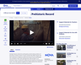
In this video segment adapted from NOVA, a geologist digs a trench along the San Andreas Fault to reveal three thousand years of earthquake history. Information from the layers of sediment may help geologists to predict earthquakes.

Subject:
Applied Science
Astronomy
Chemistry
Education
Geology
Geoscience
Physical Science
Physics
Space Science
Technology
Material Type:
Activity/Lab
Diagram/Illustration
Provider:
PBS LearningMedia
Provider Set:
PBS Learning Media: Multimedia Resources for the Classroom and Professional Development
Author:
National Science Foundation
WGBH Educational Foundation
Date Added:
12/17/2005
Earthquakes: The Seismograph
Read the Fine Print
Educational Use
Rating
0.0 stars

This video segment adapted from NOVA uses historical illustrations, photographs, and animations to explain how seismographs work, the difference between P and S waves, and the Richter scale.

Subject:
Astronomy
Chemistry
Education
Geology
Geoscience
Physical Science
Physics
Space Science
Material Type:
Activity/Lab
Diagram/Illustration
Provider:
PBS LearningMedia
Provider Set:
PBS Learning Media: Multimedia Resources for the Classroom and Professional Development
Author:
National Science Foundation
WGBH Educational Foundation
Date Added:
12/17/2005
Earthquakes and Plate Boundaries
Read the Fine Print
Rating
0.0 stars

This activity uses the free software 'Seismic Eruption' to visualize seismicity and volcanic activity in space and time and to explore the relationship of earthquakes and volcanic activiy to plate tectonics. Students run simulations on the Pacific coasts of South America and California and the mid-oceanic ridge in the Atlantic Ocean, answer questions, and construct a cross-section. A link to download the software is provided.

Subject:
Astronomy
Chemistry
Geology
Geoscience
Physical Science
Physics
Space Science
Material Type:
Activity/Lab
Interactive
Provider:
UCAR Staff
Provider Set:
New York State Earth Science Instructional Collection
Author:
Drew Patrick
Date Added:
11/06/2014
Earth's Albedo and Global Warming
Unrestricted Use
CC BY
Rating
0.0 stars

This interactive visualization adapted from NASA and the U.S. Geological Survey illustrates the concept of albedo, which is the measure of how much solar radiation is reflected from Earth's surface.

Subject:
Applied Science
Career and Technical Education
Environmental Science
Environmental Studies
Physical Science
Physics
Material Type:
Simulation
Provider:
CLEAN: Climate Literacy and Energy Awareness Network
Provider Set:
CLEAN: Climate Literacy and Energy Awareness Network
Author:
NASA Goddard Space Flight Center Scientific Visualization Studio
NSIDC (National Snow and Ice Data Center)
USGS (US Geological Survey)
Date Added:
06/19/2012
Earth's Atmosphere: Composition and structure
Read the Fine Print
Educational Use
Rating
0.0 stars

This module explores the composition of the earth's atmosphere, how temperature and pressure vary in the atmosphere, and the scientific developments that led to an understanding of these basic concepts.

Subject:
Astronomy
Atmospheric Science
Chemistry
Education
Geology
Geoscience
Physical Science
Physics
Space Science
Material Type:
Interactive
Unit of Study
Provider:
UCAR Staff
Provider Set:
Visionlearning
Author:
Anne Egger
Date Added:
10/31/2003
Earth's Changing Climate: How Do We Know What We Know?
Conditional Remix & Share Permitted
CC BY-SA
Rating
0.0 stars

This article provides background information that will help teachers present the science associated with the study of climate, past, present and future. The magazine Beyond Weather and the Water Cycle is structured around the recognized principles of climate literacy. The author explains the science concepts included in the principle related to climate study and research and also identifies additional sources of information.

Subject:
Applied Science
Education
Geoscience
Mathematics
Physical Science
Space Science
Technology
Material Type:
Teaching/Learning Strategy
Provider:
Ohio State University College of Education and Human Ecology
Provider Set:
Beyond Weather and the Water Cycle
Author:
Kimberly Lightle
National Science Foundation
Date Added:
05/30/2012
Earth's Changing Climates
Read the Fine Print
Rating
0.0 stars

In this activity, students are guided through graphs of surface air temperature anomaly data and Vostok ice core data to illustrate how scientists use these data to develop the basis for modeling how climate is likely to change in the future.

Subject:
Applied Science
Archaeology
Career and Technical Education
Environmental Science
Environmental Studies
Physical Geography
Physical Science
Social Science
Material Type:
Activity/Lab
Provider:
CLEAN: Climate Literacy and Energy Awareness Network
Provider Set:
CLEAN: Climate Literacy and Energy Awareness Network
Author:
Concord Consortium
Date Added:
09/24/2018
Earth's Changing Surface - Issue 9, December 2008
Conditional Remix & Share Permitted
CC BY-SA
Rating
0.0 stars

This issue of the free online magazine, Beyond Penguins and Polar Bears, explores glaciers, wind, water, and volcanoes and their role in shaping the landscape of the polar regions.

Subject:
Applied Science
Education
Engineering
Life Science
Mathematics
Material Type:
Lesson Plan
Provider:
Ohio State University College of Education and Human Ecology
Provider Set:
Beyond Penguins and Polar Bears: An Online Magazine for K-5 Teachers
Author:
The Ohio State University
Date Added:
10/17/2014
Earth's Changing Surface: Unit Outlines
Conditional Remix & Share Permitted
CC BY-SA
Rating
0.0 stars

This article assembles free resources from the Earth's Changing Surface issue of the Beyond Penguins and Polar Bears cyberzine into a unit outline based on the 5E learning cycle framework. Outlines are provided for Grades K-2 and 3-5.

Subject:
Applied Science
Environmental Science
Geoscience
Physical Science
Material Type:
Lesson Plan
Provider:
Ohio State University College of Education and Human Ecology
Provider Set:
Beyond Penguins and Polar Bears: An Online Magazine for K-5 Teachers
Author:
Jessica Fries-Gaither
Date Added:
10/17/2014
Earth's Climate Changes: Virtual Bookshelf
Conditional Remix & Share Permitted
CC BY-SA
Rating
0.0 stars

This list of carefully selected books for grades K-5 highlights nonfiction about climate proxies, those preserved physical characteristics, such as fossils, that scientists use to reconstruct past climates. Also highlighted are a few books that provide information about two past climatic events -- the last ice age and the Dust Bowl. In each issue of the free, online magazine Beyond Weather and the Water Cycle, the virtual bookshelf recommends books that accurately portray the theme drawn from the principles of climate sciences.

Subject:
Applied Science
Ecology
Education
Forestry and Agriculture
Geoscience
Life Science
Physical Science
Space Science
Technology
Material Type:
Teaching/Learning Strategy
Provider:
Ohio State University College of Education and Human Ecology
Provider Set:
Beyond Weather and the Water Cycle
Author:
Jessica Fries-Gaither
National Science Foundation
Date Added:
05/30/2012
Earth's Climate System
Conditional Remix & Share Permitted
CC BY-NC-SA
Rating
0.0 stars

This activity will help students to identify and analyze factors contributing to Earth's climate systems.


Provenance: Beverly Owens, Cleveland Early College High School
Reuse: This item is offered under a Creative Commons Attribution-NonCommercial-ShareAlike license http://creativecommons.org/licenses/by-nc-sa/3.0/ You may reuse this item for non-commercial purposes as long as you provide attribution and offer any derivative works under a similar license.

(Note: this resource was added to OER Commons as part of a batch upload of over 2,200 records. If you notice an issue with the quality of the metadata, please let us know by using the 'report' button and we will flag it for consideration.)

Subject:
Applied Science
Biology
Environmental Science
Life Science
Oceanography
Physical Science
Material Type:
Activity/Lab
Provider:
Science Education Resource Center (SERC) at Carleton College
Provider Set:
Teach the Earth
Author:
Beverly Owens
Molly Ludwick
Date Added:
09/26/2022
Earth's Cryosphere: Antarctica
Read the Fine Print
Educational Use
Rating
0.0 stars

Learn about the different features of snow and ice in Antarctica using satellite imagery in this video segment adapted from NASA.

Subject:
Applied Science
Ecology
Environmental Science
Forestry and Agriculture
Geoscience
Life Science
Oceanography
Physical Science
Space Science
Material Type:
Lecture
Provider:
PBS LearningMedia
Provider Set:
PBS Learning Media: Multimedia Resources for the Classroom and Professional Development
Author:
National Science Foundation
WGBH Educational Foundation
Date Added:
01/17/2008
Earth's Energy Cycle - Albedo
Unrestricted Use
CC BY
Rating
0.0 stars

Students perform a lab to explore how the color of materials at Earth's surface affect the amount of warming. Topics covered include developing a hypothesis, collecting data, and making interpretations to explain why dark-colored materials become hotter.

Subject:
Applied Science
Career and Technical Education
Environmental Science
Environmental Studies
Physical Science
Physics
Material Type:
Activity/Lab
Provider:
CLEAN: Climate Literacy and Energy Awareness Network
Provider Set:
CLEAN: Climate Literacy and Energy Awareness Network
Author:
National Center for Atmospheric Research (NCAR)
Date Added:
06/19/2012
The Earth's Heat Budget
Unrestricted Use
CC BY
Rating
0.0 stars

Hands-on laboratory activity that allows students to investigate the effects of distance and angle on the input of solar radiation at Earth's surface, the role played by albedo, the heat capacity of land and water, and how these cause the seasons. Students predict radiative heating based on simple geometry and experiment to test their hypotheses.

Subject:
Applied Science
Environmental Science
Oceanography
Physical Science
Physics
Material Type:
Activity/Lab
Provider:
CLEAN: Climate Literacy and Energy Awareness Network
Provider Set:
CLEAN: Climate Literacy and Energy Awareness Network
Author:
National Association of Geoscience Teachers
Roy Plotnick
Date Added:
06/19/2012
Earth's Interior CogSketch geoscience worksheet
Conditional Remix & Share Permitted
CC BY-NC-SA
Rating
0.0 stars

The Earth's Interior worksheet involves the layers of the Earth and is meant to help students: 1) Draw the layers of the Earth true-to-scale (on an image with a scale bar), and 2) Grasp the size of the Earth by starting at a somewhat familiar scale (the upper 40km of the crust) and progressively adding layers and increasing the scale to the radius of the Earth (~6,400km). Moving from the familiar to the unfamiliar has been shown to be an effective strategy to understand large magnitudes (Resnick, Shipley, Newcombe, Massey, & Wills, 2012).

Starting at the surface, the student adds layers of the earth as the scale increases (40km, 400km, 700km, 3,000km, and 6,400km). The layers include the base of continental crust, upper mantle, transition zone, lower mantle, and the outer core, as well as drawing the height of a building at the surface to help gain perspective as the scale changes. Students also complete 3 multiple choice questions at the end of the worksheet to solidify and focus on goals and important concepts.

This worksheet uses the sketch-understanding program with built-in tutor: CogSketch. Therefore, students, instructors, and/or institution computer labs need to download the program from the CogSketch website: http://www.qrg.northwestern.edu/software/cogsketch/. At any point during the worksheet, students can click the FEEDBACK button and their sketch is compared to the solution sketch. The built-in tutor identifies any discrepancies and reports pre-written feedback to help the student correct their sketch until they are done with the activity. Once worksheets are emailed to the instructor, worksheets can be batch graded and easily evaluated. This program allows instructors to assign sketching activities that require very little time commitment. Instead, the built-in tutor provides feedback whenever the student requests, without the presence of the instructor. More information on using the program and the activity is in the Instructor's Notes.

We have developed approximately two dozen introductory geoscience worksheets using this program. Each worksheet has a background image and instructions for a sketching task. You can find additional worksheets by searching for "CogSketch" using the search box at the top of this page. We expect to have uploaded all of them by the end of the summer of 2016.

(Note: this resource was added to OER Commons as part of a batch upload of over 2,200 records. If you notice an issue with the quality of the metadata, please let us know by using the 'report' button and we will flag it for consideration.)

Subject:
Biology
Geology
Life Science
Physical Science
Material Type:
Activity/Lab
Provider:
Science Education Resource Center (SERC) at Carleton College
Provider Set:
Teach the Earth
Author:
Bridget Garnier
Date Added:
04/23/2020