Updating search results...

Search Resources

95 Results

View
Selected filters:
  • active-learning
Unit 1: Exploring Harrier Meadow, an Urban Wetland System
Conditional Remix & Share Permitted
CC BY-NC-SA
Rating
0.0 stars

Students will conduct a virtual exploration of Harrier Meadow, a saltmarsh in the New Jersey Meadowlands. They will identify its vulnerability to pollution, its tidal connection to the Hackensack Estuary and the Atlantic Ocean along with its proximity to New York City. Vegetation patterns within this wetland will be explored, focusing on a salinity tolerant native plant (Pickleweed) that is returning to the marsh. The return of such native species is critically important to wetland restoration efforts that aim to reclaim native habitat following decades of environmental degradation since the industrial revolution. These vegetation patterns are the focus of resistivity and electromagnetic surveys that the students explore in the subsequent units of this module. The geophysical surveys aim to better understand the underlying factors controlling the distribution of Pickleweed. By understanding where the Pickleweed is thriving, restoration efforts could subsequently be improved by locating regions of such wetlands with similar underlying factors where Pickleweed (and other native plants) could be successfully reintroduced. In the first unit of this module, students will use Google Earth (on the web), high-resolution video acquired from an Unmanned Aerial Vehicle (UAV) and an ArcGIS Storymap in their exploration. Primary outcome: students comprehend the association between salinity and Pickleweed and formulate plans to test a hypothesis for Pickleweed persistence/patterning in Harrier Meadow that will ultimately be implemented using near surface geophysical methods in the remaining units of the module.

(Note: this resource was added to OER Commons as part of a batch upload of over 2,200 records. If you notice an issue with the quality of the metadata, please let us know by using the 'report' button and we will flag it for consideration.)

Subject:
Biology
Career and Technical Education
Environmental Studies
Hydrology
Life Science
Mathematics
Measurement and Data
Physical Science
Statistics and Probability
Material Type:
Activity/Lab
Data Set
Lesson Plan
Reading
Provider:
Science Education Resource Center (SERC) at Carleton College
Provider Set:
Teach the Earth
Author:
Compiled by Lee Slater, Rutgers University Newark (lslater@newark.rutgers.edu)
Date Added:
09/03/2022
Unit 1: Introducing shallow seismology to explore our subsurface environment
Conditional Remix & Share Permitted
CC BY-NC-SA
Rating
0.0 stars

This introductory unit is designed to provide stand-alone introduction to geophysical imaging of the shallow subsurface, motivate students to become invested in the topic, provide career context for these scientific subjects, and build enthusiasm for the following units. The shallow seismic refraction module (Measuring Depth to Bedrock using Seismic Refraction) is designed to fill the need to expose students to geophysical concepts and surrounding earth science principles so that students begin to know why geophysics is important to geoscience and how these concepts are related to future careers and day-to-day life.

(Note: this resource was added to OER Commons as part of a batch upload of over 2,200 records. If you notice an issue with the quality of the metadata, please let us know by using the 'report' button and we will flag it for consideration.)

Subject:
Biology
Career and Technical Education
Environmental Studies
Life Science
Mathematics
Measurement and Data
Statistics and Probability
Material Type:
Activity/Lab
Data Set
Lesson Plan
Provider:
Science Education Resource Center (SERC) at Carleton College
Provider Set:
Teach the Earth
Author:
Introduction to the importance and relevance of geophysics. Andy Parsekian, University of Wyoming, aparseki@uwyo.edu
Date Added:
09/03/2022
Unit 2: Geophysical Properties of the Subsurface
Conditional Remix & Share Permitted
CC BY-NC-SA
Rating
0.0 stars

Electrical measurement of unconsolidated soils in the laboratory.

Provenance: Lee Slater, Rutgers University-Newark
Reuse: This item is in the public domain and maybe reused freely without restriction.
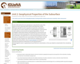
Archie (1950) defined the term petrophysics to describe the study of the physics of rocks, particularly with respect to the fluids they contain. Although originally focused on geophysical exploration, petrophysics concepts are now used to interpret near surface geophysics measurements made to address environmental and engineering problems. This unit investigates relationships between these geophysical measurements and the physical and chemical properties of soils and sediments in the Earth's near subsurface. The specific focus is on the electrical properties of soils and how they are related to the ionic concentration of the pore fluids, the water content, porosity and grain size. Field results from a geophysical survey performed in Kearny Marsh, close to Harrier Meadow, are included to illustrate how electrical conductivity of a soil measured with an electromagnetic sensor is a good proxy for pore fluid ionic concentration, in this case related to contamination from a bordering landfill.

(Note: this resource was added to OER Commons as part of a batch upload of over 2,200 records. If you notice an issue with the quality of the metadata, please let us know by using the 'report' button and we will flag it for consideration.)

Subject:
Career and Technical Education
Chemistry
Environmental Studies
Hydrology
Mathematics
Measurement and Data
Physical Science
Statistics and Probability
Material Type:
Activity/Lab
Data Set
Lesson Plan
Reading
Provider:
Science Education Resource Center (SERC) at Carleton College
Provider Set:
Teach the Earth
Author:
Compiled by Lee Slater, Rutgers University Newark (lslater@newark.rutgers.edu)
Date Added:
09/03/2022
Unit 2: How seismic waves travel through the ground
Conditional Remix & Share Permitted
CC BY-NC-SA
Rating
0.0 stars

This unit presents core underlying principles needed to understand refraction seismology concepts including refraction of rays, types of seismic waves, interpreting information about subsurface materials from seismic properties and developing conceptual models of the subsurface environment.

(Note: this resource was added to OER Commons as part of a batch upload of over 2,200 records. If you notice an issue with the quality of the metadata, please let us know by using the 'report' button and we will flag it for consideration.)

Subject:
Biology
Career and Technical Education
Environmental Studies
Life Science
Mathematics
Measurement and Data
Statistics and Probability
Material Type:
Activity/Lab
Data Set
Lesson Plan
Reading
Provider:
Science Education Resource Center (SERC) at Carleton College
Provider Set:
Teach the Earth
Author:
Basic concepts in refraction seismology. Andy Parsekian, University of Wyoming, aparseki@uwyo.edu
Date Added:
09/03/2022
Unit 2: The Carbon Cycle
Conditional Remix & Share Permitted
CC BY-NC-SA
Rating
0.0 stars

Students will explore the different aspects of the carbon cycle on Earth. This includes the original source of all the carbon on our planet, the near ubiquity of carbon, the six principle reservoirs of carbon in the Earth system, and the movement (flux) of carbon between reservoirs. Students will approach the chemical history of carbon by personifying the "journey" of specific carbon atoms throughout geologic time.
The unit emphasizes the grand challenges of energy resources and climate change by grounding these issues in a solid understanding of carbon from a systems thinking perspective. The point here is for students to gain a more robust appreciation for the movement of carbon between atmosphere and geosphere, between hydrosphere and biosphere. The unit provides dynamic understanding of how perturbations to one sphere or changes in the amount of carbon in a given reservoir can have implications throughout the Earth system.

(Note: this resource was added to OER Commons as part of a batch upload of over 2,200 records. If you notice an issue with the quality of the metadata, please let us know by using the 'report' button and we will flag it for consideration.)

Subject:
Applied Science
Biology
Career and Technical Education
Environmental Science
Environmental Studies
Geology
Life Science
Mathematics
Measurement and Data
Physical Science
Statistics and Probability
Material Type:
Activity/Lab
Module
Provider:
Science Education Resource Center (SERC) at Carleton College
Provider Set:
Teach the Earth
Author:
Callan Bentley
Date Added:
09/29/2022
Unit 3: Codorus Creek case study: Measuring and interpreting seismic refraction data
Conditional Remix & Share Permitted
CC BY-NC-SA
Rating
0.0 stars

This unit presents an applied Case Study example and the associated concepts related to designing a seismic survey and analyzing the data. Parts of the instrument are discussed and practical experience simulating travel time arrivals on a travel time-offset plot are presented. A real dataset from the Case Study site at Codorus Creek, York, PA is presented and analysis strategies are discussed.

(Note: this resource was added to OER Commons as part of a batch upload of over 2,200 records. If you notice an issue with the quality of the metadata, please let us know by using the 'report' button and we will flag it for consideration.)

Subject:
Biology
Career and Technical Education
Environmental Studies
Life Science
Mathematics
Measurement and Data
Statistics and Probability
Material Type:
Activity/Lab
Case Study
Data Set
Lesson Plan
Reading
Provider:
Science Education Resource Center (SERC) at Carleton College
Provider Set:
Teach the Earth
Author:
Using seismic refraction data in a case study for urban renewal. Andy Parsekian, University of Wyoming, aparseki@uwyo.edu
Date Added:
09/03/2022
Unit 3: Field Geophysical Measurements
Conditional Remix & Share Permitted
CC BY-NC-SA
Rating
0.0 stars

Near surface geophysical measurements are performed by moving sensors across the Earth's surface. Active geophysical sensors transmit a signal into the Earth and record a returned signal that contains information on the physical and chemical properties of the Earth (see Unit 2). This unit introduces the student to the basics of geophysical data acquisition using two techniques that record variations in the electrical conductivity (see Unit 2) of the Earth: [1] electrical imaging (EI), and [2] electromagnetic (EM) conductivity mapping.


Basic concept of electrical imaging measurements

Provenance: Lee Slater, Rutgers University-Newark
Reuse: This item is in the public domain and maybe reused freely without restriction.
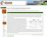
Electrical imaging is a galvanic geophysical approach whereby electrical contact with the Earth is made directly via electrodes (typically metal stakes) that are inserted into the ground. Electromagnetic conductivity mapping is a non-contact approach whereby the physics of EM induction is used to sense changes in electrical conductivity. The advantages and disadvantages of using galvanic (EI) and non-contact (EM) techniques for measuring electrical conductivity are described. Ohm's Law is introduced and students investigate how electrical resistance measurements are related to the electrical conductivity of soils. Field implementation of both EI and EM techniques is demonstrated using surveys performed in Harrier Meadow as an example. Students investigate how variations in survey configuration parameters (e.g. electrode configuration and electrode spacing in EI, frequency and coil spacing in EM) control investigation depth (how far into the ground the signals sense) and spatial resolution (what size objects can be detected). The concept of pre-modeling a geophysical survey (i.e. running some simulations of likely effectiveness of the methods before going to the field) to evaluate expected investigation depth and sensitivity is introduced. The Excel-based Scenario Evaluator for Electrical Resistivity (SEER) tool provided by the United States Geological Survey (USGS) is used to demonstrate some key concepts.

(Note: this resource was added to OER Commons as part of a batch upload of over 2,200 records. If you notice an issue with the quality of the metadata, please let us know by using the 'report' button and we will flag it for consideration.)

Subject:
Career and Technical Education
Chemistry
Environmental Studies
Hydrology
Mathematics
Measurement and Data
Physical Science
Statistics and Probability
Material Type:
Activity/Lab
Data Set
Interactive
Reading
Provider:
Science Education Resource Center (SERC) at Carleton College
Provider Set:
Teach the Earth
Author:
Compiled by Lee Slater, Rutgers University Newark (lslater@newark.rutgers.edu)
Date Added:
09/03/2022
Unit 4: The Magic of Geophysical Inversion
Conditional Remix & Share Permitted
CC BY-NC-SA
Rating
0.0 stars

The concepts of forward modeling and inverse modeling

Provenance: Lee Slater, Rutgers University-Newark
Reuse: If you wish to use this item outside this site in ways that exceed fair use (see http://fairuse.stanford.edu/) you must seek permission from its creator.
This unit introduces the student to the concept of geophysical inversion, which is the process of estimating the geophysical properties of the subsurface from the geophysical observations. The basic mechanics of the inversion process used to estimate spatial variations in electrical conductivity from electrical imaging (EI) datasets are introduced in a way that avoids the heavy mathematics. The challenges of inverting two dimensional geophysical datasets and the strategies for limiting the inversion to geologically reasonable solutions are described. The unfortunate characteristics of geophysical images (blurriness, imaging artifacts) are explained to highlight the limitations of inversion and to emphasize that the inverted images never match with geological reality. Students use the Excel-based Scenario Evaluator for Electrical Resistivity (SEER) tool introduced in Unit 3, Field Geophysical Measurements, to investigate key inversion concepts associated with measurement errors and the benefits of adding boreholes to surface data using synthetic datasets. Students are then led through an inversion of the two-dimensional EI dataset acquired in Harrier Meadow using ResIPy, a Python-based graphical user interface developed for instructional use. Following the instructional video, students then perform the inversion in ResIPy themselves and explore how variations in inversion settings related to the errors in the measurements result in distinctly different images.

(Note: this resource was added to OER Commons as part of a batch upload of over 2,200 records. If you notice an issue with the quality of the metadata, please let us know by using the 'report' button and we will flag it for consideration.)

Subject:
Career and Technical Education
Chemistry
Environmental Studies
Hydrology
Mathematics
Measurement and Data
Physical Science
Statistics and Probability
Material Type:
Activity/Lab
Data Set
Interactive
Reading
Provider:
Science Education Resource Center (SERC) at Carleton College
Provider Set:
Teach the Earth
Author:
Compiled by Lee Slater, Rutgers University Newark (lslater@newark.rutgers.edu)
Date Added:
09/03/2022
Unit 5: Integrated Geophysical Interpretation and Comparison with Ground Truthing
Conditional Remix & Share Permitted
CC BY-NC-SA
Rating
0.0 stars

Screenshot of the slider tool used to relate geophysical images to vegetation pattern

Provenance: Lee Slater, Rutgers University-Newark
Reuse: This item is in the public domain and maybe reused freely without restriction.
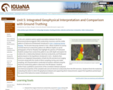
In this unit, students explore spatial associations between the three-dimensional electromagnetic (EM) conductivity inversions and the visible patterns of Salicornia (Pickleweed) introduced in Unit 1, Exploring Harrier Meadow. The Arcview Storymap started in Unit 1 allows students to overlay inverted electrical conductivity patterns for different depths on aerial photographs of Harrier Meadow that highlight the patches of Pickleweed. Students analyze how conductivity patterns vary with depth and explore for evidence for a relationship between electrical conductivity and Pickleweed patches based on the hypothesis introduced in Unit 1. Students then perform an integrated interpretation of both the EM and electrical imaging inversions along with the results of direct sampling (coring, pore water sampling, soil characterization) conducted at locations selected using the electrical conductivity patterns observed in the EM dataset. Students perform basic qualitative assessments of the correlation between physical and chemical properties of the sampled soils and soil electrical conductivity from the EM inversions. Students finish the module by evaluating the extent to which the geophysical dataset and supporting direct measurements support the hypothesis pertaining to the cause of the Salicornia clusters introduced in Unit 1.

(Note: this resource was added to OER Commons as part of a batch upload of over 2,200 records. If you notice an issue with the quality of the metadata, please let us know by using the 'report' button and we will flag it for consideration.)

Subject:
Career and Technical Education
Chemistry
Environmental Studies
Hydrology
Mathematics
Measurement and Data
Physical Science
Statistics and Probability
Material Type:
Activity/Lab
Data Set
Lesson Plan
Reading
Provider:
Science Education Resource Center (SERC) at Carleton College
Provider Set:
Teach the Earth
Author:
Compiled by Lee Slater, Rutgers University Newark (lslater@newark.rutgers.edu)
Date Added:
09/03/2022
Using An M&M Magma Chamber To Illustrate Magmatic Differentiation
Conditional Remix & Share Permitted
CC BY-NC-SA
Rating
0.0 stars

Magmatic differentiation is an important concept in the geology curriculum. Students are generally introduced to magmatic differentiation in the introductory course, whereas the details are typically developed in mineralogy and petrology courses. In particular, students often struggle to understand the processes of fractional crystallization.

Fractional crystallization by gravity settling can be illustrated using a model magma chamber consisting of M&M'sÂ. In this model, each major cation (e.g., Si, Ti, Al, Fe, Mg, Ca, Na, K) is represented by a different color M&MÂ; other kinds of differently colored or shaped pieces could also be used. Appropriate numbers of each color M&M are combined to approximate the cation proportions of a basaltic magma; this is the "parental magma". The M&M's are then placed in a group on a tabletop to form a magma chamber. Students then fractionate the magma in ten crystallization steps. In each step the M&M's are moved to the bottom of the magma chamber forming a series of cumulus layers; the M&M's are removed in proportions that are identical to those of the stoichiometric proportions of cations in the crystallizing minerals (e.g., olivine, pyroxene, feldspars, quartz, magnetite, ilmenite). Students observe the changing cation composition (proportions of colors of M&M'sÂ) in the cumulus layers and in the magma chamber and graph the results using spreadsheet software. Students classify the cumulates and resulting liquid after each crystallization step, and they compare the model system with natural magmatic systems (e.g., absence of important fractionating phases, volatiles). Students who have completed this exercise demonstrate increased understanding of fractionation processes exhibit greater familiarity with mineral stoichiometry, classification, solid-solution in minerals, element behavior (e.g., incompatibility), and chemical variation diagrams.

(Note: this resource was added to OER Commons as part of a batch upload of over 2,200 records. If you notice an issue with the quality of the metadata, please let us know by using the 'report' button and we will flag it for consideration.)

Subject:
Biology
Life Science
Mathematics
Measurement and Data
Statistics and Probability
Material Type:
Activity/Lab
Provider:
Science Education Resource Center (SERC) at Carleton College
Provider Set:
Teach the Earth
Author:
Karl Wirth
Date Added:
09/11/2020
Using Learning Assistants to Support Peer Instruction with Classroom Response Systems ("Clickers")
Conditional Remix & Share Permitted
CC BY-NC-SA
Rating
0.0 stars

Learning Assistants are used to facilitate student discussion in peer instruction during clicker questions (i.e., classroom response systems), by asking Socratic questions, emphasizing reasoning, and probing student thinking.

Subject:
Applied Science
Arts and Humanities
Biology
Chemistry
Ecology
Environmental Science
Geoscience
Life Science
Physical Science
Physics
Material Type:
Activity/Lab
Teaching/Learning Strategy
Provider:
Science Education Resource Center (SERC) at Carleton College
Provider Set:
Starting Point (SERC)
Author:
Douglas Duncan
Jennifer Knight
Stephanie Chasteen
Steven J. Pollock
Date Added:
08/28/2012
Vector Addition - Component Method
Conditional Remix & Share Permitted
CC BY-SA
Rating
0.0 stars

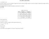
This web page is an interactive physics problem on vector addition. The page explains the concept of breaking a vector into components and adding them together, and works through an example problem. The attached Java applet visualizes the problem. This is part of a collection of similar simulation-based student activities.

Subject:
Physical Science
Physics
Material Type:
Simulation
Provider:
Boston University
Author:
Andrew Duffy
Date Added:
05/13/2008
WISE - The Web-Based Inquiry Science Environment
Conditional Remix & Share Permitted
CC BY-SA
Rating
0.0 stars

The Web-based Inquiry Science Environment (WISE) is a free on-line science learning environment for students in grades 4-12. In WISE, students work on exciting inquiry projects on topics such as genetically modified foods, earthquake prediction, and the deformed frogs mystery. Students learn about and respond to contemporary scientific controversies through designing, debating, and critiquing solutions, all via the internet. Curriculum projects are complete and ready to use in the classroom. The projects are designed to meet standards and complement existing science curricula. The Teacher Area lets instructors explore new projects and grade students' work on the web, as well as to collaborate with other teachers and researchers.

Subject:
Applied Science
Astronomy
Biology
Chemistry
Ecology
Education
Educational Technology
Environmental Science
Forestry and Agriculture
Geology
Geoscience
Life Science
Physical Science
Physics
Space Science
Technology
Material Type:
Module
Unit of Study
Provider:
ComPADRE Digital Library
Provider Set:
ComPADRE: Resources for Physics and Astronomy Education
Author:
National Science Foundation
Technology Enhanced Learning in Science (TELS)
Date Added:
05/03/2010
Web-o-Cycles
Conditional Remix & Share Permitted
CC BY-NC-SA
Rating
0.0 stars

Called the "Web-o-Cycles," groups of students are each assigned a different matter cycle to become deeply familiar with not only the internal components and interactions, but also possible connections to other cycles. For example, volcanic activity in the rock cycle also discharges sulfur into the atmosphere, which turn interacts with the water cycle in cloud formation. Connections such as these are made between posters of the cycles using colored yard, hooked on the appropriate nodes on each cycle and labeled by the nature of the interaction with the note cards hung on the yarn. In a short period of time, the classroom is a web of yarn, connecting each cycle to the others.

The next element of this activity attempts to capture elements of complex Earth systems, especially the concepts of equilibrium, hysteresis, power law relationships, and sensitive dependence. All lines connecting the cycles are held taut, representing an equilibrium condition. Small shifts in one cycle are compensated for by consequent shifts in other cycles. Selecting one of the interconnecting strands, tension is in introduced, first in small pulls which accumulate to imbalance and shift the cycles slightly. A single large pull in one strand, to the point of breaking the yarn, causes some lines to slacken, perhaps to the point that they cannot be easily restored to tautness without dramatic shifts in the connected cycles. Re-tightening the connections causes a shift in the cycles, which takes place quickly and assumes a slightly different but at least familiar pattern. Having students then share their observations of the process of pattern description-imbalances-shifts-new equilibrium allows them to recognize the dynamic nature of Earth systems interactions as well as to seek deeper understanding of hidden elements within the Earth system.

Materials needed:

At least four posters depicting detailed graphical representations of matter cycles, such as water, carbon, rock, nitrogen, sulfur, phosphorous, mounted on cardboard or another rigid material. Students should have available to them information on each cycle, depicting relative volumes of material in each cycle phase, residence times of the material in those phases, and the processes that drive changes from one phase to another;
At least one ball of yarn, in a different color, for each poster;
Note cards on which students will write a description of the individual processes used to link cycles;
Paper clips to hang the note cards on these connective strands.

(Note: this resource was added to OER Commons as part of a batch upload of over 2,200 records. If you notice an issue with the quality of the metadata, please let us know by using the 'report' button and we will flag it for consideration.)

Subject:
Biology
Career and Technical Education
Environmental Studies
Life Science
Material Type:
Activity/Lab
Provider:
Science Education Resource Center (SERC) at Carleton College
Provider Set:
Teach the Earth
Author:
Eric Pyle
Date Added:
08/16/2019
Writing and Literature: Composition as Inquiry, Learning, Thinking, and Communication
Conditional Remix & Share Permitted
CC BY-SA
Rating
0.0 stars

In the age of Buzzfeeds, hashtags, and Tweets, students are increasingly favoring conversational writing and regarding academic writing as less pertinent in their personal lives, education, and future careers. Writing and Literature: Composition as Inquiry, Learning, Thinking and Communication connects students with works and exercises and promotes student learning that is kairotic and constructive. Dr. Tanya Long Bennett, professor of English at the University of North Georgia, poses questions that encourage active rather than passive learning. Furthering ideas presented in Contribute a Verse: A Guide to First-Year Composition as a complimentary companion, Writing and Literature builds a new conversation covering various genres of literature and writing. Students learn the various writing styles appropriate for analyzing, addressing, and critiquing these genres including poetry, novels, dramas, and research writing. The text and its pairing of helpful visual aids throughout emphasizes the importance of critical reading and analysis in producing a successful composition. Writing and Literature is a refreshing textbook that links learning, literature, and life.

Subject:
Composition and Rhetoric
English Language Arts
Material Type:
Textbook
Provider:
University System of Georgia
Provider Set:
Galileo Open Learning Materials
Author:
Tanya Long Bennet
Date Added:
07/02/2019