Updating search results...

Search Resources

4256 Results

View
Selected filters:
  • geoscience
Changing Planet: Ocean Temperatures
Read the Fine Print
Rating
0.0 stars

This video follows Bermuda scientists into the field as they collect data that documents a warming trend in ocean temperatures. BIOS Director Tony Knapp discusses some of the impact of warming temperatures on sea levels, storms, and marine ecosystems.

Subject:
Applied Science
Career and Technical Education
Environmental Science
Environmental Studies
Oceanography
Physical Science
Provider:
CLEAN: Climate Literacy and Energy Awareness Network
Provider Set:
CLEAN: Climate Literacy and Energy Awareness Network
Author:
NASA/Windows on the Universe
NBC Learn
Date Added:
10/27/2014
Changing Planet: Rising Sea Level
Read the Fine Print
Rating
0.0 stars

This video discusses the social and economic impacts (worldwide and in the US) of sea level rise caused by global warming (aired April 1, 2011). Note: you may need to scroll down the Changing Planet video page to get to this video.

Subject:
Applied Science
Career and Technical Education
Environmental Science
Environmental Studies
Geoscience
History
History, Law, Politics
Oceanography
Physical Science
Provider:
CLEAN: Climate Literacy and Energy Awareness Network
Provider Set:
CLEAN: Climate Literacy and Energy Awareness Network
Author:
NBC Learn
Windows to the Universe
Date Added:
10/27/2014
Changing Planet: Thawing Permafrost and Methane
Unrestricted Use
CC BY
Rating
0.0 stars

This video examines the thawing of permafrost due to changes in climate and shows examples of the impacts that warming temperatures have on permafrost in the Arctic, including the release of the greenhouse gas methane. Dramatic results are shown, including sink holes forming on the landscape and beneath buildings, roads, and other infrastructure, causing some communities to relocate.

Subject:
Applied Science
Environmental Science
Physical Science
Provider:
CLEAN: Climate Literacy and Energy Awareness Network
Provider Set:
CLEAN: Climate Literacy and Energy Awareness Network
Author:
NBC Learn
UCAR
Date Added:
06/19/2012
Changing Planet: Warming Lakes
Read the Fine Print
Rating
0.0 stars

The video addresses impact of warming temperatures on major lakes of the world with specific focus on Lake Superior and Lake Tanganyika. It discusses the science of water stratification and its impact on lake ecosystems and on human populations whose livelihoods depend on the lakes.

Subject:
Applied Science
Career and Technical Education
Ecology
Environmental Science
Environmental Studies
Geoscience
History
History, Law, Politics
Life Science
Physical Science
Provider:
CLEAN: Climate Literacy and Energy Awareness Network
Provider Set:
CLEAN: Climate Literacy and Energy Awareness Network
Author:
National Earth Science Teachers Association (NESTA)
Windows to the Universe/NBC Learn
Date Added:
10/27/2014
Changing With the Tide
Conditional Remix & Share Permitted
CC BY-NC-SA
Rating
0.0 stars

This lesson plan is written around a brief role-play in which students learn about and act out plants and animals in a salt marsh habitat as the tides change.

(Note: this resource was added to OER Commons as part of a batch upload of over 2,200 records. If you notice an issue with the quality of the metadata, please let us know by using the 'report' button and we will flag it for consideration.)
Subject:
Biology
Chemistry
Life Science
Physical Science
Material Type:
Activity/Lab
Provider:
Science Education Resource Center (SERC) at Carleton College
Provider Set:
Teach the Earth
Author:
Rebecca Teed
Date Added:
02/02/2021
Chaos in Population Dynamics -- Understanding Chaos in the Logistic Model
Conditional Remix & Share Permitted
CC BY-NC-SA
Rating
0.0 stars

Spreadsheets Across the Curriculum module. Students build spreadsheets to explore conditions that lead to chaotic behavior in logistic models of populations that grow discretely.

Subject:
Biology
Ecology
Geoscience
Life Science
Mathematics
Physical Science
Material Type:
Activity/Lab
Provider:
Science Education Resource Center (SERC) at Carleton College
Provider Set:
Pedagogy in Action
Author:
David McAvity
Date Added:
11/06/2014
Character coding
Conditional Remix & Share Permitted
CC BY-NC-SA
Rating
0.0 stars

Character coding has been called the bete noire of phylogenetic analysis. As you may have seen from class, the definition of "character" is squishy and varies between authors. Although there isn't agreement on exactly what a character is, it is possible to predict how certain character definitions and coding strategies affect phylogenetic analysis.
This activity focuses on character coding, specifically about how different coding strategies can affect analysis. In this exercise we will try to look at different coding strategies by considering the simple shapes below.

(1) What is a character, and what qualities do characters have?
(2) Given the 'morphology' depicted above, what features vary?
(3) Given the variation you identified, come up with as many character codings as you can; i.e., different ways that this variation can be coded into characters.
(4) For each of the coding strategies you come up with in question 3, identify its assumptions, limitations, and strengths.
(5) Identify your preferred coding strategy and defend your choice.

Students asked to define what a character is and to discuss what they 'require', and then to come up with an exhaustive list of coding strategies for the sample morphology. They are then asked to list assumptions/limitations of each strategy.

(Note: this resource was added to OER Commons as part of a batch upload of over 2,200 records. If you notice an issue with the quality of the metadata, please let us know by using the 'report' button and we will flag it for consideration.)
Subject:
Biology
Life Science
Material Type:
Activity/Lab
Provider:
Science Education Resource Center (SERC) at Carleton College
Provider Set:
Teach the Earth
Author:
Jeff Wilson
Date Added:
06/19/2020
Characteristics of the Sun
Read the Fine Print
Educational Use
Rating
0.0 stars

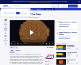
This video segment adapted from NASA describes the basic characteristics of our star, the Sun.

Subject:
Astronomy
Chemistry
Education
Geoscience
Physical Science
Physics
Space Science
Material Type:
Activity/Lab
Diagram/Illustration
Provider:
PBS LearningMedia
Provider Set:
PBS Learning Media: Multimedia Resources for the Classroom and Professional Development
Author:
National Science Foundation
WGBH Educational Foundation
Date Added:
12/17/2005
Characterizing Plate Boundaries
Conditional Remix & Share Permitted
CC BY-NC-SA
Rating
0.0 stars

To prepare for this exercise students read about the processes that operate at plate boundaries and how they are related to the distinct patterns of seismicity, volcanism, surface elevations (e.g., ridges versus trenches), and seafloor ages characteristic of different boundary types. During the week the assignment is available online, students have access to:
(1) an index map that locates three boundaries they are to study; and
(2) four maps from Sawyer's Discovering Plate Boundaries website that provide the data mentioned above.Â

Student tasks are to:Â
(1) document patterns in each type of data along the three targeted boundaries; andÂ
(2) use these observations in conjunction with their understandings of the processes that operate along different types of boundaries to decide whether each of the targeted sites is most likely to be a divergent, convergent, or shear boundary.Â

This activity gives students practice in map reading, interpreting the likely tectonic setting of a boundary by pulling together constraints from several types of data, and collaborating with their classmates in an online environment. The activity also provides a foundation for understanding a wide range of phenomena that are discussed later in the semester in the context of plate tectonic processes.
Modifications on this activity from the community

Show More
Show LessContributed by Tom Hickson
I also use a version of Dale Sawyer's Discovering Plate Boundaries exercise in an online course. I used the basic idea of this activity and moved in onto Canvas, our LMS. Here is my adaptation of the activity, with maps and examples, illustrating how I have implemented it:

Description of the assignment: Student handout, ONLINE_ Characterizing Plate Boundaries (adapted).pdf (Acrobat (PDF) 166kB Feb19 21)
Answer sheet for students to record observations and interpretations: Target Boundaries: Student answer sheet (Acrobat (PDF) 1MB Feb19 21)
World map with Target Boundaries (Acrobat (PDF) 483kB Feb19 21)

Maps of the "target boundaries" -- my selected areas of focus for the exercise:


Example map, Boundary 3

Provenance: Thomas A. Hickson, University of St. Thomas
Reuse: This item is offered under a Creative Commons Attribution-NonCommercial-ShareAlike license http://creativecommons.org/licenses/by-nc-sa/3.0/ You may reuse this item for non-commercial purposes as long as you provide attribution and offer any derivative works under a similar license.


Example map, Boundary 2

Provenance: Thomas A. Hickson, University of St. Thomas
Reuse: This item is offered under a Creative Commons Attribution-NonCommercial-ShareAlike license http://creativecommons.org/licenses/by-nc-sa/3.0/ You may reuse this item for non-commercial purposes as long as you provide attribution and offer any derivative works under a similar license.


Map example, boundary 1

Provenance: Thomas A. Hickson, University of St. Thomas
Reuse: This item is offered under a Creative Commons Attribution-NonCommercial-ShareAlike license http://creativecommons.org/licenses/by-nc-sa/3.0/ You may reuse this item for non-commercial purposes as long as you provide attribution and offer any derivative works under a similar license.

Teaching Tips
Adaptations that allow this activity to be successful in an online environment
Sawyer's Discovering Plate Boundaries is a jigsaw exercise in which students collaboratively develop an empirical classification of plate boundaries by first studying an individual data set (e.g., seismicity) and then working as part of a multidisciplinary team to develop a composite classification for the boundaries of a single plate using several types of data. In order for the classification to be truly empirical, students are not introduced to the "traditional" classification of plate boundaries till the end of the exercise.Â

In adapting this assignment to the online environment I have:

(1) asked students to prepare by becoming familiar with the standard classification of plate boundaries and the processes that operate at them;Â
(2) limited their work to three targeted boundaries of different types; andÂ
(3) provided guidance about which features to look for in the each data set. I have found that these modifications help online students, who often work alone "on their own schedules", to avoid getting "lost" and frustrated with the assignment and to compensate for the lack of collaborative input they would receive in a classroom setting.

Elements of this activity that are most effective
The success of this exercise is really seems to depend on how well a student follows the directions. If a student learns about the geologic differences among plate boundaries, makes careful observations, and thoughtfully compares his or her observations to the expected patterns he or she typically does quite well based on answers to the follow-up questions. If, on the other hand, a student simply looks up the types of the targeted boundaries on a map and then attempts to "back out" the observations that he or she thinks should fit, the result is often inconsistency and a poor score on the questions. (I can often tell which approach a student is taking based on the queries they post to the discussion board, but rarely seem to be able to get those who are trying to work backwards through the assignment to change direction.)
Recommendations for other faculty adapting this activity to their own course:
To date my experience developing an engaging online exercise to help students learn the principles of plate tectonics has only been partly successful. I think that having such an exercise is critical, however, because this topic provides the framework for so much of what we learn in the geosciences. Based on my efforts to adapt elements of Discovering Plate Boundaries to an online environment I would offer three recommendations.

(1) Provide examples. Confronted with an unfamiliar map students are sometimes confused when asked to decide if seafloor age, for example, is uniform or variable along the length of a boundary. Showing them what you mean using snapshots from a map can often clear questions like this up quickly. Similarly, for written work a single example that gives them a clear sense of "what you're looking for" and can often head off a lot of questions.
(2) Choose the boundaries you ask students to study carefully. The scarcity of documented volcanism along a mid-ocean ridge or the burial of seafloor age belts by sediment along a trench can result in student observations that are correct, but problematic for correctly assessing the nature of a boundary.
(3) Stay on top of student questions and comments, and be prepared to make well-publicized "mid-course corrections" if something you thought was clear turns out to be misunderstood. These minor corrections happen naturally in face-to-face classes but can require real diligence to catch and correct in the online environment.

(Note: this resource was added to OER Commons as part of a batch upload of over 2,200 records. If you notice an issue with the quality of the metadata, please let us know by using the 'report' button and we will flag it for consideration.)
Subject:
Biology
Life Science
Material Type:
Activity/Lab
Provider:
Science Education Resource Center (SERC) at Carleton College
Provider Set:
Teach the Earth
Author:
Bill Hirt
Date Added:
02/19/2021
Charles Darwin II: Natural selection
Read the Fine Print
Educational Use
Rating
0.0 stars

This is the second in a series of modules which detail the research of Charles Darwin and evolutionary theory. This module continues with a discussion of the processes that led to Darwin's formulation of the theory of natural selection.

Subject:
Astronomy
Biology
Education
Geoscience
Life Science
Physical Science
Space Science
Material Type:
Interactive
Unit of Study
Provider:
UCAR Staff
Provider Set:
Visionlearning
Author:
Alfred Rosenberger
Date Added:
02/12/2004
Charles Darwin I: The origin of species
Read the Fine Print
Educational Use
Rating
0.0 stars

This module introduces Darwin's Galapagos travels and an introduction to the theory of evolution as a force for biological change and diversification. This is the first in a series of modules which detail the research of Charles Darwin and evolutionary theory.

Subject:
Astronomy
Biology
Education
Geoscience
Life Science
Physical Science
Space Science
Material Type:
Interactive
Unit of Study
Provider:
UCAR Staff
Provider Set:
Visionlearning
Author:
Alfred Rosenberger
Date Added:
12/09/2003
Charting Temperature Changes
Unrestricted Use
CC BY
Rating
0.0 stars

In this activity, students chart temperature changes over time in Antarctica's paleoclimate history by reading rock cores. Students use their data to create an interactive display illustrating how Antarctica's climate timeline can be interpreted from ANDRILL rock cores.

Subject:
Physical Science
Material Type:
Activity/Lab
Provider:
CLEAN: Climate Literacy and Energy Awareness Network
Provider Set:
CLEAN: Climate Literacy and Energy Awareness Network
Author:
Antarctica's Climate Secrets: Project Andrill
LuAnn Dahlman
Date Added:
06/19/2012
Chasing Tornadoes
Read the Fine Print
Educational Use
Rating
0.0 stars

In this video segment adapted from NOVA, scientists are on the hunt for tornadoes. Using Doppler radar, they gather data in the hopes of solving the mystery of how tornadoes form.

Subject:
Atmospheric Science
Physical Science
Material Type:
Activity/Lab
Diagram/Illustration
Provider:
PBS LearningMedia
Provider Set:
PBS Learning Media: Multimedia Resources for the Classroom and Professional Development
Author:
National Science Foundation
WGBH Educational Foundation
Date Added:
12/17/2005
Chemical Differentiation in the Palisades Sill
Conditional Remix & Share Permitted
CC BY-NC-SA
Rating
0.0 stars

The purpose of this assignment is for students to synthesize field observations, petrography, and whole-rock chemical analyses in order to investigate chemical differentiation processes in a basaltic magma chamber. The students first complete a petrography lab on both hand samples and thin sections that represent a complete stratigraphic section through sill at Fort Lee, NJ. I then provide them with major- and trace-element data and a table of distribution coefficients for common phases that would be crystallizing from basaltic magma. I then ask them to discuss the chemical differentiation of the sill by writing up a 1-2 page interpretative summary based on their petrographic observations and the chemical data.

(Note: this resource was added to OER Commons as part of a batch upload of over 2,200 records. If you notice an issue with the quality of the metadata, please let us know by using the 'report' button and we will flag it for consideration.)
Subject:
Biology
Chemistry
Life Science
Mathematics
Measurement and Data
Physical Science
Statistics and Probability
Material Type:
Activity/Lab
Data Set
Lesson Plan
Provider:
Science Education Resource Center (SERC) at Carleton College
Provider Set:
Teach the Earth
Author:
Matthew Gorring
Date Added:
08/06/2019
Chemical Equilibrium Misconceptions
Conditional Remix & Share Permitted
CC BY-NC-SA
Rating
0.0 stars

This STELLA modeling and writing assignment helps students confront and replace common misconceptions about chemical equilibrium.

(Note: this resource was added to OER Commons as part of a batch upload of over 2,200 records. If you notice an issue with the quality of the metadata, please let us know by using the 'report' button and we will flag it for consideration.)

Subject:
Biology
Chemistry
Life Science
Physical Science
Material Type:
Homework/Assignment
Provider:
Science Education Resource Center (SERC) at Carleton College
Provider Set:
Teach the Earth
Author:
Barry Bickmore
Date Added:
08/10/2019
Chemical Equilibrium Misconceptions
Conditional Remix & Share Permitted
CC BY-NC-SA
Rating
0.0 stars

This STELLA modeling and writing assignment helps students confront and replace common misconceptions about chemical equilibrium.

Subject:
Chemistry
Geoscience
Physical Science
Material Type:
Activity/Lab
Provider:
Science Education Resource Center (SERC) at Carleton College
Provider Set:
Starting Point (SERC)
Author:
Barry Bickmore
Date Added:
08/28/2012
Chemical Inputs and Outputs at Subduction Zones
Conditional Remix & Share Permitted
CC BY-NC-SA
Rating
0.0 stars

In this exercise students utilize data from geochemistry databases to analyze inputs and outputs associated with arc volcanism.

(Note: this resource was added to OER Commons as part of a batch upload of over 2,200 records. If you notice an issue with the quality of the metadata, please let us know by using the 'report' button and we will flag it for consideration.)
Subject:
Biology
Chemistry
Geoscience
Life Science
Physical Science
Material Type:
Activity/Lab
Data Set
Lesson Plan
Provider:
Science Education Resource Center (SERC) at Carleton College
Provider Set:
Teach the Earth
Author:
Karin Block
Date Added:
09/25/2022
Chemical Weathering
Conditional Remix & Share Permitted
CC BY-NC-SA
Rating
0.0 stars

This tombstone weathering lab is designed to provide students with tangible understanding of chemical weathering and weathering rates. To prepare for this lab, students will have learned in previous labs to identify common minerals and rocks and will have attended lectures about the process of chemical weathering. During the first part of the lab we travel to the city cemetery to collect data on the age and extent of chemical weathering of tombstones that are made of limestone and igneous rocks. After collecting data for ~1 hour, we return to the computer lab where students use Microsoft Excel to analyze and interpret their data. Their task is to calculate a chemical weathering rate for limestone for our region and compare that rate to those from other regions. This activity gives students experience in the process of scientific inquiry: data collection, data analysis and data interpretation. Students develop Microsoft Excel skills: writing formulas, producing charts, understanding trendlines and R2 values.

(Note: this resource was added to OER Commons as part of a batch upload of over 2,200 records. If you notice an issue with the quality of the metadata, please let us know by using the 'report' button and we will flag it for consideration.)

Subject:
Biology
Life Science
Material Type:
Activity/Lab
Module
Provider:
Science Education Resource Center (SERC) at Carleton College
Provider Set:
Teach the Earth
Author:
Kira Lawrence
Date Added:
08/21/2019
Chemist and Biologist Catherine Drennan
Read the Fine Print
Educational Use
Rating
0.0 stars

In this video produced for Teachers' Domain, learn about MIT professor Cathy Drennan's research into microorganisms that remove carbon dioxide, a greenhouse gas, from the atmosphere.

Subject:
Applied Science
Ecology
Environmental Science
Forestry and Agriculture
Geoscience
Life Science
Physical Science
Space Science
Material Type:
Lesson
Provider:
PBS LearningMedia
Provider Set:
PBS Learning Media Common Core Collection
Author:
Amgen Foundation
WGBH Educational Foundation
Date Added:
09/08/2009