Updating search results...

Search Resources

86 Results

View
Selected filters:
  • volcanoes
Natural Disasters
Read the Fine Print
Educational Use
Rating
0.0 stars

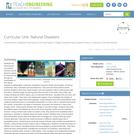
Students are introduced to our planet's structure and its dynamic system of natural forces through an examination of the natural hazards of earthquakes, volcanoes, landslides, tsunamis, floods and tornados, as well as avalanches, fires, hurricanes and thunderstorms. They see how these natural events become disasters when they impact people, and how engineers help to make people safe from them. Students begin by learning about the structure of the Earth; they create clay models showing the Earth's layers, see a continental drift demo, calculate drift over time, and make fault models. They learn how earthquakes happen; they investigate the integrity of structural designs using model seismographs. Using toothpicks and mini-marshmallows, they create and test structures in a simulated earthquake on a tray of Jell-O. Students learn about the causes, composition and types of volcanoes, and watch and measure a class mock eruption demo, observing the phases that change a mountain's shape. Students learn that the different types of landslides are all are the result of gravity, friction and the materials involved. Using a small-scale model of a debris chute, they explore how landslides start in response to variables in material, slope and water content. Students learn about tsunamis, discovering what causes them and makes them so dangerous. Using a table-top-sized tsunami generator, they test how model structures of different material types fare in devastating waves. Students learn about the causes of floods, their benefits and potential for disaster. Using riverbed models made of clay in baking pans, students simulate the impact of different river volumes, floodplain terrain and levee designs in experimental trials. They learn about the basic characteristics, damage and occurrence of tornadoes, examining them closely by creating water vortices in soda bottles. They complete mock engineering analyses of tornado damage, analyze and graph US tornado damage data, and draw and present structure designs intended to withstand high winds.

Subject:
Applied Science
Engineering
Material Type:
Activity/Lab
Lesson Plan
Provider:
TeachEngineering
Provider Set:
TeachEngineering
Date Added:
04/10/2009
Naturally Disastrous
Read the Fine Print
Educational Use
Rating
0.0 stars

Students are introduced to natural disasters, and learn the difference between natural hazards and natural disasters. They discover the many types of natural hazards avalanche, earthquake, flood, forest fire, hurricane, landslide, thunderstorm, tornado, tsunami and volcano as well as specific examples of natural disasters. Students also explore why understanding these natural events is important to engineers and everyone's survival on our planet.

Subject:
Applied Science
Atmospheric Science
Engineering
Geology
Physical Science
Material Type:
Activity/Lab
Lesson Plan
Provider:
TeachEngineering
Provider Set:
TeachEngineering
Author:
Denise W. Carlson
Geoffrey Hill
Malinda Schaefer Zarske
Date Added:
09/18/2014
Old Sticks in the Mud: Hazards of Lahars from Mount Rainier Volcano
Conditional Remix & Share Permitted
CC BY-NC-SA
Rating
0.0 stars

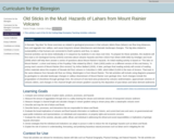
Volcanic debris flows (lahars) flow long distances, bury and aggrade river valleys, and cause long-term stream disturbances and dramatic landscape changes. Students will evaluate the nature, scale, and history of past lahars from Mount Rainier in a river valley and interpret the past and potential future impact on humans of lahars.

(Note: this resource was added to OER Commons as part of a batch upload of over 2,200 records. If you notice an issue with the quality of the metadata, please let us know by using the 'report' button and we will flag it for consideration.)

Subject:
Biology
Career and Technical Education
Environmental Studies
Geology
Hydrology
Life Science
Physical Science
Material Type:
Activity/Lab
Homework/Assignment
Provider:
Science Education Resource Center (SERC) at Carleton College
Provider Set:
Teach the Earth
Author:
Patrick Pringle
Date Added:
11/04/2021
Olympus Mons and Hawaii
Conditional Remix & Share Permitted
CC BY-NC-SA
Rating
0.0 stars

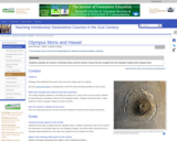
Students use the height and radius of Olympus Mons to estimate its volume. They then propose a method to estimate the volume of lava that has erupted over from the Hawaiian hotspot over time. I then show them a graph of the cumulative volcanic volume as a function of distance from Kilauea (from Clague and Dalrymple). They compare these volumes and also consider the possibility that some of the lava erupted from the Hawaiian hotspot has been subducted.

(Note: this resource was added to OER Commons as part of a batch upload of over 2,200 records. If you notice an issue with the quality of the metadata, please let us know by using the 'report' button and we will flag it for consideration.)

Subject:
Biology
Life Science
Mathematics
Measurement and Data
Statistics and Probability
Material Type:
Activity/Lab
Provider:
Science Education Resource Center (SERC) at Carleton College
Provider Set:
Teach the Earth
Author:
Carol Ormand
Date Added:
09/01/2022
Our Changing Earth: Virtual Bookshelf
Conditional Remix & Share Permitted
CC BY-SA
Rating
0.0 stars

This article features children's literature about erosion, glaciers, earthquakes, and volcanoes for use in the elementary classroom.

Subject:
Applied Science
Environmental Science
Material Type:
Lesson Plan
Provider:
Ohio State University College of Education and Human Ecology
Provider Set:
Beyond Penguins and Polar Bears: An Online Magazine for K-5 Teachers
Author:
Kate Hastings
Date Added:
10/17/2014
Perspectives on Ocean Science: Volcanoes
Read the Fine Print
Rating
0.0 stars

Join Scripps Institution's David Hilton as takes us on a journey to Costa Rica on the first stage of research to find out if volcanoes put out as much as the earth's mantle takes back during the processes of subduction and volcanism. (28 minutes)

Subject:
Oceanography
Physical Science
Material Type:
Lecture
Provider:
UCTV Teacher's Pet
Date Added:
01/10/2006
Physical Geology
Unrestricted Use
CC BY
Rating
0.0 stars

Physical Geology is a comprehensive introductory text on the physical aspects of geology, including rocks and minerals, plate tectonics, earthquakes, volcanoes, glaciation, groundwater, streams, coasts, mass wasting, climate change, planetary geology and much more. It has a strong emphasis on examples from western Canada, especially British Columbia, and also includes a chapter devoted to the geological history of western Canada. The book is a collaboration of faculty from Earth Science departments at Universities and Colleges across British Columbia and elsewhere.

Subject:
Geology
Physical Science
Material Type:
Textbook
Provider:
BCcampus
Provider Set:
BCcampus Open Textbooks
Author:
Steven Earle
Date Added:
03/02/2016
Physical Geology, First University of Saskatchewan Edition
Conditional Remix & Share Permitted
CC BY-NC-SA
Rating
0.0 stars

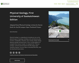
Physical Geology is a comprehensive introductory text on the physical aspects of geology, including rocks and minerals, plate tectonics, earthquakes, volcanoes, mass wasting, climate change, planetary geology and much more. It has a strong emphasis on examples from western Canada. It is adapted from "Physical Geology" written by Steven Earle for the BCcampus Open Textbook Program. To access links to download PDF files, click the Read Book button below.

Subject:
Geology
Physical Science
Material Type:
Textbook
Provider:
University of Saskatchewan
Author:
Karla Panchuk
Date Added:
03/26/2019
Physical Geology: Idaho Field Trip
Conditional Remix & Share Permitted
CC BY-NC-SA
Rating
0.0 stars

This optional field trip is designed to augment the in-class learning experience in introductory physical geology by providing students the opportunity to see firsthand local geological features and understand their context in the long-term tectonic evolution of the western United States. The university is conveniently located in a portion of the American west where a plethora of geological features are readily accessible over a total field trip duration of 6 hours. Over a total of 6 field stops, students are presented with an opportunity to observe features relevant to topics learned in class involving rock types, volcanic features (lava flows and ash fall deposits), faults and folds, mass wasting features, catastrophic flood deposits (Bonneville and Missoula floods), and loess deposits.

(Note: this resource was added to OER Commons as part of a batch upload of over 2,200 records. If you notice an issue with the quality of the metadata, please let us know by using the 'report' button and we will flag it for consideration.)

Subject:
Biology
Geology
Life Science
Physical Science
Material Type:
Activity/Lab
Provider:
Science Education Resource Center (SERC) at Carleton College
Provider Set:
Teach the Earth
Author:
Simon Kattenhorn
Date Added:
09/01/2020
Physical and Chemical Variations Along the Central American Volcanic Arc
Conditional Remix & Share Permitted
CC BY-NC-SA
Rating
0.0 stars

The Central American volcanic arc displays large arc-parallel variations in chemical composition that yield important clues concerning the complex origin of magmas in subduction zones. In this exercise, students use data compiled for the NSF MARGINS program to compare heights, volumes, and whole-rock compositions of 39 Quaternary volcanic centers along the Central American arc, together with crustal thicknesses, to assess the possible sources of the magmas and the petrologic processes that have modified them prior to eruption.

(Note: this resource was added to OER Commons as part of a batch upload of over 2,200 records. If you notice an issue with the quality of the metadata, please let us know by using the 'report' button and we will flag it for consideration.)

Subject:
Biology
Chemistry
Geoscience
Life Science
Physical Science
Material Type:
Activity/Lab
Data Set
Lesson Plan
Provider:
Science Education Resource Center (SERC) at Carleton College
Provider Set:
Teach the Earth
Author:
Kent Ratajeski
Date Added:
11/15/2016
Plate Tectonics II: Plates, plate boundaries, and driving forces
Read the Fine Print
Educational Use
Rating
0.0 stars

The distribution of earthquakes and volcanoes around the world confirmed the theory of plate tectonics first proposed by Wegener. These phenomena also help categorize plate boundaries into three different types: convergent, divergent, and transform.

Subject:
Astronomy
Chemistry
Education
Geology
Geoscience
Physical Science
Physics
Space Science
Material Type:
Interactive
Unit of Study
Provider:
UCAR Staff
Provider Set:
Visionlearning
Author:
Anne Egger
Date Added:
03/18/2003
Plate Tectonics: The Hawaiian Archipelago
Read the Fine Print
Educational Use
Rating
0.0 stars

This video segment adapted from NOVA uses animation to show the relationship between the movement of a tectonic plate and whether volcanoes on the Hawaiian Islands are active or dormant.

Subject:
Astronomy
Chemistry
Education
Geology
Geoscience
Physical Science
Physics
Space Science
Material Type:
Activity/Lab
Diagram/Illustration
Provider:
PBS LearningMedia
Provider Set:
PBS Learning Media: Multimedia Resources for the Classroom and Professional Development
Author:
National Science Foundation
WGBH Educational Foundation
Date Added:
10/21/2005
Ready to Erupt!
Read the Fine Print
Educational Use
Rating
0.0 stars

Students observe an in-classroom visual representation of a volcanic eruption. The water-powered volcano demonstration is made in advance, using sand, hoses and a waterballoon, representing the main components of all volcanoes. During the activity, students observe, measure and sketch the volcano, seeing how its behavior provides engineers with indicators used to predict an eruption.

Subject:
Applied Science
Engineering
Geology
Physical Science
Material Type:
Activity/Lab
Provider:
TeachEngineering
Provider Set:
TeachEngineering
Author:
Denise W. Carlson
Geoffrey Hill
Malinda Schaefer Zarske
Date Added:
10/14/2015
STEM in 30: Shake Rattle and Roll: The Science Underneath Earthquakes and Volcanoes
Conditional Remix & Share Permitted
CC BY-NC
Rating
0.0 stars

Travel to the Pacific Northwest, home to some of the most seismically active areas in the U.S. Learn from experts about tectonic activity and find out if they know when the "big one” will hit.

Subject:
Physical Science
Material Type:
Activity/Lab
Author:
National Air and Space Museum
Date Added:
05/14/2020
Save Our City!
Read the Fine Print
Educational Use
Rating
0.0 stars

Students learn about various natural hazards and specific methods engineers use to prevent these hazards from becoming natural disasters. They study a hypothetical map of an area covered with natural hazards and decide where to place natural disaster prevention devices by applying their critical thinking skills and an understanding of the causes of natural disasters.

Subject:
Applied Science
Engineering
Material Type:
Activity/Lab
Lesson Plan
Provider:
TeachEngineering
Provider Set:
TeachEngineering
Author:
Denise Carlson
Geoffrey Hill
Malinda Schaefer Zarske
Date Added:
09/26/2008
Smithsonian Science Starter: Volcanoes from Space with Astronaut Ricky Arnold
Conditional Remix & Share Permitted
CC BY-NC
Rating
0.0 stars

Did you know astronauts can see volcanoes erupting from space? Learn about this from NASA Astronaut Ricky Arnold and see a model volcano erupt.

Subject:
Physical Science
Material Type:
Activity/Lab
Provider:
National Air and Space Museum
Author:
National Air and Space Museum
Date Added:
09/02/2022
Tectonic Plates, Earthquakes, and Volcanoes
Read the Fine Print
Educational Use
Rating
0.0 stars

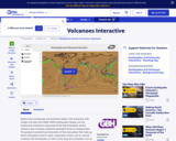
This interactive activity produced for Teachers' Domain shows the relationship between tectonic boundaries and the locations of earthquake events and volcanoes around the world.

Subject:
Astronomy
Chemistry
Education
Geology
Geoscience
Physical Science
Physics
Space Science
Material Type:
Activity/Lab
Data Set
Diagram/Illustration
Interactive
Provider:
PBS LearningMedia
Provider Set:
PBS Learning Media: Multimedia Resources for the Classroom and Professional Development
Author:
National Science Foundation
WGBH Educational Foundation
Date Added:
12/17/2005
VEPP: A guided inquiry - Three months in the life of a volcano
Conditional Remix & Share Permitted
CC BY-NC-SA
Rating
0.0 stars

This is an exercise that is in development and has not yet been fully tested in the classroom. Please check back regularly for updates and changes.

This guided inquiry will investigate the three month phase of activity in the vicinity of Pu`u `O`o and the summit region (June 1, 2007 -- August 30, 2007).
Students will examine already prepared monitoring data derived from the VEPP website (GPS, tilt and seismic), and, with guidance, discover what other information is available to understand and speculate on the nature of the activity, including webcams, videos, still images, maps, and press releases.
Full length description:
Prior to doing this introductory laboratory exercise, students should be introduced to the basic instruments used in volcano monitoring. Before class, students will be provided with an assignment to reinforce their understanding about the techniques used in volcano monitoring.

During lab, students (in small groups) will be provided with the data files from a three month period of time in the vicinity of Pu`u `O`o and the summit region (June 1, 2007 -- August 30, 2007) (GPS, RSAM and Tilt) at the start of the exercise. The data files are provided under Instructor Materials below.
A worksheet will be provided to the students to guide them through the initial investigation of the graphs. Example questions include: What is the data showing in each of the graphs? Are there any specific events that are evident in your graph? As a group, can you determine if the events seen in one graph correlate to events seen in any of the other graphs? A discussion of what data the graphs are illustrating will be facilitated by the instructor.

Once students have examined and understand what the data is showing, they will propose hypotheses to explain the observed data trends and correlations. Through just-in-time teaching (JiTT), students will be provided with or guided to further information that may assist them in discovering the nature of the activity. For example, they can request to see maps, videos, webcams, and images of the area during the three-month period spanned by the exercise.
Materials for implementing this laboratory are provided for instructors and students (forthcoming).

(Note: this resource was added to OER Commons as part of a batch upload of over 2,200 records. If you notice an issue with the quality of the metadata, please let us know by using the 'report' button and we will flag it for consideration.)

Subject:
Biology
Life Science
Material Type:
Activity/Lab
Provider:
Science Education Resource Center (SERC) at Carleton College
Provider Set:
Teach the Earth
Author:
Jennifer Thomson
Date Added:
04/05/2022
VEPP: Determining the relationship between the summit and Pu'u 'O'o on Kilauea
Conditional Remix & Share Permitted
CC BY-NC-SA
Rating
0.0 stars

This is an exercise that is in development and will not be fully tested until Fall 2010. Please check back regularly for updates and changes.
Brief three-line description of the activity or assignment and its strengths:
Students first learn about several volcanic monitoring techniques. Given three hypotheses on the movement of magma in the plumbing between the summit and Pu'u 'Ō'ō on Kilauea, students make predictions about what they would expect to see for each hypothesis in the data. They then analyze the data and test each hypothesis.

Full length description:

In this activity, students learn, using a balloon experiment and sketches, how the monitoring techniques of ground tilt and ground motion (using GPS) illustrate magma chamber inflation and deflation. Students also are briefly introduced to the varying composition of basalt lava.
Three hypotheses about the movement of magma between the Kilauea summit and Pu'u 'Ō'ō are given to the students. For each hypothesis, students make predictions about what they would expect to see with each monitoring technique. After making predictions, students are given handouts with the data from each technique, they analyze the data to evaluate each hypothesis, and they make a conclusion about the movement of magma beneath Kilauea.

(Note: this resource was added to OER Commons as part of a batch upload of over 2,200 records. If you notice an issue with the quality of the metadata, please let us know by using the 'report' button and we will flag it for consideration.)

Subject:
Biology
Life Science
Material Type:
Activity/Lab
Provider:
Science Education Resource Center (SERC) at Carleton College
Provider Set:
Teach the Earth
Author:
Karen Kortz
Date Added:
09/12/2020