Updating search results...

Search Resources

216 Results

View
Selected filters:
  • tectonics
Earthquake Intensity
Conditional Remix & Share Permitted
CC BY-NC-SA
Rating
0.0 stars

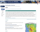
Introductory lesson that compares ShakeMaps between earthquakes in the same location but different magnitudes, and earthquakes of the same magnitude but different depths, to acquaint learners to the fundamental controls on intensity of shaking felt during an event: magnitude and distance from the earthquake source.

(Note: this resource was added to OER Commons as part of a batch upload of over 2,200 records. If you notice an issue with the quality of the metadata, please let us know by using the 'report' button and we will flag it for consideration.)
Subject:
Biology
Life Science
Material Type:
Activity/Lab
Provider:
Science Education Resource Center (SERC) at Carleton College
Provider Set:
Teach the Earth
Author:
Jennifer Pickering
Date Added:
08/16/2022
Earthquake Machine
Conditional Remix & Share Permitted
CC BY-NC-SA
Rating
0.0 stars

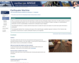
In this activity, learners work collaboratively in small groups to explore the earthquake cycle by using a physical model. Attention is captured through several short video clips illustrating the
awe-inspiring power of ground shaking resulting from earthquakes. To make students' prior knowledge explicit and activate their thinking about the topic of earthquakes, each student writes their definition of an earthquake on a sticky note. Next, through a collaborative process, small groups of students combine their individual definitions to create a consensus definition for an earthquake.

(Note: this resource was added to OER Commons as part of a batch upload of over 2,200 records. If you notice an issue with the quality of the metadata, please let us know by using the 'report' button and we will flag it for consideration.)
Subject:
Biology
Life Science
Material Type:
Activity/Lab
Homework/Assignment
Provider:
Science Education Resource Center (SERC) at Carleton College
Provider Set:
Teach the Earth
Author:
IRIS (Incorporated Research Institutions for Seismology) and ShakeAlert
Date Added:
09/26/2022
Earthquakes
Conditional Remix & Share Permitted
CC BY-NC-SA
Rating
0.0 stars

For this exercise we meet in a computer lab and students access the IRIS Earthquake Browser to download geospatial information of earthquakes. Students use the GEON Integrated Data Viewer (IDV) to explore the location of earthquake zones and their 3-dimensional characteristics. Students compare the earthquake characteristics of subduction zones, mid-oceanic ridges, and transform faults. This leads into a discussion of plate tectonics.

(Note: this resource was added to OER Commons as part of a batch upload of over 2,200 records. If you notice an issue with the quality of the metadata, please let us know by using the 'report' button and we will flag it for consideration.)
Subject:
Biology
Life Science
Material Type:
Activity/Lab
Data Set
Interactive
Provider:
Science Education Resource Center (SERC) at Carleton College
Provider Set:
Teach the Earth
Author:
Achim Herrmann
Date Added:
04/04/2021
Earthquakes Living Lab: The Theory of Plate Tectonics
Read the Fine Print
Educational Use
Rating
0.0 stars

Students gather evidence to explain the theory of plate tectonics. Using the online resources at the Earthquakes Living Lab, students examine information and gather evidence supporting the theory. They also look at how volcanoes and earthquakes are explained by tectonic plate movement, and how engineers use this information. Working in pairs, students think like engineers and connect what they understand about the theory of plate tectonics to the design of structures for earthquake-resistance. A worksheet serves as a student guide for the activity.

Subject:
Applied Science
Engineering
Geology
Physical Science
Material Type:
Activity/Lab
Provider:
TeachEngineering
Provider Set:
TeachEngineering
Author:
Jessica Noffsinger
Jonathan Knudtsen
Karen Johnson
Mike Mooney
Minal Parekh
Scott Schankweiler
Date Added:
09/18/2014
The Earths Shells - Thicknesses and Densities
Conditional Remix & Share Permitted
CC BY-NC-SA
Rating
0.0 stars

This module explores the combination of densities and shell thicknesses that produce an aggregate density of the Earth of 5.5 g/cm3.

(Note: this resource was added to OER Commons as part of a batch upload of over 2,200 records. If you notice an issue with the quality of the metadata, please let us know by using the 'report' button and we will flag it for consideration.)
Subject:
Biology
Geoscience
Life Science
Mathematics
Measurement and Data
Physical Science
Physics
Statistics and Probability
Material Type:
Activity/Lab
Provider:
Science Education Resource Center (SERC) at Carleton College
Provider Set:
Teach the Earth
Author:
Len Vacher
Date Added:
08/18/2019
Ecuador Workshop
Conditional Remix & Share Permitted
CC BY-NC-SA
Rating
0.0 stars

This is a project to assist in the design, drawing, modeling and hopefully constructing of a small Community Children’s Center near Guayaquil, Ecuador. For the last year, Nicki Lehrer, from MIT’s Aero/Astro Department, has been organizing efforts to build the project. The goal of the workshop is to provide her with a full fleshed out design for the community center so it can be built in the summer of 2007.

Subject:
Applied Science
Architecture and Design
Social Science
Sociology
Material Type:
Full Course
Provider Set:
MIT OpenCourseWare
Author:
Wampler, Jan
Date Added:
09/01/2006
Emergent Models in Google Earth
Conditional Remix & Share Permitted
CC BY-NC-SA
Rating
0.0 stars

Working in groups, students learn to navigate a virtual globe, read geophysical data, and assess plate tectonic models. They prepare by studying about plate tectonics from their notes or from the text, and then apply that knowledge to real tectonic settings on the virtual globe. Students drag 3D models out of the subsurface and compare real data to model interpretations. They can also substitute their own sketches for our images.

(Note: this resource was added to OER Commons as part of a batch upload of over 2,200 records. If you notice an issue with the quality of the metadata, please let us know by using the 'report' button and we will flag it for consideration.)

Subject:
Biology
Geology
Life Science
Physical Science
Material Type:
Activity/Lab
Provider:
Science Education Resource Center (SERC) at Carleton College
Provider Set:
Teach the Earth
Author:
Declan De Paor
Date Added:
09/14/2020
Episodic tremor and slip: The Case of the Mystery Earthquakes | Lessons on Plate Tectonics
Conditional Remix & Share Permitted
CC BY-NC-SA
Rating
0.0 stars

Earthquakes in western Washington and Oregon are to be expected -- the region lies in the Cascadia Subduction Zone. Offshore, the Juan de Fuca tectonic plate subducts under the North American plate, from northern California to British Columbia. The region, however, also experiences exotic seismicity -- Episodic Tremor and Slip (ETS).In this lesson, your students study seismic and GPS data from the region to recognize a pattern in which unusual tremors--with no surface earthquakes--coincide with jumps of GPS stations. This is ETS. Students model ductile and brittle behavior of the crust with lasagna noodles to understand how properties of materials depend on physical conditions. Finally, they assemble their knowledge of the data and models into an understanding of ETS in subduction zones and its relevance to the millions of residents in Cascadia.

(Note: this resource was added to OER Commons as part of a batch upload of over 2,200 records. If you notice an issue with the quality of the metadata, please let us know by using the 'report' button and we will flag it for consideration.)
Subject:
Biology
Life Science
Mathematics
Measurement and Data
Statistics and Probability
Material Type:
Activity/Lab
Provider:
Science Education Resource Center (SERC) at Carleton College
Provider Set:
Teach the Earth
Author:
Shelley Olds
Date Added:
08/27/2022
Evaluating the lines of evidence for plate tectonics
Conditional Remix & Share Permitted
CC BY-NC-SA
Rating
0.0 stars

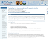
In this in-class exercise, students compare several lines of evidence that support the ideas of continental drift and plate tectonics. Before the class meeting, each student is given a preparation assignment in which he/she studies one "continental drift" and one "ocean floor data" map. In class, students divide into teams of 3, with each team member having prepared different specialties. They discuss their respective maps and look for spatial patterns among the data.

(Note: this resource was added to OER Commons as part of a batch upload of over 2,200 records. If you notice an issue with the quality of the metadata, please let us know by using the 'report' button and we will flag it for consideration.)
Subject:
Biology
Geology
Life Science
Oceanography
Physical Science
Material Type:
Activity/Lab
Provider:
Science Education Resource Center (SERC) at Carleton College
Provider Set:
Teach the Earth
Author:
Becca Walker
Date Added:
08/14/2019
Exercise on the Mesozoic/Cenozoic Development of the North American Cordillera
Conditional Remix & Share Permitted
CC BY-NC-SA
Rating
0.0 stars

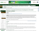
This assignment is intended to have students use the map reading skills they have learned in previous labs and their understanding of the lower crust and upper mantle derived from classroom lectures and demonstrations to develop a three-dimensional picture the Southern Canadian Cordillera. I try to incorporate the notion of temporal change by asking students to describe the region at different times in the past and to speculate what the region would look like if certain tectonic events happened in the future.

Key words: tectonics, Cordillera,subduction, fold thrust belts

(Note: this resource was added to OER Commons as part of a batch upload of over 2,200 records. If you notice an issue with the quality of the metadata, please let us know by using the 'report' button and we will flag it for consideration.)
Subject:
Biology
Life Science
Physical Science
Physics
Material Type:
Lesson Plan
Provider:
Science Education Resource Center (SERC) at Carleton College
Provider Set:
Teach the Earth
Author:
Steven Wojtal
Date Added:
09/01/2020
Exploring Evidence of Plate Tectonics Using GeoMapApp
Conditional Remix & Share Permitted
CC BY-NC-SA
Rating
0.0 stars

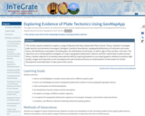
This activity requires students to explore a range of datasets that help substantiate Plate Tectonic Theory. Students investigate plate tectonic environments (convergent, divergent, transform boundaries), topography/bathymetry of continents and ocean basins, the distribution and pattern of earthquakes, the distribution of volcanoes, as well as ages of the sea-floor, and more.

(Note: this resource was added to OER Commons as part of a batch upload of over 2,200 records. If you notice an issue with the quality of the metadata, please let us know by using the 'report' button and we will flag it for consideration.)
Subject:
Biology
Life Science
Oceanography
Physical Science
Material Type:
Activity/Lab
Interactive
Provider:
Science Education Resource Center (SERC) at Carleton College
Provider Set:
Teach the Earth
Author:
Sean Cornell
Date Added:
11/19/2020
Exploring Tectonic Motions with GPS
Conditional Remix & Share Permitted
CC BY-NC-SA
Rating
0.0 stars

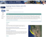
Using a map showing the horizontal velocities of GPS stations in the Plate Boundary Observatory and other GPS networks in Alaska and Western United States, students are able to describe the motions in different regions by interpreting the vectors resulting from long-term high-precision Global Positioning System (GPS) data.
Show more information on NGSS alignment
Hide
NGSS ALIGNMENT
Disciplinary Core Ideas
History of Earth: HS-ESS1-5
Earth' Systems: MS-ESS2-2
Earth and Human Activity: MS-ESS3-2, HS-ESS3-1
Science and Engineering Practices
4. Analyzing and Interpreting Data
5. Using Mathematics and Computational Thinking
6. Constructing Explanations and Designing Solutions
Crosscutting Concepts
4. Systems and System Models
7. Stability and Change

(Note: this resource was added to OER Commons as part of a batch upload of over 2,200 records. If you notice an issue with the quality of the metadata, please let us know by using the 'report' button and we will flag it for consideration.)
Subject:
Biology
Life Science
Mathematics
Measurement and Data
Statistics and Probability
Material Type:
Activity/Lab
Provider:
Science Education Resource Center (SERC) at Carleton College
Provider Set:
Teach the Earth
Author:
Shelley Olds
Date Added:
09/26/2022
Exploring lithological assemblages and structural styles of granite-greenstone belts
Conditional Remix & Share Permitted
CC BY-NC-SA
Rating
0.0 stars

1. Day 1: End of class Mini lecture (15 minutes) on:
a. what greenstone belts are (where in the world, rock assemblages, structures)
b. vertical vs. horizontal tectonic models (old arguments and current details).
c. Superior Province (one example) introduction

2. Homework and Jigsaw Activity: Looking at "typical" structures within greenstone belts.
This assignment asks students to compare papers with folding models vs. thrusting models. One set of papers that provides a good contrast focuses on the Beardmore-Geraldton greenstone belt in the Superior Province, Canada. Students will also use a paper with Lithoprobe seismic data across the Superior Province.

a. Folding model: Kehlenbeck, M. M. 1986. Folds and folding in the Beardmore-Geraldton fold belt. Canadian Journal of Earth Sciences (CJES) 23, 158-171.
b. Thrusting model: Devaney, J. R. & Williams, H. R. 1989. Evolution of an Archean subprovince boundary: a sedimentological and structural study of part of the Wabigoon-Quetico boundary in northern Ontario. CJES 26 1013-1026.
c. Percival, J. A. et al. 2006. Tectonic evolution of the western Superior Province from NATMAP and Lithoprobe studies. CJES 43(7): 1085-1117.

Divide the class into 3 "expert" groups and assign one paper to each group. Students need to create an outline of the major structures (faults, folds, both) described and the evidence provided for the structural interpretation. Students should bring two copies of their outline to class.

3. Day 2
Turn in one copy of outline (to be assessed for grade) and meet with the group to create a composite, master outline (30 minutes). Students break up into small groups (one from each "expert" group), discover very different structural style interpretations, and try to determine WHY there are the discrepancies (lack of data, preconceived notions influencing interpretations, etc). The goal of the new group is to prepare each student to write a short paper. Each student is assigned to write a 1-page paper exploring reasons why there are discrepancies between the models. Students are also encouraged to speculate on what other evidence or future research might help resolve the apparent conflict. Students begin paper in class and finish outside of class.

4. Day 3
Students hand in paper (to be graded). Mini lecture/ discussion on key related questions.
a. Does either model (folding or faulting) support or negate either vertical or horizontal tectonic models?
b. Are there any modern analogues to greenstone belts? If so, what are the differences or limitations to the comparisons (lithological and structural)?

(Note: this resource was added to OER Commons as part of a batch upload of over 2,200 records. If you notice an issue with the quality of the metadata, please let us know by using the 'report' button and we will flag it for consideration.)
Subject:
Biology
Life Science
Material Type:
Activity/Lab
Provider:
Science Education Resource Center (SERC) at Carleton College
Provider Set:
Teach the Earth
Author:
Dyanna Czeck
Date Added:
08/26/2019
Fault-bounded mountains and morphometric properties
Conditional Remix & Share Permitted
CC BY-NC-SA
Rating
0.0 stars

This exercise is based on the information presented in following article:

Bull, W.B., 1984, Tectonic Geomorphology: Journal of Geological Education 32, pp.310-324.

To prepare for the classroom exercise, the instructor briefly presents the concept that measurable landform properties can reflect the intensity of tectonic activity. We discuss that certain landforms and settings are particularly useful in these types of analyses, for example, fault-bounded mountains and piedmonts. The class goes through a quick review of dip-slip faults, fault scarps, and triangular facets, and the Tobin Range is introduced as a typical example of a fault-bounded mountain range. We then ask the question, what are the useful characteristics of these settings in terms of inferring tectonic activity?

To address the question, students work in groups of 2 or 3. Each group is given a set of topographic maps chosen from the following (the region can also be printed from CDs of digital, seamless topo.s, but the quad. names are provided for reference):

7.5 minute quad.s: Home Station Ranch , Jersey Summit , Kennedy Canyon, Mount Tobin , Needle Peak

15-minute quad.s: Mt. Tobin, Buffalo Springs, Cain Mountain

On each map set, two lengths along the fault scarps are marked. One is marked in red and one in purple. Each student group has a map set of a slightly different region, but all map sets have a red fault scarp and a purple fault scarp marked. The red fault scarps in all of the sets are those that have experienced more recent displacement.

Each group is asked to do the following:

1. List physical characteristics of each of the two fault-bounded mountains/piedmonts that are marked on your quad.s with different colors.

2. Decide among yourselves which fault-bounded mountains/piedmont has experienced more recent displacement.

3. Suggest morphometric properties that could be used to differentiate between the more recent and less recent displacement, and explain why each of your properties makes sense. Morphometric properties must be measurable from the topographic maps.

After about 10 minutes, the class reconvenes and we go through the first two questions as a class. Then, each group presents at least one morphometric property and explains their reasoning.

Once we have a list of properties that the class agrees on, the instructor presents and the class discusses the properties that Bull (1984) used in his research of the Tobin Range region, such as sinuosity, the ratio between the valley floor width and the total valley height, the development of triangular facets.
Designed for a geomorphology course
Addresses student fear of quantitative aspect and/or inadequate quantitative skills

(Note: this resource was added to OER Commons as part of a batch upload of over 2,200 records. If you notice an issue with the quality of the metadata, please let us know by using the 'report' button and we will flag it for consideration.)
Subject:
Biology
Life Science
Material Type:
Activity/Lab
Provider:
Science Education Resource Center (SERC) at Carleton College
Provider Set:
Teach the Earth
Author:
Sue Swanson
Date Added:
09/02/2020
The Faults at Delphi, the Oracle, and the Tectonic Setting of the Gulf of Corinth: Case Example
Conditional Remix & Share Permitted
CC BY-NC-SA
Rating
0.0 stars

Students interpret data on the faults at Delphi, evaluate the tectonic context of the faults, and explore the proposed connection between faults and the Delphic Oracle of Ancient Greece.

(Note: this resource was added to OER Commons as part of a batch upload of over 2,200 records. If you notice an issue with the quality of the metadata, please let us know by using the 'report' button and we will flag it for consideration.)
Subject:
Biology
Life Science
Material Type:
Activity/Lab
Provider:
Science Education Resource Center (SERC) at Carleton College
Provider Set:
Teach the Earth
Author:
Barb Tewksbury
Date Added:
08/09/2019
Field and Laboratory Project - Volcanology and Petrology of Interbedded Andesitic Lava Flows and Volcaniclastic Rocks from Washburn Volcano, Yellowstone National Park
Conditional Remix & Share Permitted
CC BY-NC-SA
Rating
0.0 stars

We anticipate that hikers will start from Dunraven Pass at 8:00 AM. Hikers should return to the vans at 12:00 PM, from there we will go to a picnic area for lunch. All hikers must therefore turn around and head for the vans no later than 10:45. Because of these strict time limitations, there will probably not be
sufficient time to examine the rocks in as much detail as one would hope. The trip is thus largely a self guided tour. It will, nevertheless, give you an opportunity to examine several rock types associated with calc-alkaline composite cones and provide a spectacular view of the Yellowstone Caldera, weather permitting.

(Note: this resource was added to OER Commons as part of a batch upload of over 2,200 records. If you notice an issue with the quality of the metadata, please let us know by using the 'report' button and we will flag it for consideration.)
Subject:
Biology
Chemistry
Life Science
Physical Science
Material Type:
Activity/Lab
Provider:
Science Education Resource Center (SERC) at Carleton College
Provider Set:
Teach the Earth
Author:
Todd Feeley
Date Added:
08/29/2019
The Floating Lithosphere - Cross Section of North America
Conditional Remix & Share Permitted
CC BY-NC-SA
Rating
0.0 stars

In this module, students calculate the pressure at the depth of compensation along a cross section of North America.

(Note: this resource was added to OER Commons as part of a batch upload of over 2,200 records. If you notice an issue with the quality of the metadata, please let us know by using the 'report' button and we will flag it for consideration.)
Subject:
Biology
Geology
Geoscience
Life Science
Mathematics
Measurement and Data
Physical Science
Statistics and Probability
Material Type:
Activity/Lab
Provider:
Science Education Resource Center (SERC) at Carleton College
Provider Set:
Teach the Earth
Author:
Len Vacher
Date Added:
09/05/2019
The Floating Lithosphere - Isostacy
Conditional Remix & Share Permitted
CC BY-NC-SA
Rating
0.0 stars

Students are asked to numerically and then analytically determine the relations governing the depth of compensation.

(Note: this resource was added to OER Commons as part of a batch upload of over 2,200 records. If you notice an issue with the quality of the metadata, please let us know by using the 'report' button and we will flag it for consideration.)
Subject:
Biology
Geoscience
Life Science
Mathematics
Measurement and Data
Physical Science
Physics
Statistics and Probability
Material Type:
Activity/Lab
Provider:
Science Education Resource Center (SERC) at Carleton College
Provider Set:
Teach the Earth
Author:
Len Vacher
Date Added:
09/04/2019
The Floating Lithosphere - Isostacy
Conditional Remix & Share Permitted
CC BY-NC-SA
Rating
0.0 stars

Students are asked to numerically and then analytically determine the relations governing the depth of compensation.

(Note: this resource was added to OER Commons as part of a batch upload of over 2,200 records. If you notice an issue with the quality of the metadata, please let us know by using the 'report' button and we will flag it for consideration.)
Subject:
Biology
Geoscience
Life Science
Mathematics
Measurement and Data
Physical Science
Physics
Statistics and Probability
Material Type:
Activity/Lab
Provider:
Science Education Resource Center (SERC) at Carleton College
Provider Set:
Teach the Earth
Author:
Len Vacher
Date Added:
09/24/2022
Food Rheology; Folding Fun
Conditional Remix & Share Permitted
CC BY-NC-SA
Rating
0.0 stars

In this activity students analyze the rheologic and structural properties of various foods (everything from pudding to white bread) and think about how they expect them to behave under lateral pressure and how they will affect each other. They design experiments, run the experiments and then do lab write-ups. Depending on your emphasis, you can use this to help teach folding mechanics, rheology, why beds deform the way they do, decollements (pudding works great), deformation mechanisms, folding and even more. It is a single lecture activity, though the lead-in lecture and activity and clean-up take about 40-50 minutes.

(Note: this resource was added to OER Commons as part of a batch upload of over 2,200 records. If you notice an issue with the quality of the metadata, please let us know by using the 'report' button and we will flag it for consideration.)
Subject:
Biology
Life Science
Mathematics
Measurement and Data
Statistics and Probability
Material Type:
Activity/Lab
Provider:
Science Education Resource Center (SERC) at Carleton College
Provider Set:
Teach the Earth
Author:
Erin Beutel
Date Added:
09/01/2019