Updating search results...

Search Resources

493 Results

View
Selected filters:
  • Hydrology
Spreadsheet analysis of chemical hydrographs
Conditional Remix & Share Permitted
CC BY-NC-SA
Rating
0.0 stars

Students download a comma-delimited data set that is a time series of stream discharge measurements and the concentration of a trace element in the stream. Given the concentration of this element in the precipitation and in the groundwater, the students analyze the data using spreadsheet software to separate the hydrograph into baseflow and quickflow components. Students produce a graph of their results. To do the analysis, students must derive an appropriate equation based on other equations presented in the text (Eqs. 1.2 and 1.3).

(Note: this resource was added to OER Commons as part of a batch upload of over 2,200 records. If you notice an issue with the quality of the metadata, please let us know by using the 'report' button and we will flag it for consideration.)

Subject:
Chemistry
Hydrology
Physical Science
Material Type:
Activity/Lab
Provider:
Science Education Resource Center (SERC) at Carleton College
Provider Set:
Teach the Earth
Date Added:
08/27/2019
Stream Detectives
Read the Fine Print
Rating
0.0 stars

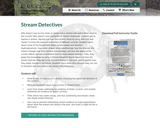
Who doesn’t love to toss sticks or leaves into a stream and watch them move in the current? Who doesn’t love mysteries? In Stream Detectives, students get to explore a stream, figuring out how the currents move by using stick and leaf “boats” to track the speed and direction of different currents. Students learn about some of the factors that affect current speed and direction (hydrodynamics), how water shapes stone (weathering), how the channel of a stream changes over time (stream morphology), and how the speed of the current affects the size of sediment that it leaves behind (erosion). Then, they apply this knowledge by using a Stream Detective Key to figure out how the stream features they see in the moment formed in the past, and to predict how they might change in the future. Students learn skills and concepts they can use to interpret and learn about any stream they encounter.

Subject:
Hydrology
Physical Science
Material Type:
Activity/Lab
Provider:
Beetles: Science and Teaching for Field Instructors
Date Added:
05/14/2020
Stream Investigation:  Investigate How a Local Stream Might Have an Impact on Our Surrounding Landscape
Conditional Remix & Share Permitted
CC BY-NC-SA
Rating
0.0 stars

This activity is a field investigation where students will make stream observations to determine its geologic processes and influence to our local topography.

Subject:
Hydrology
Physical Science
Material Type:
Activity/Lab
Provider:
Science Education Resource Center (SERC) at Carleton College
Provider Set:
Pedagogy in Action
Author:
Joseph Cynor
Date Added:
08/10/2012
Stream Profile Activity
Read the Fine Print
Rating
0.0 stars

In this activity, students use elevation and distance data to construct graphic profiles and determine the average gradients for three streams. A series of discussion questions addresses concepts of deposition, erosion, and nickpoints, and gives students practice compiling evidence to provide scientific explanations. Graphs can be constructed by hand on paper or generated using graphing software.

Subject:
Astronomy
Chemistry
Geoscience
Hydrology
Physical Science
Physics
Space Science
Material Type:
Activity/Lab
Interactive
Provider:
UCAR Staff
Provider Set:
New York State Earth Science Instructional Collection
Author:
Zach Miller
Date Added:
11/06/2014
Stream Study: What Does the Chemistry Tell Us?
Unrestricted Use
CC BY
Rating
0.0 stars

Watershed Awareness using Technology and Environmental Research for Sustainability (WATERS)

The WATERS project is developing and researching a student-centered, place-based, and accessible curriculum for teaching watershed concepts and water career awareness for students in the middle grades. This 10-lesson unit includes online, classroom, and field activities. Students use a professional-grade online GIS modeling resource, simulations, sensors, and other interactive resources to collect environmental data and analyze their local watershed issues. The WATERS project is paving a path to increased access to research-based, open access curricula that hold the potential to significantly increase awareness of and engagement with watershed concepts and career pathways in learners nationwide.

This material is licensed under a Creative Commons Attribution 4.0 License. The software is licensed under Simplified BSD, MIT or Apache 2.0 licenses. Please provide attribution to the Concord Consortium and the URL https://concord.org.

Subject:
Applied Science
Ecology
Environmental Science
Hydrology
Life Science
Physical Science
Material Type:
Activity/Lab
Lesson
Provider:
Concord Consortium
Author:
Concord Consortium
Jamie Rumage
Date Added:
12/20/2023
Streams, floods, and sediment transport
Conditional Remix & Share Permitted
CC BY-NC-SA
Rating
0.0 stars

The students will conduct a fluvial sediment transport study in Little Fountain Creek basin. The overall goal is to compare the size of clasts in the streambed material to the size of clasts that can be transported by various flood events. The objectives are to:
1. characterize the size, shape, and composition of the streambed sediment and interpret changes in the downstream direction
2. assess the size of the sediment that might be transported for a flood with a 2-yr, a 10-yr, and a 100-yr recurrence interval
3. estimate the recurrence interval of the 2013 flood and the size of sediment that event might have transported
4. integrate knowledge gained in a written report with appropriate visual elements.

(Note: this resource was added to OER Commons as part of a batch upload of over 2,200 records. If you notice an issue with the quality of the metadata, please let us know by using the 'report' button and we will flag it for consideration.)

Subject:
Biology
Hydrology
Life Science
Physical Science
Material Type:
Activity/Lab
Provider:
Science Education Resource Center (SERC) at Carleton College
Provider Set:
Teach the Earth
Author:
Carol Wicks
Date Added:
12/10/2020
Stream velocity Investigation Using Inquiry
Conditional Remix & Share Permitted
CC BY-NC-SA
Rating
0.0 stars

This activity is a field investigation using science inquiry and problem solving, where small groups of students design their own experiment to determine stream velocity, collect and analyze their data, draw conclusions, and make further inferences based group discussion/collaboration.

Subject:
Hydrology
Physical Science
Material Type:
Activity/Lab
Provider:
Science Education Resource Center (SERC) at Carleton College
Provider Set:
Pedagogy in Action
Author:
Jennifer Dietz
Date Added:
08/10/2012
Super Trunfo Geográfico
Unrestricted Use
Public Domain
Rating
0.0 stars

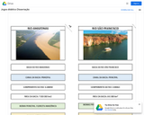
O jogo fora construído com base em dados disponíveis em base de dados diversos como o site da Agência Nacional de Águas, Agências de Meio Ambiente dos Estados, artigos científicos publicados em eventos, relatórios de gestão de comitê de bacias hidrográficas ou outras fontes que servissem como fieis disseminadores da informação que estava sendo buscada. No geral, essa foi a parte mais dificultosa do trabalho a coleta dos dados dos rios pela disseminação da informação em várias fontes, pela pouca padronização de informação. Destarte, priorizamos dados gerais e que pudessem ser comparados como extensão do rio e área da bacia hidrográfica, por exemplo.
A justificativa está na possibilidade de aplicação de conteúdos, conceitos e elementos de diferentes áreas do conhecimento como Geografia, Matemática e Biologia, permitindo a integração de diferentes ações entre professores de várias áreas de conhecimento, em meio às variações de possibilidade de interação pedagógica, mediada, portanto, pela aplicação de jogos didáticos em sala de aula.
Tendo em vista a proposta de trabalhar com alunos com deficiência o jogo fora pensado para responder às demandas de alunos com múltiplas deficiências usando princípios do Universal Design for Learning (UDL) ou Desenho Universal para Aprendizagem (DUA). O DUA se baseia então em três princípios genéricos: (i) proporcionar múltiplos meios de envolvimento, de forma que seja possível estimular o interesse dos alunos e motivá-los para a aprendizagem recorrendo a múltiplas formas; (ii) proporcionar múltiplos meios de representação de forma que seja possível apresentar a informação e o conteúdo em múltiplos formatos para que todos tenham acesso e; (iii) Proporcionar múltiplos meios de ação e expressão nas quais seja possível permitir formas alternativas de expressão e de demonstração das aprendizagens, por parte dos alunos (NUNES e MADUREIRA, 2015).
Essas ferramentas permitem possibilidades mais flexíveis em que seja possível “pensar na acessibilidade desde a concepção dos projetos [educacionais] […] [enquanto] uma solução mais atrativa e necessária à sociedade contemporânea” (RICARDO, SAÇO e FERREIRA, 2017, p. 1527). As barreiras que existirem para o processo educacional, serão reduzidas pela flexibilidade do currículo, por suporte aos docentes na melhoria do acesso ao conhecimento e à aprendizagem dentro da sala de aula.
Para esse produto técnico foi pensado em um Sistemas de Comunicação Alternativa e Ampliada (SCAA) que pode ser entendido como um recurso que codifica e transmite mensagens sem que seja necessário recrutar habilidades de escrita ou vocalização (GOMIDE, 2017). Os SCAA possuem uma variação expressiva que vai desde “o uso de gestos, língua de sinais, expressões faciais, o uso de pranchas de alfabeto, de símbolos pictográficos, ou ainda pelo uso de sistemas sofisticados de computador com voz sintetizada, por exemplo” (GOMIDE, 2017, p. 25).
Vários são os SCAA disponíveis no mercado, podendo os profissionais de optar por recursos de baixa tecnologia ou recursos de alta tecnologia (GOMIDE, 2017). Os Recursos de Baixa Tecnologia referem-se a recursos mais acessíveis que possibilitam a comunicação quando inexiste a linguagem oral e podem ser usados em Pranchas de Comunicações Alternativa (PCA).
Por ser um sistema de linguagem imagético e pictórico a PCA pode ser editada para contemplar a necessidade que se apresentar para cada aluno especificamente. Gomide (2017) aponta que é necessário ter em vista o nível cultural e escolar das pessoas que irão utilizar aquele sistema para que a linguagem usada possa ser acessível. A linguagem textual é útil para usuários alfabetizados e a linguagem imagética pode ser aplicada para qualquer usuário.

Subject:
Biology
Botany
Hydrology
Life Science
Physical Geography
Physical Science
Material Type:
Game
Provider:
Universitat Politècnica de València
Author:
Anezia Maria Fonseca Barbosa
Dyego Anderson Silva Pereira
Date Added:
11/13/2019
Superhydrophobicity: The Lotus Effect
Read the Fine Print
Educational Use
Rating
0.0 stars

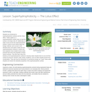
Students are introduced to superhydrophobic surfaces and the "lotus effect." Water spilled on a superhydrophobic surface does not wet the surface, but simply rolls off. Additionally, as water moves across the superhydrophobic surface, it picks up and carries away any foreign material, such as dust or dirt. Students learn how plants create and use superhydrophobic surfaces in nature and how engineers have created human-made products that mimic the properties of these natural surfaces. They also learn about the tendency of all superhydrophobic surfaces to develop water droplets that do not roll off the surface but become "pinned" under certain conditions, such as water droplets formed from condensation. They see how the introduction of mechanical energy can "unpin" these water droplets and restore the desirable properties of the superhydrophobic surface.

Subject:
Applied Science
Engineering
Hydrology
Physical Science
Material Type:
Lesson Plan
Provider:
TeachEngineering
Provider Set:
TeachEngineering
Author:
Chuan-Hua Chen
Date Added:
09/18/2014
Surface Feature Identification
Conditional Remix & Share Permitted
CC BY-NC-SA
Rating
0.0 stars

Students are provided the latitude and longitude of various locations and asked to identify the river stage or surface water deposition/erosional feature.

Subject:
Applied Science
Environmental Science
Hydrology
Physical Geography
Physical Science
Material Type:
Activity/Lab
Provider:
Science Education Resource Center (SERC) at Carleton College
Provider Set:
Teach the Earth
Author:
Katherine Ocker Stone
Date Added:
01/20/2023
Surface Tension
Read the Fine Print
Educational Use
Rating
0.0 stars

Surface tension accounts for many of the interesting properties we associate with water. By learning about surface tension and adhesive forces, students learn why liquid jets of water break into droplets rather than staying in a continuous stream. Through hands-on activities, students learn how the combination of adhesive forces and cohesive forces cause capillary motion. They study different effects of capillary motion and use capillary motion to measure surface tension. Students explore the phenomena of wetting and hydrophobic and hydrophilic surfaces and see how water's behavior changes when a surface is treated with different coatings. A lotus leaf is a natural example of a superhydrophobic surface, with its water-repellent, self-cleaning characteristics. Students examine the lotus effect on natural leaves and human-made superhydrophobic surfaces, and explore how the lotus leaf repels dewy water through vibration. See the Unit Overview section for details on each lesson in this unit.

Subject:
Applied Science
Engineering
Hydrology
Physical Science
Material Type:
Full Course
Unit of Study
Provider:
TeachEngineering
Provider Set:
TeachEngineering
Author:
Chuan-Hua Chen
Date Added:
09/18/2014
A Sustainable Southwest Japanese Garden
Conditional Remix & Share Permitted
CC BY-NC-SA
Rating
0.0 stars

Project Description (Microsoft Word 14kB Jan26 10)
Water collection and usage in the Sustainable SW Japanese Garden

The Albuquerque Water Authority has several activities on their web site to help with making a personal water audit, selecting xeriscape plants, designing garden areas as well as forms for rebates. We used the ABQ Water Authority design format to calculate which plants to install. Students start with a personal water audit and then move to the design of the garden.
Personal water audit http://www.abcwua.org/Understanding_Your_Bill.aspx
Techniques to consevere water outdoors http://www.abcwua.org/Save_Water_Outdoors.aspx
Planning Xeriscape - students create their own personal garden and we transfer the concepts to the Japanese Garden. We are looking at Japanese design elements with a SW flare and thereby modeling what the internees did when they were limited to the surrounding rock, vegetation and water collection. http://www.abcwua.org/Xeriscaping.aspx

Calculating roof area using a Google satellite image

We use a measurable square on the pathway for the scale and then we calculate the square feet of the roof area. A transparency is used to overlay the image and calculate the water harvest.

Calculating the capacity of the 1500 gallon cistern in terms of water needed per plant

Students experiment with buckets to see ascertain the best collection site. The water is measured after rainfalls and compared to the weather data collected by the NOAA.

(Note: this resource was added to OER Commons as part of a batch upload of over 2,200 records. If you notice an issue with the quality of the metadata, please let us know by using the 'report' button and we will flag it for consideration.)

Subject:
Hydrology
Physical Science
Material Type:
Homework/Assignment
Provider:
Science Education Resource Center (SERC) at Carleton College
Provider Set:
Teach the Earth
Author:
Rhonda Spidell
Date Added:
08/17/2022
Swim to and from the Sea!
Read the Fine Print
Educational Use
Rating
0.0 stars

Students are introduced to the basic biology behind Pacific salmon migration and the many engineered Columbia River dam structures that aid in their passage through the river's hydroelectric dams. Students apply what they learn about the salmon life cycle as they think of devices and modifications that might be implemented at dams to aid in the natural cycle of fish migration, and as they make (hypothetical) Splash Engineering presentations about their proposed fish mitigation solutions for Birdseye River's dam in Thirsty County.

Subject:
Applied Science
Engineering
Hydrology
Physical Science
Material Type:
Lesson Plan
Provider:
TeachEngineering
Provider Set:
TeachEngineering
Author:
Denise W. Carlson
Jeff Lyng
Kristin Field
Lauren Cooper
Date Added:
09/18/2014
TCE Transport to Woburn Wells G and H
Conditional Remix & Share Permitted
CC BY-NC-SA
Rating
0.0 stars

To prepare to view the TCE animation, students could view the 'A Civil Action' movie and the instructor could read to them excerpts from the trial testimony and images from Woburn, wells G and H, geologic materials, geologic cross sections, the trial participants, and the federal courtroom in Boston (available as a attachment to this activity and at a website listed below). The discussion in Bair (2001) about scientists in the courtroom, the specific (excerpted) testimony presented by the three expert witnesses in the 'A Civil Action' trial, a chart summarizing the differences in their testimony, and the views of a federal judge on the goal of science versus the goal of a civil trial may also be worthwhile reading by the class prior to the assignment.

The instructor could also show students the large plates included in the USGS report by Myette and others (1987) that display potentiometric data and contours before and after the famous aquifer test performed in December 1985 and January 1986, just before the trial, and discuss the ramifications of having only two sets of water-level measurements to characterize all the changes in the flow system between 1964 and 1979, when wells G and H periodically operated. This makes students consider the substantial differences in making predictions based on a steady-state conceptualization of the flow system or a transient conceptualization.

The instructor could also show the animation of induced infiltration from the Aberjona River to wells G and H that also was created by Martin van Oort (M.S., 2005) and based on the research of Maura Metheny (M.S., 1998; Ph.D., 2004) at Ohio State University. Viewing both animations enables students to see that the water produced by wells G and H is a highly transient mixture derived from many different source areas within the valley.

The article by Bair and Metheny (2002) concerning the remediation activities at the Wells G & H Superfund Site could be used to show how groundwater contamination is cleaned up, why different remediation schemes needed to be used in different hydrogeologic settings, and why cleanup to U.S. EPA standards can take decades.

(Note: this resource was added to OER Commons as part of a batch upload of over 2,200 records. If you notice an issue with the quality of the metadata, please let us know by using the 'report' button and we will flag it for consideration.)

Subject:
Biology
Business and Communication
Hydrology
Life Science
Management
Physical Science
Political Science
Social Science
Material Type:
Activity/Lab
Homework/Assignment
Provider:
Science Education Resource Center (SERC) at Carleton College
Provider Set:
Teach the Earth
Author:
Scott Bair
Date Added:
09/04/2019
Tale of Two Cities (and two hurricanes): New Orleans
Conditional Remix & Share Permitted
CC BY-NC-SA
Rating
0.0 stars

Students use spreadsheets to analyze the reasons why New Orleans has subsided in the past 250 years.

Subject:
Applied Science
Ecology
Engineering
Environmental Science
Geology
Geoscience
History
History, Law, Politics
Hydrology
Life Science
Physical Science
Material Type:
Activity/Lab
Provider:
Science Education Resource Center (SERC) at Carleton College
Provider Set:
Pedagogy in Action
Author:
Tom Juster
Date Added:
11/06/2014
Temperature and precipitation as limiting factors in ecosystems
Read the Fine Print
Rating
0.0 stars

This classroom activity is aimed at an understanding of different ecosystems by understanding the influence of temperature and precipitation. Students correlate graphs of vegetation vigor with those of temperature and precipitation data for four diverse ecosystems, ranging from near-equatorial to polar, and spanning both hemispheres to determine which climatic factor is limiting growth.

Subject:
Applied Science
Career and Technical Education
Environmental Science
Environmental Studies
Hydrology
Physical Science
Physics
Material Type:
Activity/Lab
Provider:
CLEAN: Climate Literacy and Energy Awareness Network
Provider Set:
CLEAN: Climate Literacy and Energy Awareness Network
Author:
GLOBE Project
Date Added:
08/17/2018
Terrarium-Investigating the water cycle in a 1 or 2 liter bottle.
Conditional Remix & Share Permitted
CC BY-NC-SA
Rating
0.0 stars

This guided inquiry investigation will show students how water moves through the water cycle, and how it affects plant life.

Subject:
Hydrology
Physical Science
Material Type:
Activity/Lab
Provider:
Science Education Resource Center (SERC) at Carleton College
Provider Set:
Pedagogy in Action
Date Added:
11/06/2014
Think Scientifically: The Sun and The Water Cycle
Read the Fine Print
Rating
0.0 stars

Learners will read or listen to a story about two sisters, Marisol and Sofia, as they explore the Sun's role in the water cycle. Additionally, numerous extension resources are included in the accompanying educator guide, such as suggestions for no-cost language arts activities, links to further science activities, a book walk cue chart to guide classroom discussion before, during, and after the story, a graphic organizer, and alignments to the National Science Education Standards (NSES) and the Next Generation Science Standards (NGSS).

Subject:
Hydrology
Physical Science
Material Type:
Activity/Lab
Lesson Plan
Provider:
NASA
Provider Set:
NASA Wavelength
Date Added:
11/05/2014
Tippy Tap Plus Piping
Read the Fine Print
Educational Use
Rating
0.0 stars

The Tippy Tap hand-washing station is an inexpensive and effective device used extensively in the developing world. One shortcoming of the homemade device is that it must be manually refilled with water and therefore is of limited use in high-traffic areas. In this activity, student teams design, prototype and test piping systems to transport water from a storage tank to an existing Tippy Tap hand-washing station, thereby creating a more efficient hand-washing station. Through this example service-learning engineering project, students learn basic fluid dynamic principles that are needed for creating efficient piping systems.

Subject:
Applied Science
Engineering
Hydrology
Physical Science
Material Type:
Activity/Lab
Provider:
TeachEngineering
Provider Set:
TeachEngineering
Author:
Benjamin S. Terry
Denise W. Carlson
Kaisa Wallace-Moyer
Stephanie Rivale
Date Added:
09/18/2014
Tracking Water Using NASA Satellite Data
Read the Fine Print
Educational Use
Rating
0.0 stars

Using real data from NASA's GRACE satellites, students will track water mass changes in the U.S., data that measures changes in ice, surface and especially groundwater. The background information includes an animated video about where water exists and how it moves around Earth, as well as short video clips to introduce the GRACE mission and explain how satellites collect data. Students will estimate water resources using heat-map data, create a line graph for a specific location, then assess trends and discuss implications.

This activity illustrates the importance of water resources and how changes in climate are closely linked to changes in water resources. The activity could fit into many parts of a science curriculum, for example a unit on water could be connected to climate change.

Subject:
Applied Science
Career and Technical Education
Environmental Science
Environmental Studies
Hydrology
Physical Science
Material Type:
Activity/Lab
Provider:
CLEAN: Climate Literacy and Energy Awareness Network
Provider Set:
CLEAN: Climate Literacy and Energy Awareness Network
Author:
Jet Propulsion Laboratory
National Aeronautics and Space Administration
Date Added:
06/25/2019