Updating search results...

Search Resources

362 Results

View
Selected filters:
  • geography
Teen Maps Contaminants from a Coal Plant
Read the Fine Print
Educational Use
Rating
0.0 stars

In this video adapted from Earth Island Institute, meet a high school student who educated her community about how a coal-burning power plant was contributing to asthma and other health problems there.

Subject:
Ecology
Forestry and Agriculture
Geoscience
Life Science
Physical Science
Material Type:
Lesson
Provider:
PBS LearningMedia
Provider Set:
PBS Learning Media Common Core Collection
Author:
NIEHS
WGBH Educational Foundation
Date Added:
03/02/2011
Temperate Rainforest
Read the Fine Print
Rating
0.0 stars

In this problem-based learning activity, students are asked to research and make recommendations that balance the benefits of a healthy forest with the economic needs of the people who log it. Students use NIH Image software to analyze satellite imagery from Landsat. This activity is from Exploring the Environment.

Subject:
Applied Science
Engineering
Geoscience
Physical Science
Technology
Material Type:
Activity/Lab
Diagram/Illustration
Lesson Plan
Provider:
NASA
Provider Set:
NASA Wavelength
Date Added:
11/05/2014
This Land is Our Land
Read the Fine Print
Rating
0.0 stars

Throughout history, as the concepts of empire and nation-states took hold, individual countries secured their borders and tried to keep unwanted migrants out. As we enter the 21st century Anwarul K. Chowdhury, an Under-Secretary of the United Nations, says, 'The first step towards examining the road to peace should start with an appreciation of the changing nature of conflicts. Gone are days of war between states for conquest, extension of spheres of influence in the name of ideology ... Today's wars are about settling border disputes....' In these lessons students confront that issue. Students begin by discussing why people cross borders and the rights people have when they enter another country. Students will discover the factors that determine the location of borders through the examination of maps, cartoons, and primary source documents. After completing this introductory activity, students will analyze a chart comparing the economic situation in the neighboring countries of Zimbabwe and Botswana, and predict what economic problems each country has. They will then view segments of the WIDE ANGLE film 'Border Jumpers' (2005) to understand why these economic problems exist, develop further arguments for those streaming into Botswana from Zimbabwe and for those in Botswana itself, and compare them to their own predictions. As a culminating activity, students will work in groups to develop a presentation for a simulation of the 17th Annual Nobel Peace Prize Forum. Their presentations will be shared with their classmates, and, if desired, sent to the United Nations.

Subject:
History
World History
Material Type:
Activity/Lab
Lesson Plan
Teaching/Learning Strategy
Provider:
Thirteen/WNET New York
Provider Set:
WIDE ANGLE: Window into Global History
Author:
Mirla Morrison
Date Added:
05/19/2006
To Teach is to Learn: Final Project in Envronmental or Intro Geology
Conditional Remix & Share Permitted
CC BY-NC-SA
Rating
0.0 stars

This is the final project/presentation for undergraduate students in a relatively small introductory geoscience class where most (but not all) students are taking the class to satisfy their lab science requirement. Students are asked to create their own geological teaching demonstration and/or activity geared to high school or college geoscience classes which allows students to deepen their knowledge in a particular area of their interest. The style of the assignment is similar to the labs in the course where the students participation is "requested" in a (fictional) letter of request and they must respond appropriately with a letter of reply as well as completion of the specific assignment (which, in this case, includes the activity/demonstration, Teacher's Notes, Supply List, Geological Background, and Peer Evaluations). In addition to creating this demonstration/activity and write-up, the students much also trial and present their demonstration/activity to the rest of the class, the instructor, and a visiting K-12 environmental scientist in a conference-style session (name-tags and program provided) for evaluation.

(Note: this resource was added to OER Commons as part of a batch upload of over 2,200 records. If you notice an issue with the quality of the metadata, please let us know by using the 'report' button and we will flag it for consideration.)

Subject:
Biology
Career and Technical Education
Environmental Studies
Life Science
Material Type:
Lesson Plan
Provider:
Science Education Resource Center (SERC) at Carleton College
Provider Set:
Teach the Earth
Author:
Leah Joseph
Date Added:
08/07/2019
Today's Front Pages:  Today's News in the Target Language
Conditional Remix & Share Permitted
CC BY-NC-SA
Rating
0.0 stars

Students participate in a JiTT activity to read the front pages of two target language newspapers and to report the content to their classmates in the target language. When this exercise is done on a regular basis, it can result in increasing vocabulary and speech fluency.

Subject:
Arts and Humanities
English Language Arts
Geoscience
Language, Grammar and Vocabulary
Physical Science
Material Type:
Activity/Lab
Provider:
Science Education Resource Center (SERC) at Carleton College
Provider Set:
Starting Point (SERC)
Author:
Laura Franklin
Date Added:
08/28/2012
Topics in Culture and Globalization
Conditional Remix & Share Permitted
CC BY-NC-SA
Rating
0.0 stars

The concept of globalization fosters the understanding of the interconnectedness of cultures and societies geographically wide apart; America, Europe, Asia, and Africa. Subject scans existing debates over globalization around the world. This course explores how globalization impacts everyday life in the First and Third World; how globalization leads to a common cosmopolitan culture; the emergence of a global youth culture; and religious, social, and political movements that challenge globalization. Materials examined include pop music, advertisements, film posters, and political cartoons.

Subject:
Anthropology
Arts and Humanities
Graphic Arts
Social Science
Material Type:
Full Course
Provider Set:
MIT OpenCourseWare
Author:
Condry, Ian
Date Added:
09/01/2003
Topographic Map Creation
Read the Fine Print
Rating
0.0 stars

In this activity, students create two- and three-dimensional maps by using a data grid of an imaginary section of Earth's surface. They are challenged to create six different maps of various surface features and answer questions about them.

Subject:
Astronomy
Chemistry
Geoscience
Physical Geography
Physical Science
Physics
Space Science
Material Type:
Activity/Lab
Interactive
Provider:
UCAR Staff
Provider Set:
New York State Earth Science Instructional Collection
Author:
Charles Burrows
Date Added:
11/06/2005
Torn in Two: Mapping the American Civil War
Unrestricted Use
CC BY
Rating
0.0 stars

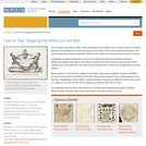
The Civil War, from 1861 to 1865, is the centerpiece of our nation's story. It looms large, not merely because of its brutality and scope but because of its place in the course of American history. The seeds of war were planted long before 1861 and the conflict remains part of our national memory. Geography has helped shape this narrative. The physical landscape influenced economic differences between the regions, the desire to expand into new territories, the execution of the conflict both in the field and on the home front, and the ways in which our recollections have been shaped. Maps enable us to present the complex strands that, when woven together, provide a detailed account of the causes and conduct of the war. These visual images remain a salient aspect of our memory. Photographs, prints, diaries, songs and letters enhance our ability to tell this story, when our nation, as a Currier & Ives cartoon depicts, was about to be "Torn in Two." This exhibition tells the story of the American Civil War both nationally and locally in Boston, Massachusetts, through maps, documents, letters, and other primary sources. This exhibition was developed by the Norman B. Leventhal Map Center, a nonprofit organization established as a partnership between the Boston Public Library and philanthropist Norman Leventhal.

Subject:
History
U.S. History
Material Type:
Diagram/Illustration
Primary Source
Unit of Study
Provider:
Digital Public Library of America
Provider Set:
DPLA Exhibitions
Date Added:
05/01/2015
Tour the World Club
Conditional Remix & Share Permitted
CC BY-NC
Rating
0.0 stars

Tour the World Club
By: Joy Karges Copyright 2019 by Joy Karges under Creative Commons Non-Commercial License. Individuals and organizations may copy, reproduce, distribute, and perform this work and alter or remix this work for non-commercial purposes only.

Abstract
This Tour the World club gives students the opportunity to interact with the world, other cultures, and people groups. Through six or seven different countries and many hands-on activities, students will learn what it means to keep an open mind, they will develop a curiosity for the world, and they will be encouraged to prioritize learning and asking questions over giving judgments when faced with something new.

NEBRASKA HONORS PROGRAM CLC EXPANDED LEARNING OPPORTUNITY CLUBS INFORMATION SHEET:
Name of Club: Tour the World

Age/Grade Level: 9-10 yr./3rd & 4th Grade

Number of Attendees: (ideal number: 10)

Goal of the Club: (learning objectives/outcomes) Learn what it means to keep an open mind, foster curiosity for the world, and encourage questions over judgements when faced with something new.

Resources: (Information for club provided by) Several international students at my university: Yassine, Laetitia, Evode, Ruth, and Rebecca, as well as some online resources.

Content Areas: (check all that apply)

☐ Arts (Visual, Music, Theater &Performance)
☐ Literacy
☐ STEM (Science, Technology, Engineering &Math)
☒ Social Studies
☐ Wellness (Physical Education, Health, Nutrition &Character Education)
Outputs or final products: (Does the club have a final product/project to showcase to community?) A completed “passport” with their favorite things about each country we visit, as well as several other take-home crafts.

Introducing your Club/Activities: This Tour the World Club gives students the opportunity to interact with the world, other cultures, and people groups.

General Directions: Think of 6-7 countries you are interested in and research more about their cultural aspects; food, holidays, flag, geographic location, language, sports, etc. Integrate hands-on activities to help students connect to a few of these aspects.

Tips/Tricks: Don’t try to teach too many cultural aspects, pick two or three and go more in depth. Make everything as interactive as possible.

Subject:
Education
Material Type:
Activity/Lab
Lesson
Lesson Plan
Date Added:
08/10/2019
Tracking the Sun's Patterns Around the Globe
Conditional Remix & Share Permitted
CC BY-NC-SA
Rating
0.0 stars

Students will create a panorama drawing of their own landscape.  They will include landmarks and cardinal directions in their drawings, and use their drawings to plot the movement of the sun in the sky over the course of a day. They may make their observations in one day, or over a period of days or weeks. Once students have created their own panoramas, they will look at panoramas taken in the North and South Poles and compare similarities and differences. They will then explore the “Sun Path Simulator” online. Before beginning these lessons, students should already know: 1) How to find the four, cardinal directions, and 2) That the Earth rotates on its axis, and revolves around the sun. 3) How to tell time.  This unit pairs nicely with the Mystery Science Unit, Spinning Sky. Where indicated, worksheets and videos for lessons can be found on their website. Links to all other worksheets for the entire unit are in the “Overview” Section of my slideshow. Each day’s lesson comes with a worksheet to focus the students and to show evidence of student learning.

Subject:
Astronomy
Atmospheric Science
Material Type:
Activity/Lab
Diagram/Illustration
Homework/Assignment
Lesson Plan
Student Guide
Author:
Anya Rose
Date Added:
02/23/2022
Tropical Poison
Read the Fine Print
Rating
0.0 stars

In this problem-based learning activity, students will examine opposing views on the Amazon Rainforest and will take a position on land-use and species conservation in one of the last areas of biodiversity on Earth. This activity is part of Exploring the Environment.

Subject:
Geoscience
Life Science
Physical Science
Material Type:
Activity/Lab
Lesson Plan
Provider:
NASA
Provider Set:
NASA Wavelength
Date Added:
11/05/2014
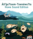
Txwnéwu7ts Howe Sound Education Kit
Only Sharing Permitted
CC BY-NC-ND
Rating
0.0 stars

The Ocean Wise Howe Sound Education Kit Is available in multiple grade editions, all in French and English and include both a student work book and teacher accompanying guidebook. Each kit features several lessons on the unique UNESCO heritage site of the Howe Sound environment.

Átl’ḵa7tsem/Txwnéwu7ts/ Howe Sound is a coastal fjord ecosystem in the Salish Sea. It is a vital area to First Nation communities, providing natural resources that allowed Indigenous peoples to thrive for generations before colonization. Following colonization and years of destructive human activity, such as industrial and coastal development, efforts are currently underway by government, industry groups, and local communities to transition the Sound’s marine ecosystem from crisis to recovery. Indigenous communities, in particular, are working hard to restore life and traditional practices for generations to come.

Using Átl’ḵa7tsem/ Txwnéwu7ts/ Howe Sound as a case study, students can recognize how ecosystems, species, human impact, and climate change are interconnected. This work is essential for students to make informed decisions as the future stewards of our planet.

Subject:
Applied Science
Arts and Humanities
Atmospheric Science
Biology
Career and Technical Education
Cultural Geography
Ecology
Education
Elementary Education
English Language Arts
Environmental Science
Environmental Studies
Geoscience
Hydrology
Life Science
Maritime Science
Oceanography
Physical Science
Reading Informational Text
Social Science
World Cultures
Zoology
Material Type:
Activity/Lab
Case Study
Diagram/Illustration
Full Course
Interactive
Lesson
Lesson Plan
Module
Reading
Student Guide
Unit of Study
Author:
Ocean WIse
Date Added:
04/26/2024
U.S. Geography - Beginning Level
Read the Fine Print
Rating
0.0 stars

This lesson introduces basic map-reading skills and directional vocabulary. It orients the students to the geography of the United States in comparison to their native country. The students learn vocabulary to discuss geographic features while practicing the answers to Civics Test questions about rivers, oceans, border states, territories, and capitals. There are suggested teaching strategies for small group and whole class activities to practice the new vocabulary using U.S. wall maps and category games with file folders and sticky notes. For the Civics Test, applicants do not need to locate these places on a map, but they do need to understand their existence and be able to correctly answer questions about them. Lastly, the handout Map Directions for the Literacy Level Writing Practice helps beginners practice spelling and handwriting while using key vocabulary from the lesson. Covers civics test items 44, 88, 89, 90, 91, 92, 93, 94.

Subject:
Education
Language Education (ESL)
Physical Geography
Physical Science
Material Type:
Lesson Plan
Provider:
U.S. Citizenship and Immigration Services
Provider Set:
Beginning Level Lesson Plans
Date Added:
09/04/2015
Unit 1: Data Set Analysis
Conditional Remix & Share Permitted
CC BY-NC-SA
Rating
0.0 stars

In this unit, students will be introduced to different data types used in the geosciences and other disciplines to understand environmental problems. The instructor will discuss the difference between qualitative and quantitative. Then, students will be given data sets related to water in Phoenix, Arizona. Students will work in groups of two to five to categorize different data sets as qualitative or quantitative and to reflect on their emotive responses to different data. The session ends with a discussion about the potential uses of these various data sets in decision-making around water in Phoenix, and uses this to foster a discussion about the ways in which different data sources lend insight into complex system problems.

(Note: this resource was added to OER Commons as part of a batch upload of over 2,200 records. If you notice an issue with the quality of the metadata, please let us know by using the 'report' button and we will flag it for consideration.)

Subject:
Biology
Career and Technical Education
Environmental Studies
Geology
Life Science
Mathematics
Measurement and Data
Physical Science
Social Science
Sociology
Statistics and Probability
Material Type:
Activity/Lab
Module
Provider:
Science Education Resource Center (SERC) at Carleton College
Provider Set:
Teach the Earth
Author:
Kate Darby
Lisa Phillips
Michael Phillips
Date Added:
04/22/2021
Unit 1: Foundational Concepts
Conditional Remix & Share Permitted
CC BY-NC-SA
Rating
0.0 stars

Unit 1 introduces foundational concepts in geoscience, emergency management, and political science that are critical for developing a systems thinking approach and for achieving the learning objectives in the storm module. More specifically, within Unit 1, students acquire a vocabulary related to storm systems and risk, engage in practical exercises on event probability and frequency, and complete written activities and oral presentations that reinforce these concepts, using their own community and two case studies as examples. The activities include: a pre-and post-Unit survey on natural hazard risk, an optional concept map exercise to identify associations of risk in major storms, an exercise on probability and frequency of natural hazards in general and major storms in particular, an exercise using hazard vulnerability analysis (HVA) and the HVA's findings, and a synthesis assignment that requires analysis of an assigned hazard mitigation plan (HMP) and development of a proposal to improve mitigation plans.

(Note: this resource was added to OER Commons as part of a batch upload of over 2,200 records. If you notice an issue with the quality of the metadata, please let us know by using the 'report' button and we will flag it for consideration.)

Subject:
Physical Science
Social Science
Material Type:
Activity/Lab
Module
Provider:
Science Education Resource Center (SERC) at Carleton College
Provider Set:
Teach the Earth
Author:
Lisa Doner
Lorraine Motola
Patricia Stapleton
Date Added:
04/05/2022
Unit 1: Hazards, vulnerability and risk
Conditional Remix & Share Permitted
CC BY-NC-SA
Rating
0.0 stars

Students will identify and apply credible geologic and social science data sets to identify local hazards and vulnerable groups and structures, and assess risk for their community.

(Note: this resource was added to OER Commons as part of a batch upload of over 2,200 records. If you notice an issue with the quality of the metadata, please let us know by using the 'report' button and we will flag it for consideration.)

Subject:
Biology
Career and Technical Education
Environmental Studies
Geology
Life Science
Mathematics
Measurement and Data
Physical Science
Social Science
Sociology
Material Type:
Activity/Lab
Module
Provider:
Science Education Resource Center (SERC) at Carleton College
Provider Set:
Teach the Earth
Author:
Brittany Brand
Melissa Schlegel
Pamela McMullin-Messier
Date Added:
11/20/2021
Unit 1: Introduction to Global Food Security
Conditional Remix & Share Permitted
CC BY-NC-SA
Rating
0.0 stars

This introductory lesson will build the foundation for students to progress through the remaining units by defining food security and discussing the major factors contributing to food insecurity today (climate change, population growth, economic downturns, and change in global food consumption/wealth). Tied intimately to global food security is the concept of malnutrition. In this unit, students will engage with the three subcategories of malnutrition, which will provide an important basis for understanding the variation of food security across the globe and will challenge often held assumptions that food security only comes in the form of extreme hunger. Finally, students will be introduced to the global food system and will use the case study of chocolate to describe its components. As a formative assessment, students will take a five question multiple-choice quiz on the concept of malnutrition and the major causes of global food insecurity.

(Note: this resource was added to OER Commons as part of a batch upload of over 2,200 records. If you notice an issue with the quality of the metadata, please let us know by using the 'report' button and we will flag it for consideration.)

Subject:
Biology
Life Science
Material Type:
Activity/Lab
Case Study
Module
Provider:
Science Education Resource Center (SERC) at Carleton College
Provider Set:
Teach the Earth
Author:
Amy Potter
Date Added:
12/02/2021
Unit 1: Introduction to Systems Thinking â What is a System?
Conditional Remix & Share Permitted
CC BY-NC-SA
Rating
0.0 stars

This unit introduces systems and systems thinking. The unit is easily adaptable to any course and includes an introduction of terminology, motivation for using systems thinking, and practice reading, as well as interpreting and evaluating systems diagrams. Note that an Internet connection and speakers are required to play the audio file in Part 3.

(Note: this resource was added to OER Commons as part of a batch upload of over 2,200 records. If you notice an issue with the quality of the metadata, please let us know by using the 'report' button and we will flag it for consideration.)

Subject:
Biology
Career and Technical Education
Environmental Studies
Geology
Life Science
Physical Science
Material Type:
Activity/Lab
Module
Provider:
Science Education Resource Center (SERC) at Carleton College
Provider Set:
Teach the Earth
Author:
Karl Kreutz
Lisa Gilbert
deborah gross
Date Added:
09/08/2022
Unit 1: Slip-sliding away: case study landslides in Italy and Peru
Conditional Remix & Share Permitted
CC BY-NC-SA
Rating
0.0 stars

How have mass-wasting events affected communities, and what lessons have we learned from these natural disasters that might help us mitigate future hazards? In this unit, students answer these questions by being introduced to the landscape and societal characteristics that contributed to loss of property and life during the 1970 Nevado HuascarÃn (Peru) and 2010 San Fratello (Sicily, Italy) events.

Show more about Online Teaching suggestions
Hide
Online-ready: This opening class discussion about landslides and societal impacts could easily be converted to an online discussion format.

(Note: this resource was added to OER Commons as part of a batch upload of over 2,200 records. If you notice an issue with the quality of the metadata, please let us know by using the 'report' button and we will flag it for consideration.)

Subject:
Biology
Life Science
Material Type:
Activity/Lab
Case Study
Module
Provider:
Science Education Resource Center (SERC) at Carleton College
Provider Set:
Teach the Earth
Author:
Becca Walker
Sarah Hall
Date Added:
02/02/2022