Updating search results...

Search Resources

167 Results

View
Selected filters:
  • lecture
Unit 3: Energy Flows and Feedback Processes
Conditional Remix & Share Permitted
CC BY-NC-SA
Rating
0.0 stars

In this unit, we use energy flows within the climate system to introduce climate feedbacks and system diagrams. The class session uses an interactive lecture approach having students work on multiple tasks throughout the class session. A system diagram highlighting the complexity of climate change mitigation policy is created to highlight the interdisciplinary nature of addressing anthropogenically forced climate change. The climatic effects of volcanic eruptions are highlighted to provide necessary scaffolding for this module's capstone assessment.

(Note: this resource was added to OER Commons as part of a batch upload of over 2,200 records. If you notice an issue with the quality of the metadata, please let us know by using the 'report' button and we will flag it for consideration.)
Subject:
Applied Science
Biology
Environmental Science
Life Science
Material Type:
Activity/Lab
Assessment
Module
Provider:
Science Education Resource Center (SERC) at Carleton College
Provider Set:
Teach the Earth
Author:
Allison Dunn
Bob Mackay
Phil Resor
Date Added:
09/19/2022
Unit 3: Natural and Agricultural Erosion Rates
Conditional Remix & Share Permitted
CC BY-NC-SA
Rating
0.0 stars

Students will identify their perceptions of erosion by examining images of mountain and agricultural landscapes and discussing which environment is more erosive. They will use geospatial figures to compare erosion rates associated with both natural and agricultural landscapes in the United States. Students will then consider how the presence of agriculture has reduced the areas of soil production, replacing them with regions of soil loss. They will reflect on the negative impact of agricultural erosion on soil sustainability.

(Note: this resource was added to OER Commons as part of a batch upload of over 2,200 records. If you notice an issue with the quality of the metadata, please let us know by using the 'report' button and we will flag it for consideration.)
Subject:
Agriculture
Biology
Career and Technical Education
Life Science
Material Type:
Activity/Lab
Data Set
Lesson Plan
Module
Provider:
Science Education Resource Center (SERC) at Carleton College
Provider Set:
Teach the Earth
Author:
Hannah Scherer
Martha Murphy
Sarah Fortner
Date Added:
07/07/2022
Unit 3: Rivers and Water Diversion
Conditional Remix & Share Permitted
CC BY-NC-SA
Rating
0.0 stars

In this unit students will explore surface water and its relationship to the water cycle via watersheds and drainage divides. These topics will inform their analysis of the social and environmental impacts of the planned increase of hydroelectric dams in the Amazon. Case studies include the Ene River and the MaraÃÃn River in Peru.

(Note: this resource was added to OER Commons as part of a batch upload of over 2,200 records. If you notice an issue with the quality of the metadata, please let us know by using the 'report' button and we will flag it for consideration.)
Subject:
Biology
Career and Technical Education
Environmental Studies
Geology
Hydrology
Life Science
Physical Science
Material Type:
Activity/Lab
Module
Provider:
Science Education Resource Center (SERC) at Carleton College
Provider Set:
Teach the Earth
Author:
Ruth Hoff, Wittenberg University. Authored and compiled new case study material based on Unit 3 of Environmental Justice and Freshwater Resources module by Adriana Perez, Jill S. Schneiderman, Meg Stewart, and Joshua Villalobos
Date Added:
09/25/2022
Unit 3: Streams and Water Diversion
Conditional Remix & Share Permitted
CC BY-NC-SA
Rating
0.0 stars

Unit 3 communicates the critical need for management of fresh water and ways in which citizens may take part in its conservation and restoration. Students explore the relationships between watersheds, drainage divides and the hydrologic cycle using a case study from the Hawaiian Islands involving surface water diversions from a region inhabited by indigenous people to a region comprised of large-scale agricultural fields.

(Note: this resource was added to OER Commons as part of a batch upload of over 2,200 records. If you notice an issue with the quality of the metadata, please let us know by using the 'report' button and we will flag it for consideration.)

Subject:
Biology
Career and Technical Education
Environmental Studies
Geology
Life Science
Physical Science
Material Type:
Activity/Lab
Case Study
Module
Provider:
Science Education Resource Center (SERC) at Carleton College
Provider Set:
Teach the Earth
Author:
Jill Schneiderman
Joshua Villalobos
Meg Stewart
Date Added:
09/25/2022
Unit 3: The Interconnected Nature of the Atmosphere, Hydrosphere, and Biosphere
Conditional Remix & Share Permitted
CC BY-NC-SA
Rating
0.0 stars

Using a systems dynamics approach, students will work in groups to conceptualize and construct a model of the global carbon cycle considering five major Earth systems: atmosphere, hydrosphere, geosphere, cryosphere, and biosphere. The models will draw on information from the pre-class activity and invoke system features such as boundaries, stocks, flows, and control variables. Using a scenario describing a global, catastrophic event, the students will consider how new conditions change the behavior of carbon cycling in their model world. Students will use the model to explain changes in environmental variables such as permafrost cover, atmospheric gases, and global temperature, as well as feedbacks within the system.

(Note: this resource was added to OER Commons as part of a batch upload of over 2,200 records. If you notice an issue with the quality of the metadata, please let us know by using the 'report' button and we will flag it for consideration.)
Subject:
Biology
Career and Technical Education
Education
Environmental Studies
Life Science
Material Type:
Activity/Lab
Module
Provider:
Science Education Resource Center (SERC) at Carleton College
Provider Set:
Teach the Earth
Author:
Cailin Huyck Orr
Camille Holmgren
LeeAnna Chapman
Rebecca Teed
Sam Donovan
Date Added:
09/25/2022
Unit 4: An uplifting story of sea level change
Conditional Remix & Share Permitted
CC BY-NC-SA
Rating
0.0 stars

How much and how quickly does Earth's surface respond to changes in a glacier's mass? How can geodesy help scientists understand the relationship between ice mass change and changes in the bedrock surface? How are these processes related to regional sea level changes? In this unit, students use visualizations, bedrock GPS (Global Positioning System), and ice elevation data from Greenland's Helheim Glacier to investigate the concept of post-glacial rebound and the relative contributions of rebound and ice melting to regional sea level changes in Greenland.

Show more information on GPS versus GNSS
Hide
Note: Although the term GPS (Global Positioning System) is more commonly used in everyday language, it officially refers only to the USA's constellation of satellites. GNSS (Global Navigation Satellite System) is a universal term that refers to all satellite navigation systems including those from the USA (GPS), Russia (GLONASS), European Union (Galileo), China (BeiDou), and others. In this module, we use the term GPS even though, technically, some of the data may be coming from satellites in other systems.

Show more about Online Teaching suggestions
Hide
Online-adaptable: The lecture and main data analysis exercise can easily be moved online. The final piece is a discussion or [linkhttps://serc.carleton.edu/introgeo/gallerywalk/index.html 'gallery walk'] which can also be successfully done online but may take a little more preparation. For instance, in the case of the gallery walk, the images and questions can be available for online viewing with space available for student comments. Online groups then rotate through the stations virtually.

(Note: this resource was added to OER Commons as part of a batch upload of over 2,200 records. If you notice an issue with the quality of the metadata, please let us know by using the 'report' button and we will flag it for consideration.)
Subject:
Applied Science
Biology
Environmental Science
Life Science
Mathematics
Measurement and Data
Statistics and Probability
Material Type:
Activity/Lab
Module
Provider:
Science Education Resource Center (SERC) at Carleton College
Provider Set:
Teach the Earth
Author:
Becca Walker
Leigh Stearns
Date Added:
09/26/2022
Unit 4: Hurricane Impacts
Conditional Remix & Share Permitted
CC BY-NC-SA
Rating
0.0 stars

This unit has three options for 40-minute activities that address hurricane impacts. Alternatively, if time allows, all three could be used in sequence. Activity 4.1 includes a presentation on the terrestrial impacts of hurricanes and is mostly based on what happened when Hurricane Irene (2011) and Superstorm Sandy (2012) made landfall. This can be used as a presentation or as a topic for student-led in-class discussion. Activity 4.2 is an in-class activity: groups of students work together to make observations from before and after pictures of the same site and describe the type and magnitude of changes to the areas. Activity 4.3 explores the relationship between rainfall, river flow, and hurricanes, which has been relevant in both coastal and perhaps more importantly (and surprisingly) inland areas of the northeastern United States during recent hurricanes.

(Note: this resource was added to OER Commons as part of a batch upload of over 2,200 records. If you notice an issue with the quality of the metadata, please let us know by using the 'report' button and we will flag it for consideration.)
Subject:
Applied Science
Biology
Health, Medicine and Nursing
Life Science
Mathematics
Measurement and Data
Material Type:
Activity/Lab
Module
Provider:
Science Education Resource Center (SERC) at Carleton College
Provider Set:
Teach the Earth
Author:
Joan Ramage
Josh Galster
Lisa Gilbert
Date Added:
06/01/2022
Unit 4: Using SoilWeb to Investigate the Soil Beneath You
Conditional Remix & Share Permitted
CC BY-NC-SA
Rating
0.0 stars

Students will use SoilWeb -- , a smartphone and web application that pulls detailed soil survey data from both the 1:24,0000 Soil Survey Geographic database (SSURGO) and the 1:250,000 scale State Soil Geographic database (STATSGO). Students will retrieve soil information for the soil beneath them. They will diagram soil horizons and compare them to a profile of soil organic matter and determine the most fertile horizon. Finally, students will complete a jigsaw activity comparing local soil erosion rates, soil horizons, and soil organic matter to other sites. After students share site comparisons, they will reflect on our agricultural future and solutions needed to mitigate lost soil resources. They will discuss how the speed at which we implement soil solutions will impact society and the economy.

(Note: this resource was added to OER Commons as part of a batch upload of over 2,200 records. If you notice an issue with the quality of the metadata, please let us know by using the 'report' button and we will flag it for consideration.)
Subject:
Agriculture
Biology
Career and Technical Education
Life Science
Mathematics
Measurement and Data
Material Type:
Activity/Lab
Interactive
Module
Provider:
Science Education Resource Center (SERC) at Carleton College
Provider Set:
Teach the Earth
Author:
Hannah Scherer
Martha Murphy
Sarah Fortner
Date Added:
07/07/2022
Unit 5: Hazardous Waste and Love Canal
Conditional Remix & Share Permitted
CC BY-NC-SA
Rating
0.0 stars

Students explore the classic case of Love Canal, New York, in which Lois Gibbs -- originally described as a "hysterical housewife" -- mobilized her community and called attention to the contamination of groundwater by buried hazardous waste and the resulting impact on the health of local residents. The activities require the students to investigate the history of events at Love Canal. The materials in this unit may be used as a stand-alone day of instruction or as part of the complete Environmental Justice and Freshwater Resources InTeGrate Module.

(Note: this resource was added to OER Commons as part of a batch upload of over 2,200 records. If you notice an issue with the quality of the metadata, please let us know by using the 'report' button and we will flag it for consideration.)
Subject:
Applied Science
Biology
Career and Technical Education
Environmental Studies
Geology
Health, Medicine and Nursing
Hydrology
Life Science
Physical Science
Material Type:
Activity/Lab
Module
Provider:
Science Education Resource Center (SERC) at Carleton College
Provider Set:
Teach the Earth
Author:
Jill Schneiderman
Meg Stewart
Date Added:
09/25/2022
Unit 5: Predicting the Effects of Climate Change on Soil Loss
Conditional Remix & Share Permitted
CC BY-NC-SA
Rating
0.0 stars

Students will investigate how the factors that influence erosion work together to produce an overall erosion rate. In agricultural areas, these factors are rainfall-runoff erosivity, soil erodibility, slope characteristics, and agricultural practices. Students will analyze changes in precipitation predicted by climate change models to consider how a changing climate could influence erosion rates in agricultural areas.

(Note: this resource was added to OER Commons as part of a batch upload of over 2,200 records. If you notice an issue with the quality of the metadata, please let us know by using the 'report' button and we will flag it for consideration.)
Subject:
Agriculture
Biology
Career and Technical Education
Life Science
Material Type:
Activity/Lab
Module
Provider:
Science Education Resource Center (SERC) at Carleton College
Provider Set:
Teach the Earth
Author:
Hannah Scherer
Martha Murphy
Sarah Fortner
Date Added:
09/07/2022
Unit 6: Groundwater Availability and Resources
Conditional Remix & Share Permitted
CC BY-NC-SA
Rating
0.0 stars

Students will utilize the desert Southwest region of the United States and the Ogallala Aquifer in a case study to evaluate issues regarding groundwater and its scarcity. Groundwater is often seen as a limitless resource in the Southwest since there is little regulation controlling the amount that is withdrawn (Rule of Capture). This mentality has led to overuse and to the dwindling supply of groundwater in many parts of the Ogallala Aquifer. This module will help students connect groundwater's role in the hydrological cycle to issues of inequity that can occur when groundwater is not properly regulated.

(Note: this resource was added to OER Commons as part of a batch upload of over 2,200 records. If you notice an issue with the quality of the metadata, please let us know by using the 'report' button and we will flag it for consideration.)

Subject:
Biology
Career and Technical Education
Environmental Studies
Geology
Hydrology
Life Science
Mathematics
Measurement and Data
Physical Science
Material Type:
Activity/Lab
Case Study
Module
Provider:
Science Education Resource Center (SERC) at Carleton College
Provider Set:
Teach the Earth
Author:
Adriana Perez
Joshua Villalobos
Date Added:
09/25/2022
Unit 6: Groundwater Availability and Resources
Conditional Remix & Share Permitted
CC BY-NC-SA
Rating
0.0 stars

In this unit, students address the issue of groundwater demands and environmental justice in the arid Southwest, a region with some of the largest percentages of Hispanics and Latinos in the United States. Students discuss the Rule of Capture, the overuse of water resources, and the dwindling supply of groundwater in many parts of the Ogallala Aquifer. Students connect groundwater's role to the hydrological cycle and consider how issues of inequity can occur when groundwater is not properly regulated.

(Note: this resource was added to OER Commons as part of a batch upload of over 2,200 records. If you notice an issue with the quality of the metadata, please let us know by using the 'report' button and we will flag it for consideration.)
Subject:
Agriculture
Biology
Career and Technical Education
Hydrology
Life Science
Mathematics
Measurement and Data
Physical Science
Statistics and Probability
Material Type:
Activity/Lab
Module
Provider:
Science Education Resource Center (SERC) at Carleton College
Provider Set:
Teach the Earth
Author:
Ruth Hoff
Date Added:
11/23/2021
Unit 8. Impacts of Extreme Hydroclimatic Events
Conditional Remix & Share Permitted
CC BY-NC-SA
Rating
0.0 stars

Picture of urban flooding

Provenance: Timothy Swinson https://commons.wikimedia.org/wiki/File:Trapped_woman_on_a_car_roof_during_flash_flooding_in_Toowoomba_2.jpg
Reuse: This item is offered under a Creative Commons Attribution-NonCommercial-ShareAlike license http://creativecommons.org/licenses/by-nc-sa/3.0/ You may reuse this item for non-commercial purposes as long as you provide attribution and offer any derivative works under a similar license.

Unit 8 covers the basics of hydroclimatic extreme events with a focus on floods and droughts. Topics include introduction to floods and droughts, impact of urbanization on extremes, how to understand and predict extremes, how to tackle them (management strategies), and elements of urban climate resilience. The teaching strategy is designed with short and divided lectures filled with discussion questions and a group activity. Students will be working with time series flow data for statistical analysis of extreme events.

(Note: this resource was added to OER Commons as part of a batch upload of over 2,200 records. If you notice an issue with the quality of the metadata, please let us know by using the 'report' button and we will flag it for consideration.)

Subject:
Biology
Career and Technical Education
Environmental Studies
Geology
Life Science
Mathematics
Measurement and Data
Physical Science
Statistics and Probability
Material Type:
Activity/Lab
Module
Provider:
Science Education Resource Center (SERC) at Carleton College
Provider Set:
Teach the Earth
Author:
Manoj Jha
Date Added:
09/20/2022
Using An M&M Magma Chamber To Illustrate Magmatic Differentiation
Conditional Remix & Share Permitted
CC BY-NC-SA
Rating
0.0 stars

Magmatic differentiation is an important concept in the geology curriculum. Students are generally introduced to magmatic differentiation in the introductory course, whereas the details are typically developed in mineralogy and petrology courses. In particular, students often struggle to understand the processes of fractional crystallization.

Fractional crystallization by gravity settling can be illustrated using a model magma chamber consisting of M&M'sÂ. In this model, each major cation (e.g., Si, Ti, Al, Fe, Mg, Ca, Na, K) is represented by a different color M&MÂ; other kinds of differently colored or shaped pieces could also be used. Appropriate numbers of each color M&M are combined to approximate the cation proportions of a basaltic magma; this is the "parental magma". The M&M's are then placed in a group on a tabletop to form a magma chamber. Students then fractionate the magma in ten crystallization steps. In each step the M&M's are moved to the bottom of the magma chamber forming a series of cumulus layers; the M&M's are removed in proportions that are identical to those of the stoichiometric proportions of cations in the crystallizing minerals (e.g., olivine, pyroxene, feldspars, quartz, magnetite, ilmenite). Students observe the changing cation composition (proportions of colors of M&M'sÂ) in the cumulus layers and in the magma chamber and graph the results using spreadsheet software. Students classify the cumulates and resulting liquid after each crystallization step, and they compare the model system with natural magmatic systems (e.g., absence of important fractionating phases, volatiles). Students who have completed this exercise demonstrate increased understanding of fractionation processes exhibit greater familiarity with mineral stoichiometry, classification, solid-solution in minerals, element behavior (e.g., incompatibility), and chemical variation diagrams.

(Note: this resource was added to OER Commons as part of a batch upload of over 2,200 records. If you notice an issue with the quality of the metadata, please let us know by using the 'report' button and we will flag it for consideration.)

Subject:
Biology
Life Science
Mathematics
Measurement and Data
Statistics and Probability
Material Type:
Activity/Lab
Provider:
Science Education Resource Center (SERC) at Carleton College
Provider Set:
Teach the Earth
Author:
Karl Wirth
Date Added:
09/11/2020
Using an Applet to Demonstrate the Sampling Distribution of an F-statistic
Conditional Remix & Share Permitted
CC BY-NC-SA
Rating
0.0 stars

This visualization activity combines student data collection with the use of an applet to enhance the understanding of the distributions of mean square treatment (MST), mean square error (MSE) as well as their ratio, an F-distribution. Students will see theoretical distributions of the mean square treatment, mean square error and their ratio and how they compare to the histograms generated by the simulated data.

Subject:
Mathematics
Material Type:
Activity/Lab
Provider:
Science Education Resource Center (SERC) at Carleton College
Provider Set:
Pedagogy in Action
Author:
Roger Woodard
Date Added:
11/06/2014
Video Presentation Sessions
Conditional Remix & Share Permitted
CC BY-NC-SA
Rating
0.0 stars

Provide opportunities to experience historic and/or current scientific information through audio/visual media. Further, these sessions allow students to express and discuss their understanding of the science content and its relevance prior to writing a summary.

Subject:
Geoscience
Life Science
Physical Science
Material Type:
Activity/Lab
Provider:
Science Education Resource Center (SERC) at Carleton College
Provider Set:
Starting Point (SERC)
Author:
Wesley Boberg
Date Added:
08/28/2012
Volumes of Solids of Revolution
Conditional Remix & Share Permitted
CC BY-NC-SA
Rating
0.0 stars

This write-pair-share activity presents Calculus II students with a worksheet containing several exercises that require them to find the volume of solids of revolution using disk, washer and shell methods and to sketch three-dimensional representations of the resulting solids.

Subject:
Mathematics
Material Type:
Activity/Lab
Provider:
Science Education Resource Center (SERC) at Carleton College
Provider Set:
Pedagogy in Action
Author:
James Rutledge
Date Added:
11/06/2014
Weathering Rates
Conditional Remix & Share Permitted
CC BY-NC-SA
Rating
0.0 stars

A think-pair-share activity in which students calculate weathering rates from tombstone weathering data.

(Note: this resource was added to OER Commons as part of a batch upload of over 2,200 records. If you notice an issue with the quality of the metadata, please let us know by using the 'report' button and we will flag it for consideration.)
Subject:
Atmospheric Science
Biology
Life Science
Mathematics
Measurement and Data
Physical Science
Statistics and Probability
Material Type:
Activity/Lab
Data Set
Lesson Plan
Provider:
Science Education Resource Center (SERC) at Carleton College
Provider Set:
Teach the Earth
Author:
Rebecca Teed
Date Added:
09/04/2020
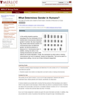
What Determines Gender in Humans?
Conditional Remix & Share Permitted
CC BY-NC-SA
Rating
0.0 stars

In this activity students examine karyotypes from five individuals to try to identify which chromosomes determine gender in humans. This activity is also a good illustration of meiotic non-disjunction.

Subject:
Genetics
Life Science
Material Type:
Activity/Lab
Provider:
Science Education Resource Center (SERC) at Carleton College
Provider Set:
Pedagogy in Action
Author:
Scott Cooper
Date Added:
11/06/2014
What Do You See?
Conditional Remix & Share Permitted
CC BY-NC-SA
Rating
0.0 stars

a. This activity is designed for students to work on their observational skills, and the communications of their observations. They will also learn to pose researchable or testable questions, to give critique (and to receive) critique on their comments and research.

Subject:
Biology
Life Science
Material Type:
Activity/Lab
Assessment
Lesson Plan
Teaching/Learning Strategy
Provider:
Science Education Resource Center (SERC) at Carleton College
Provider Set:
Pedagogy in Action
Date Added:
12/09/2011