Updating search results...

Search Resources

1474 Results

View
Selected filters:
  • Geoscience
Predator-Prey Interactions -- Modeling the Number of Fishers and Porcupines in New Hampshire
Conditional Remix & Share Permitted
CC BY-NC-SA
Rating
0.0 stars

Spreadsheets Across the Curriculum activity/Introductory Ecology course. Students build and manipulate spreadsheets to model and graph populations using the Lotka-Volterra predator-prey equations.

Subject:
Ecology
Geoscience
Life Science
Mathematics
Physical Science
Material Type:
Activity/Lab
Provider:
Science Education Resource Center (SERC) at Carleton College
Provider Set:
Pedagogy in Action
Author:
Ben Steele
Date Added:
11/06/2014
Predatory-Prey Relationships: The Fox and the Rabbit Game
Conditional Remix & Share Permitted
CC BY-NC-SA
Rating
0.0 stars

This activity is a simulation that illustrates how population sizes are affected by predator-prey relationships and competitive interactions among prey.

Subject:
Ecology
Geoscience
Life Science
Physical Science
Material Type:
Activity/Lab
Assessment
Lesson Plan
Provider:
Science Education Resource Center (SERC) at Carleton College
Provider Set:
Pedagogy in Action
Date Added:
12/09/2011
Prework for Rivers and Streams Lab (Intro Geology)
Conditional Remix & Share Permitted
CC BY-NC-SA
Rating
0.0 stars

In order to give Introductory Geology (Physical Geology) undergraduate non-majors students experience and confidence in using basic algebra to calculate very simple stream flow properties, we use a prework assignment prior to the Rivers and Streams Lab. Prework is a worksheet assigned 2 weeks in advance, which asks students to calculate velocity and discharge as well as unit conversions and calculations of stream load. The questions are put into the context of activities they completed earlier in the semester during visits to the stream (on campus) so questions are relevant to their previous experiences. The prework timeframe gives students the opportunity to seek extra help from their instructor prior to the lab period in which they will make additional measurements, similar calcualations and interpretations of their data.

(Note: this resource was added to OER Commons as part of a batch upload of over 2,200 records. If you notice an issue with the quality of the metadata, please let us know by using the 'report' button and we will flag it for consideration.)

Subject:
Biology
Geoscience
Hydrology
Life Science
Mathematics
Measurement and Data
Physical Science
Statistics and Probability
Material Type:
Activity/Lab
Module
Provider:
Science Education Resource Center (SERC) at Carleton College
Provider Set:
Teach the Earth
Author:
Rachel Teasdale
Date Added:
08/26/2019
Primary Structures and Rotation
Conditional Remix & Share Permitted
CC BY-NC-SA
Rating
0.0 stars

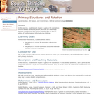
Students gesture the orientations of cross-bedded sandstones, and in particular the relationship between a single cross bed and the bed sets. They do this for photos of undeformed and deformed cross-bedding.

(Note: this resource was added to OER Commons as part of a batch upload of over 2,200 records. If you notice an issue with the quality of the metadata, please let us know by using the 'report' button and we will flag it for consideration.)

Subject:
Biology
Geology
Geoscience
Life Science
Physical Science
Material Type:
Activity/Lab
Provider:
Science Education Resource Center (SERC) at Carleton College
Provider Set:
Teach the Earth
Author:
Carol Ormand
Date Added:
09/01/2022
Primitive Insects of the Congaree Swamp
Read the Fine Print
Educational Use
Rating
0.0 stars

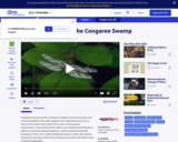
In this video segment from NatureScene, observe dragonflies and mayflies near Cedar Creek at Congaree Swamp National Park.

Subject:
Ecology
Forestry and Agriculture
Geoscience
Life Science
Physical Science
Material Type:
Lecture
Provider:
PBS LearningMedia
Provider Set:
PBS Learning Media: Multimedia Resources for the Classroom and Professional Development
Author:
SCETV
The William and Flora Hewlett Foundation
Date Added:
08/20/2008
Probability and Traffic Signals
Read the Fine Print
Some Rights Reserved
Rating
0.0 stars

Using the simple example of calculating the probability of reaching a traffic light while green, students are shown how to build a mathematical model using a very commonly-taught formula (sum of first n integers) to solve a rather practical problem. This resource is from PUMAS - Practical Uses of Math and Science - a collection of brief examples created by scientists and engineers showing how math and science topics taught in K-12 classes have real world applications.

Subject:
Geoscience
Mathematics
Physical Science
Material Type:
Lecture Notes
Provider:
NASA
Provider Set:
NASA Wavelength
Date Added:
11/05/2014
Problem-Based Learning: UV Menace
Conditional Remix & Share Permitted
CC BY-NC-SA
Rating
0.0 stars

Students work as a team to determine the causes, effects, and solutions to ozone depletion. They work out what they need to know, and split the team up to research different parts of the issue.

(Note: this resource was added to OER Commons as part of a batch upload of over 2,200 records. If you notice an issue with the quality of the metadata, please let us know by using the 'report' button and we will flag it for consideration.)

Subject:
Atmospheric Science
Biology
Geoscience
Life Science
Physical Science
Material Type:
Lesson Plan
Provider:
Science Education Resource Center (SERC) at Carleton College
Provider Set:
Teach the Earth
Author:
Rebecca Teed
Date Added:
01/28/2020
Profiling Earth's Surface using GeoMapApp
Conditional Remix & Share Permitted
CC BY-NC-SA
Rating
0.0 stars

In this exercise, students relate large-scale features on Earth's surface to lithospheric plates, the underlying asthenosphere, earthquakes, and volcanoes. After creating a cross section showing elevation using GeoMapApp, students add additional features by hand.

(Note: this resource was added to OER Commons as part of a batch upload of over 2,200 records. If you notice an issue with the quality of the metadata, please let us know by using the 'report' button and we will flag it for consideration.)

Subject:
Biology
Geology
Geoscience
Life Science
Physical Science
Material Type:
Activity/Lab
Data Set
Lesson Plan
Provider:
Science Education Resource Center (SERC) at Carleton College
Provider Set:
Teach the Earth
Author:
Laura Wetzel
Date Added:
02/22/2018
Projections and Coordinates: Turning a 3D Earth into Flatlands
Read the Fine Print
Educational Use
Rating
0.0 stars

Projections and coordinates are key advancements in the geographic sciences that allow us to better understand the nature of the Earth and how to describe location. These innovations in describing the Earth are the basis for everything that is done in a GIS framework. Shape of the Earth is a critical starting point because in fact the Earth is not round but rather a more complex shape called a geoid. Coordinate systems are often referenced to a particular model shape of the Earth, but many different formats exist because not all coordinates work equally well in all areas. While projections and coordinates are abstract concepts in themselves, students eventually find them interesting because 1) it causes them to challenge their current ideas of the Earth's shape and 2) it is much easier to visualize these ideas for learning through interactive GIS such as Google Earth.

Subject:
Applied Science
Engineering
Geoscience
Physical Science
Space Science
Technology
Material Type:
Lesson Plan
Provider:
TeachEngineering
Provider Set:
TeachEngineering
Author:
Andrey Koptelov
Nathan Howell
Date Added:
09/18/2014
Properties of Fresh and Sea Water
Read the Fine Print
Rating
0.0 stars

This is a hands-on lab activity about the properties and states of water. Learners will complete activities using different liquids to understand the three states of matter, explain how the high heat capacity and abundance of liquid water makes life on Earth possible, and understand that water containing salts and minerals has different properties than fresh water. They will graph data to analyze and articulate results and conclusions. The lab is set up as three stations that small groups of students rotate through; it can also be done as demonstrations (e.g., for younger students). Background information, common preconceptions, a glossary and more is included. This activity is part of the Aquarius Hands-on Laboratory Activities.

Subject:
Geoscience
Mathematics
Oceanography
Physical Science
Physics
Material Type:
Activity/Lab
Lesson Plan
Provider:
NASA
Provider Set:
NASA Wavelength
Date Added:
11/05/2014
Putting It All Together (Water Cycle, Deforestation, and Climate Change #4)
Conditional Remix & Share Permitted
CC BY-NC
Rating
0.0 stars

SYNOPSIS: In this lesson, students learn about extreme weather, create an infographic, and educate others on the knowledge gained from this unit.

SCIENTIST NOTES: This lesson allows students to understand the difference between weather and climate, the important variables that cause changes in weather, how weather and climate are predicted, the impact of weather extremes on the climate, and how human activities have accelerated wildfires, disrupted the water cycle, and caused other erratic weather disturbances in their communities. They would be able to explore which weather events are frequent and the overall combined impacts. All materials were rigorously reviewed, and this lesson has passed our science credibility process.

POSITIVES:
-Students participate in multiple interactive and hands-on learning activities to engage in kinesthetic, auditory, and visual learning.
-Students have an opportunity to share their growth and knowledge throughout the unit with other students and community members.

ADDITIONAL PREREQUISITES:
-This is lesson 4 of 4 in our 6th-8th grade Water Cycle, Deforestation, and Climate Change unit.
-Teachers need to determine how to choose the best course of action for sharing student learning. Options include the following:
-Class vote
-Teacher predetermines based on their best judgment
-Student panel is created
-Different groups choose different courses of action

DIFFERENTIATION:
-Students may use the Emotions Board for vocabulary support as they watch the videos in the Inquire section
-At the end of the unit, a classroom gallery walk is recommended.
-Some ideas for extensions at the end of the unit include:
-Inviting other classes in for a gallery walk
-Hosting a community night where community members can be educated on what students have learned in the unit
-Mailing student materials to different leaders in the community, particularly leaders that are in charge of the local water sources
Subject:
Geoscience
Physical Science
Space Science
Material Type:
Lesson Plan
Provider:
SubjectToClimate
Author:
Mallory Swafford
Date Added:
06/29/2023
Quantitative Classroom Exercises
Conditional Remix & Share Permitted
CC BY-NC-SA
Rating
0.0 stars

The four exercises give students an opportunity to use their knowledge of graphs, algebra, and maps to solve simple geological problems.

(Note: this resource was added to OER Commons as part of a batch upload of over 2,200 records. If you notice an issue with the quality of the metadata, please let us know by using the 'report' button and we will flag it for consideration.)

Subject:
Agriculture
Biology
Career and Technical Education
Geology
Geoscience
Hydrology
Life Science
Mathematics
Measurement and Data
Physical Science
Statistics and Probability
Material Type:
Activity/Lab
Provider:
Science Education Resource Center (SERC) at Carleton College
Provider Set:
Teach the Earth
Author:
Steven Schafersman
Date Added:
08/11/2019
Quasispecies
Conditional Remix & Share Permitted
CC BY-SA
Rating
0.0 stars

We use eigenvector-eigenvalue analysis to walk through a simple quasispecies model described in Bull, Meyers, and Lachmann, "Quasispecies made simple," PLoS Comp Biol, 1(6):e61 (2005). The dominance of a genotype depends, not merely on its ability to breed quickly (i.e. the rudimentary concept of survival of the fittest), but also on its ability to breed "true."

Subject:
Ecology
Forestry and Agriculture
Geoscience
Life Science
Mathematics
Physical Science
Material Type:
Lecture Notes
Provider:
Look At Physics
Provider Set:
A Mathematical Way to Think About Biology
Author:
David Liao
Date Added:
10/08/2012
Question of the Day: ANWR Drilling Policy
Conditional Remix & Share Permitted
CC BY-NC-SA
Rating
0.0 stars

Students analyze the interplay between science and politics on the issue of drilling for oil in the Arctic National Wildlife Refuge.

(Note: this resource was added to OER Commons as part of a batch upload of over 2,200 records. If you notice an issue with the quality of the metadata, please let us know by using the 'report' button and we will flag it for consideration.)

Subject:
Biology
Geology
Geoscience
Life Science
Mathematics
Measurement and Data
Physical Science
Statistics and Probability
Material Type:
Activity/Lab
Provider:
Science Education Resource Center (SERC) at Carleton College
Provider Set:
Teach the Earth
Author:
Question of the Day developed by William Prothero, University of California, Santa Barbara.
Date Added:
10/17/2019
Questions, Questions: Taking Energy Inquiry Further in the School Library
Conditional Remix & Share Permitted
CC BY-SA
Rating
0.0 stars

This article from Beyond Weather and the Water Cycle provides ideas on how school librarians can work with elementary teachers to teach about the Sun's impact on weather and climate. The author introduces the Standards for the 21st Century Learner, developed by the American Association of School Librarians. The author focuses on Standard 1, which calls for students to inquire, think critically, and gain knowledge through developing and refining questions, investigating answers, seeking divergent perspectives in information, and assessing whether the information found answers the questions posed. The free, online magazine draws its themes from the Seven Essential Principles of Climate Literacy, with each issue focusing on one of the seven principles.

Subject:
Arts and Humanities
Education
English Language Arts
Geoscience
Physical Science
Physics
Reading Informational Text
Space Science
Material Type:
Teaching/Learning Strategy
Provider:
Ohio State University College of Education and Human Ecology
Provider Set:
Beyond Weather and the Water Cycle
Author:
Marcia Mardis
National Science Foundation
Date Added:
05/30/2012
Radioactive Decay and Geochronology
Conditional Remix & Share Permitted
CC BY-NC-SA
Rating
0.0 stars

Students create a STELLA model of the radioactive decay process.

(Note: this resource was added to OER Commons as part of a batch upload of over 2,200 records. If you notice an issue with the quality of the metadata, please let us know by using the 'report' button and we will flag it for consideration.)

Subject:
Biology
Geoscience
Life Science
Mathematics
Measurement and Data
Physical Science
Statistics and Probability
Material Type:
Activity/Lab
Interactive
Provider:
Science Education Resource Center (SERC) at Carleton College
Provider Set:
Teach the Earth
Author:
Kirsten Menking
Date Added:
09/03/2020
Radiometric Dating
Conditional Remix & Share Permitted
CC BY-NC-SA
Rating
0.0 stars

This activity leads students through derivations of the equations associated with radiometric dating.

(Note: this resource was added to OER Commons as part of a batch upload of over 2,200 records. If you notice an issue with the quality of the metadata, please let us know by using the 'report' button and we will flag it for consideration.)

Subject:
Biology
Geology
Geoscience
Life Science
Mathematics
Measurement and Data
Physical Science
Statistics and Probability
Material Type:
Activity/Lab
Provider:
Science Education Resource Center (SERC) at Carleton College
Provider Set:
Teach the Earth
Author:
Related Links Radioactive Decay Exponential Growth and Decay Peter Kohn - James Madison University Christopher Gellasch - Uniformed Services University Jim Sochacki - James Madison University Scott Eaton - James Madison University Richard Ford - Weber State University
Date Added:
01/14/2020
Rain Erosion-Does the Rate of Water Effect Erosion?
Conditional Remix & Share Permitted
CC BY-NC-SA
Rating
0.0 stars

This activity is a guided inquiry investigation where students gather data on rate of water falling on erosion. Student will interpret their data, and develop a conclusion from the data. The data will lead to further questions, which can be developed by the students.

Subject:
Geology
Geoscience
Physical Science
Material Type:
Activity/Lab
Provider:
Science Education Resource Center (SERC) at Carleton College
Provider Set:
Pedagogy in Action
Author:
kyle johnson
Date Added:
08/16/2012
Reader of the Rocks
Conditional Remix & Share Permitted
CC BY-SA
Rating
0.0 stars

This article profiles Julie Codispoti, assistant curator at the United States Polar Rock Repository, and discusses the basics of polar geology. Modified versions are available for younger students.

Subject:
Applied Science
Environmental Science
Geoscience
Physical Science
Material Type:
Lesson Plan
Provider:
Ohio State University College of Education and Human Ecology
Provider Set:
Beyond Penguins and Polar Bears: An Online Magazine for K-5 Teachers
Author:
Stephen Whitt
Date Added:
10/17/2014
Reader of the Rocks: Grades 4-5: Illustrated Book
Conditional Remix & Share Permitted
CC BY-SA
Rating
0.0 stars

This informational text introduces students to the discipline of geology, and specifically polar geology. Students meet Julie Codispoti, assistant curator of the U.S. Polar Rock Repository, and learn how she overcame an initial dislike of science to become a geologist. Students also learn that rocks, like books, can teach us about the world long ago. The text is written at a grade four through grade five reading level. This version is a full-color PDF that can be printed, cut and folded to form a book. Each book contains color photographs and illustrations.

Subject:
Geoscience
Life Science
Physical Science
Material Type:
Diagram/Illustration
Provider:
Ohio State University College of Education and Human Ecology
Provider Set:
Beyond Penguins and Polar Bears: An Online Magazine for K-5 Teachers
Author:
Stephen Whitt
Date Added:
08/17/2010