Updating search results...

SERC: Pedagogy In Action

3918 affiliated resources

Search Resources

View
Selected filters:
Creating Shaded Relief Images and 3D Scenes Using Aerial Photos, DEMs, Arc, and ArcScene
Conditional Remix & Share Permitted
CC BY-NC-SA
Rating
0.0 stars

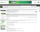
The first part of this activity teaches students how to make a high quality shaded relief image of an aerial photo using ArcMap, an orthophoto, and a DEM by matching the illumination direction on the hillshade created from the DEM with the illumination direction at the time the photo was taken.

In the second part of this activity, students use a digital orthophoto with an associated DEM, and ArcScene to construct a high resolution 3D visual version of the scene that can be tilted, panned, and zoomed in real time, providing an outstanding way for students to visualize landscape.

This activity does not come with a data set. Any orthophoto and DEM can be used.

(Note: this resource was added to OER Commons as part of a batch upload of over 2,200 records. If you notice an issue with the quality of the metadata, please let us know by using the 'report' button and we will flag it for consideration.)

Subject:
Biology
Life Science
Material Type:
Activity/Lab
Provider:
Science Education Resource Center (SERC) at Carleton College
Provider Set:
Teach the Earth
Author:
Barb Tewksbury
Date Added:
08/29/2019
Creating Understanding: How Metamorphic Rock is Formed
Conditional Remix & Share Permitted
CC BY-NC-SA
Rating
0.0 stars

This activity gives a visual representation of how we are able to see the different layers of metamorphic rocks.

Subject:
Geology
Physical Science
Material Type:
Activity/Lab
Lesson Plan
Simulation
Provider:
Science Education Resource Center (SERC) at Carleton College
Provider Set:
Pedagogy in Action
Author:
Sherrie Seidensticker
Date Added:
10/04/2011
Creating Your Own Sunset
Conditional Remix & Share Permitted
CC BY-NC-SA
Rating
0.0 stars

This activity gives a visual representation of how we are able to observe many colors in a sunrise or sunset.

Subject:
Physical Science
Physics
Material Type:
Activity/Lab
Lesson Plan
Simulation
Provider:
Science Education Resource Center (SERC) at Carleton College
Provider Set:
Pedagogy in Action
Author:
Sherrie Seidensticker
Date Added:
10/04/2011
Creating a Connection between Everyday Life and Stoichiometry using ChemPrime
Conditional Remix & Share Permitted
CC BY-NC-SA
Rating
0.0 stars

This activity allows the student to access a webpage that provides examples of stoichiometry using terminology and objects they use in their everyday life. This activity can help a student make a connection between the complex chemical concept of stoichiometry and their current knowledge.

Subject:
Chemistry
Physical Science
Material Type:
Activity/Lab
Provider:
Science Education Resource Center (SERC) at Carleton College
Provider Set:
Pedagogy in Action
Author:
Lisa I. Smith
Date Added:
11/06/2014
Creating a Household Budget
Conditional Remix & Share Permitted
CC BY-NC-SA
Rating
0.0 stars

Spreadsheets Across the Curriculum module. Students track their expenses and use Excel to compare them to Seattle/Tacoma averages. Developed for adult students taking English as a Second Language.

Subject:
Economics
Social Science
Material Type:
Activity/Lab
Provider:
Science Education Resource Center (SERC) at Carleton College
Provider Set:
Pedagogy in Action
Author:
Sara Baldwin
Date Added:
11/06/2014
Creating a Natural Disaster Blog/VoiceThread to Understand Resilience
Conditional Remix & Share Permitted
CC BY-NC-SA
Rating
0.0 stars

Student groups create blogs or VoiceThreads on selected natural disaster events including a description of the event, the cause of the disaster, response & recovery, prediction & prevention and resilience to the event.

(Note: this resource was added to OER Commons as part of a batch upload of over 2,200 records. If you notice an issue with the quality of the metadata, please let us know by using the 'report' button and we will flag it for consideration.)
Subject:
Biology
Career and Technical Education
Environmental Studies
Geology
Life Science
Physical Science
Material Type:
Activity/Lab
Provider:
Science Education Resource Center (SERC) at Carleton College
Provider Set:
Teach the Earth
Author:
Anne Hall
Date Added:
12/11/2020
Creating a Partial Pressure Diagram for the Cu-CO2-O2-H2O System
Conditional Remix & Share Permitted
CC BY-NC-SA
Rating
0.0 stars

Students will be guided through the procedure for creating a partial-pressure diagram in the low-temperature system Cu-CO2-O2-H2O system for the minerals cuprite, tenorite, native copper, azurite, and malachite. They will write chemical reactions and use Gibbs Free Energies to calculate Log K and plot lines on a graph with axes Log P CO2 and Log PO2 for stability boundaries between minerals. They are provided with data to then create their own diagram for the Fe-CO2-O2 system.

(Note: this resource was added to OER Commons as part of a batch upload of over 2,200 records. If you notice an issue with the quality of the metadata, please let us know by using the 'report' button and we will flag it for consideration.)
Subject:
Biology
Life Science
Physical Science
Physics
Material Type:
Activity/Lab
Provider:
Science Education Resource Center (SERC) at Carleton College
Provider Set:
Teach the Earth
Author:
Terri Woods
Date Added:
08/29/2022
Creating a Spam Filter
Conditional Remix & Share Permitted
CC BY-NC-SA
Rating
0.0 stars

This activity asks students to work in a team to develop a set of rules that can be used to program a SPAM filter for a client. The rules are based on characteristics of the subject lines of emails. Students are given samples of SPAM and non-SPAM subject lines to examine. After their rules are ready, they are given a test set of data to use and are asked to come up with a numerical measure to quantify how well their method (model) works. Each team writes a report describing how their model works and how well it performed on the test data. This activity could serve as an introduction to ideas of classification. Alternatively, the activity could be the basis for student introduction to types of statistical errors.

Subject:
Mathematics
Material Type:
Activity/Lab
Assessment
Provider:
Science Education Resource Center (SERC) at Carleton College
Provider Set:
Measuring Study Effectiveness
Date Added:
08/28/2012
Creating a Water Table Map for Newark Road Prairie
Conditional Remix & Share Permitted
CC BY-NC-SA
Rating
0.0 stars

Because many students are familiar with contouring methods, they can mechanically construct water table maps from canned data sets with ease. However, their contouring abilities may mask their level of understanding. This field exercise aims to instill a deeper understanding of the nature of a water table surface as students also learn fundamental hydrogeological field techniques.

The exercise is based at Newark Road Prairie, which is owned and managed by Beloit College and located approximately five miles from campus. The property contains native prairie, wetlands, and a small stream. Although many schools may not own similar types of properties, land managers are often willing to allow the installation of shallow wells on public lands (e.g., county parks, state wildlife areas). Seven shallow monitoring wells and four staff gages are currently installed at Newark Road Prairie.

When we arrive at the field site, we begin by making observations on the subtle changes in topography and the direction of stream flow. Although we have just carried in all of the field equipment, I ask what type of information we will need to create a water table map. Handouts for the exercise are distributed after this discussion (see Supplementary Materials below).

Students are divided into groups of three for the field portion of the exercise, although each student ultimately drafts their own map using group and class data. Each group gets an electronic water level meter, a GPS unit, and a measuring tape, and we discuss the magnitude of error incorporated into the measurements taken by each of the instruments. We then review basic operation procedures for the water level meters and the GPS units, and students confirm that their GPS units are using the correct coordinate system and datum (UTM, NAD83).

We discuss surveying techniques as a class, and supplemental instructions are also provided in the handout (see Supplementary Materials below). We establish a centrally-located, bench mark (usually one of the staff gages) from which the students survey the wells and other staff gages. Each group is responsible for surveying at least two wells or staff gages. Groups distribute their surveying results to the rest of the class when we return to campus. Each group checks their results in the field, which reduces the chance of propagating surveying errors throughout the class.

Groups need to take water level measurements, survey wells, and record GPS coordinates for each well and staff gage. Additionally, because Newark Road Prairie has an established grid system with posts and markers at ten meter intervals, students measure the distance of each well/staff gage from at least three markers in order to evaluate the accuracy of their GPS measurements. Groups rotate the surveying equipment and are responsible for collecting all of the necessary data within the two lab periods. Two three-hour lab periods provide ample time for each group to collect the necessary data sets, including the time required to load/unload equipment and drive to/from the site. One 50-minute class period is provided for distributing survey results, compiling and printing base maps using ArcGIS, and contouring the water table maps.

(Note: this resource was added to OER Commons as part of a batch upload of over 2,200 records. If you notice an issue with the quality of the metadata, please let us know by using the 'report' button and we will flag it for consideration.)
Subject:
Biology
Hydrology
Life Science
Physical Science
Material Type:
Activity/Lab
Provider:
Science Education Resource Center (SERC) at Carleton College
Provider Set:
Teach the Earth
Author:
Sue Swanson
Date Added:
08/27/2019
Creating and Analyzing Folds in Visible Geology
Conditional Remix & Share Permitted
CC BY-NC-SA
Rating
0.0 stars

This activity utilizes Visible Geology to analyze folds on a stereonet using a pi-girdle technique. The assignment starts with students following a simple example, and then creating their own and sharing it with a partner. Students are introduced to concepts of fold axis, axial plane, interlimb angle in three-visualizations: model view, cross-section view, and stereonet view. By moving between these media students are able to draw deeper connections with respect to folding and to stereonet interpretation.

(Note: this resource was added to OER Commons as part of a batch upload of over 2,200 records. If you notice an issue with the quality of the metadata, please let us know by using the 'report' button and we will flag it for consideration.)
Subject:
Biology
Life Science
Mathematics
Measurement and Data
Statistics and Probability
Material Type:
Activity/Lab
Provider:
Science Education Resource Center (SERC) at Carleton College
Provider Set:
Teach the Earth
Author:
Rowan Cockett
Date Added:
09/30/2022
Creation of Dichotomous Keys From a BioBlitz
Conditional Remix & Share Permitted
CC BY-NC-SA
Rating
0.0 stars

This activity is a field investigation of the biodiversity in a given area. The exercise will give students experience making scientific observations and creating a dichotomous key.

Subject:
Biology
Life Science
Material Type:
Activity/Lab
Provider:
Science Education Resource Center (SERC) at Carleton College
Provider Set:
Pedagogy in Action
Author:
Carl Pedersen
Date Added:
08/10/2012
Creature Features - Showcase of Living Fossils
Conditional Remix & Share Permitted
CC BY-NC-SA
Rating
0.0 stars

This activity is a side project that students work on through the organismal portion of a course in paleobiology/paleontology. Students present on the lifestyle, habitat, and behavior of "living fossil" groups. The activity ties the fossil record to the modern living world and allows students to engage with ideas of evolutionary stasis, taphonomy, and functional morphology.

(Note: this resource was added to OER Commons as part of a batch upload of over 2,200 records. If you notice an issue with the quality of the metadata, please let us know by using the 'report' button and we will flag it for consideration.)
Subject:
Biology
Life Science
Material Type:
Activity/Lab
Provider:
Science Education Resource Center (SERC) at Carleton College
Provider Set:
Teach the Earth
Author:
David Sunderlin
Date Added:
08/25/2020
Credit Card Analysis
Conditional Remix & Share Permitted
CC BY-NC-SA
Rating
0.0 stars

In this example, students are asked to obtain a credit card disclosure statement, identify the various interest rates and payment rules, and keep track of a revolving monthly balance under several payment scenarios. While modeling several months to a year of credit card statements is easily accomplished with pencil, paper, and a basic calculator, this example is also well-suited for analysis with a spreadsheet.

Subject:
Mathematics
Material Type:
Activity/Lab
Provider:
Science Education Resource Center (SERC) at Carleton College
Provider Set:
Starting Point (SERC)
Author:
Stuart Boersma
Date Added:
08/28/2012
Cretaceous Marine Reptiles References List
Read the Fine Print
Some Rights Reserved
Rating
0.0 stars

This comprehensive reference list highlights numerous articles related to Cretaceous marine reptiles and provides links to other relevant, classic paleontology references. Several of these references date back to the 1800's and some articles are hyperlinked to pdf files that can be easily downloaded and printed. Examples of topics covered by these references include the Cretaceous period, paleontology, evolution, marine reptiles, Cretaceous fossils and sedimentary rocks.

Subject:
Biology
Geoscience
Life Science
Physical Science
Material Type:
Reading
Provider:
Science Education Resource Center (SERC) at Carleton College
Provider Set:
Teach the Earth
Author:
Everhart. Mike
Oceans of Kansas, Sternberg Museum of Natural History
Date Added:
11/07/2014
Cretaceous Superplume
Conditional Remix & Share Permitted
CC BY-NC-SA
Rating
0.0 stars

The following topical questions and selected resources are designed to guide you in an introductory exploration of the Cretaceous superplume event. The resources linked from this page include an assortment of web- and non-web resources, published papers, abstracts, graphics, and animations. Direct links to web resources are followed by a "more info" link that gives a short description of the web resource. These resources by no means comprise a comprehensive treatment of the literature on the subject, but should at least give you a place to start in your study of the Cretaceous superplume event.

(Note: this resource was added to OER Commons as part of a batch upload of over 2,200 records. If you notice an issue with the quality of the metadata, please let us know by using the 'report' button and we will flag it for consideration.)

Subject:
Biology
Chemistry
Geoscience
Life Science
Physical Science
Material Type:
Reading
Student Guide
Provider:
Science Education Resource Center (SERC) at Carleton College
Provider Set:
Teach the Earth
Author:
Kent Ratajeski
Date Added:
09/22/2022
The Cretaceous/ Tertiary Boundary At Iridium Hill, Garfield County, Montana
Restricted Use
Copyright Restricted
Rating
0.0 stars

The goal of this virtual field trip to Iridium Hill, Montana is to investigate the disappearance of dinosaur fossils above the Cretaceous/ Tertiary boundary. The site provides rock outcrop photos of Cretaceous and Tertiary strata (Hell Creek and Fort Union Formations), stratigraphic sections and supporting text for this classic iridium-bearing locality. Topics include the K/T boundary, iridium concentrations, stratigraphy, sedimentology and, fluvial and lacustrine depositional environments.

Subject:
Biology
Geology
Geoscience
Hydrology
Life Science
Physical Science
Material Type:
Activity/Lab
Diagram/Illustration
Provider:
Science Education Resource Center (SERC) at Carleton College
Provider Set:
Teach the Earth
Author:
Athro Limited
Date Added:
11/07/2014
Critical Review of a Journal Article: An Assessment Activity
Conditional Remix & Share Permitted
CC BY-NC-SA
Rating
0.0 stars

Students receive a "Dear Colleague" letter requesting the review of a journal article in the same format as would be received from an Assistant Editor of a major scholarly journal. The letter outlines the requirements of the review and the due date. Students also receive the review forms typically provided by a given journal (I've provided forms from the Geological Society of America Bulletin and American Mineralogist for use in an upper division course in Mineralogy, Igneous and Metamorphic Petrology. The GSA Bulletin form is better suited for manuscripts that report on articles that have a significant field or tectonic component; the American Mineralogist form is better suited for articles that focus on more analytical, theoretical, or computational applications in mineralogy and petrology.

In an upper division petrology class, I typically select articles for review that integrate numerous aspects of topics we've recently covered in class; tectonic setting, field relations, petrography, whole-rock geochemistry, geo- and thermochronology, mineral chemistry (for PTt calculations), stable isotope geochemistry, etc. My goal is to help students see how these multiple lines of evidence must be integrated into a coherent geologic interpretation of geologic process or history.

Modify the letter with the request for review and review forms to emphasize the particular course goals, content, and expectations for your own course.

(Note: this resource was added to OER Commons as part of a batch upload of over 2,200 records. If you notice an issue with the quality of the metadata, please let us know by using the 'report' button and we will flag it for consideration.)
Subject:
Biology
Geology
Life Science
Physical Science
Material Type:
Homework/Assignment
Provider:
Science Education Resource Center (SERC) at Carleton College
Provider Set:
Teach the Earth
Author:
Dave Mogk
Date Added:
08/17/2022
Critical Thinking on Sustainable Food Production and Consumer Habits
Conditional Remix & Share Permitted
CC BY-NC-SA
Rating
0.0 stars

Students are assigned to research, write, take a position and present it on the complex issue of sustainable food production and consumer habits.

(Note: this resource was added to OER Commons as part of a batch upload of over 2,200 records. If you notice an issue with the quality of the metadata, please let us know by using the 'report' button and we will flag it for consideration.)

Subject:
Agriculture
Biology
Career and Technical Education
Composition and Rhetoric
English Language Arts
Environmental Studies
Life Science
Material Type:
Activity/Lab
Provider:
Science Education Resource Center (SERC) at Carleton College
Provider Set:
Teach the Earth
Author:
Michael Faucette, Seattle Central Community College
Date Added:
12/09/2021
Critiquing Crummy Maps
Conditional Remix & Share Permitted
CC BY-NC-SA
Rating
0.0 stars

Students are given a printout of several not very good maps and asked to critique them as a group. The maps are then projected at the front of the room one at a time and each group contributes their ideas.

Subject:
Education
Educational Technology
Mathematics
Measurement and Data
Material Type:
Activity/Lab
Provider:
Science Education Resource Center (SERC) at Carleton College
Provider Set:
Teach the Earth
Author:
Emily Burns
Date Added:
01/20/2023