
(See description)
- Subject:
- Education
- Material Type:
- Reading
- Teaching/Learning Strategy
- Author:
- Linda Neff
- Amelinda Webb
- Matthew Hernando
- Date Added:
- 01/30/2024

(See description)

This resource serves as the in-class review activity over period five for the APUSH midterm summative assessment.

This is a digitalized collection of this once popular cartographic form used to depict U.S. and Canadian cities and towns during the late nineteenth and early twentieth centuries. Known also as bird's-eye views, perspective maps, and aero views, panoramic maps are non-photographic representations of cities portrayed as if viewed from above at an oblique angle. Although not generally drawn to scale, they show street patterns, individual buildings, and major landscape features in perspective.
In Part 2 of this unit, student groups will plan and execute the field collection of sensory data (scents and/or sounds) using previously developed data collection protocols. The advantage of using sensory data is that students are equipped with the analytical equipment (ears and nose) and are familiar with its use.
Class time will be devoted to developing a field investigation plan. Students will create guiding questions and choose a study area, develop or obtain maps of the study area, assign field roles to group members, and develop a timeline for completion of fieldwork. The plan will need to ensure proper execution of data collection protocol, a clear record of the data collected, and a record of field conditions.
Careful planning of fieldwork is important to ensure that the time in the field is utilized efficiently and effectively and that the data collected meets the intended requirements. Likewise, an environmental professional (such as a geoscientist) undertaking an environmental investigation would need to develop a field investigation plan to meet the needs of the investigation.
(Note: this resource was added to OER Commons as part of a batch upload of over 2,200 records. If you notice an issue with the quality of the metadata, please let us know by using the 'report' button and we will flag it for consideration.)
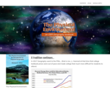
In 2017 Geography went to the Pitts… (that is me…)…I learned at that time that college textbook prices were out of pace and made college that much more difficult for students to attend.
I wanted to do my part… I looked into a free online book and found Michael E. Ritter’s “The Physical Environment An Introduction to Physical Geography” free Online Educational Resource e-book.
In Summer 2020 in the midst of a pandemic I learned that Michael Ritter would be retiring his book. He was kind enough to share the source information and I decided to take it on… I hope to make changes as needed and add material but most importantly I want to keep this resource available for those of us who relied on the content for the instruction of our students.

Updated Fall 2023
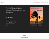
This textbook was designed especially for Community College students, as a resource to instill the knowledge and adventure that the discipline of geography holds for so many of us. The following units will cover a wide array of topics such as: Earth’s grid system, weather, climate, rivers, oceans, deserts, basic geology, and cartography. This book also integrates virtual field trips and interactive multimedia.
The Text Has 19 units;
Unit 1: Introduction to Geography as a Discipline
Unit 2: Earth’s Place within the Cosmos
Unit 3: Introduction to Geology & Geologic Time
Unit 4: Mapping Earth’s Surface
Unit 5: Earth-Sun Relationships: Reasons for the Seasons
Unit 6: Earth’s Atmosphere
Unit 7: Elements of Weather & Climate
Unit 8: Basic Mineral Development
Unit 9: Igneous Rocks
Unit 10: Sedimentary Rocks
Unit 11: Metamorphism & Metamorphic Rocks
Unit 12: Weathering & Soils
Unit 13: Earths Dynamic Surface: Plate Tectonics
Unit 14: Earths Dynamic Surface: Tectonics Force
Unit 15: Earths Dynamic Surface: Volcanoes
Unit 16: Shaped by Coastal Processes
Unit 17: Shaped by Rivers & Running Water
Unit 18: Shaped by Wind as a Geomorphic Agent
Unit 19: Shaped by Glaciers
Word Count: 51481
ISBN: 978-0-9880427-0-4
(Note: This resource's metadata has been created automatically by reformatting and/or combining the information that the author initially provided as part of a bulk import process.)

Word Count: 51481
(Note: This resource's metadata has been created automatically by reformatting and/or combining the information that the author initially provided as part of a bulk import process.)
Welcome to Physical Geography at College of the Canyons.
This textbook was designed especially for College of the Canyons students, as a resource to instill the knowledge and adventure that the discipline of geography holds for so many of us. The following units will cover a wide array of topics such as: Earth’s grid system, rivers, oceans, deserts, basic geology, and cartography.
Word Count: 113467
(Note: This resource's metadata has been created automatically by reformatting and/or combining the information that the author initially provided as part of a bulk import process.)
This site presents maps of a geographic location currently in the news.

This article highlights lessons and activities that ask students to plan expeditions to Antarctica. Students use math, science, and geography to plan their routes, clothing, and food.

This article provides links to polar-themed arts and crafts activities.

This article features activity books and polar-themed children's literature for use in the elementary classroom.

This article provides an overview of the geography, characteristics, and life of the Arctic and Southern Oceans.
Engage middle school students in a meaningful study of the lives of students from across the globe through the use of contemporary nonfiction and fiction. Students create personal autobiographies, sequence story events, and prepare well-crafted summaries while learning to use higher-level comprehension strategies such as Question-Answer Relationships and the Bio-Cube. Additionally, students conduct a critical study of the NCSS Notable Tradebook Nasreen̍s Secret School: A True Story From Afghanistan by Jeanette Winter, comparing and contrasting their own lives to Nasreen̍s and expanding their geographical knowledge of the Middle East.
In this unit, students will explore the different forms of transportation over time—from the New World and early America, to present day—and their impact on society and the environment (Change and Continuity). They will explore the impact of the different forms of transportation on economics, migration, and geography (where people live and how they adapt their environment to their transportation need), as well as how to become critical readers by gathering information from a variety of primary and secondary sources to understand the impact of transportation on history.

Short Description:
A comprehensive manual describing the process of preparing the DJI Phantom 3 Professional for photogrammetric image capture using a pre-programmed mission plan.
Word Count: 4487
(Note: This resource's metadata has been created automatically by reformatting and/or combining the information that the author initially provided as part of a bulk import process.)
Students produce a set of eight personal travel 'insights' from field trips within their bioregion. Each insight consists of an image produced by the student and accompanying text; students are producers of meaning rather than consumers.
(Note: this resource was added to OER Commons as part of a batch upload of over 2,200 records. If you notice an issue with the quality of the metadata, please let us know by using the 'report' button and we will flag it for consideration.)

Describe different sociological models for understanding global stratificationUnderstand how studies of global stratification identify worldwide inequalities