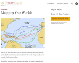
Students explore the world of maps and learn how to view the world around them in a two-dimensional format.
- Subject:
- History
- Material Type:
- Lesson Plan
- Provider:
- National Endowment for the Humanities
- Provider Set:
- EDSITEment!
- Date Added:
- 09/06/2019

Students explore the world of maps and learn how to view the world around them in a two-dimensional format.
Population research is important to Geography. This assignment is designed to teach students about population and to translate that into a geospatial map.
Term-long course activity for student groups to map the flow of stormwater runoff on newly developed or altered properties in and for the City of Bothell.
(Note: this resource was added to OER Commons as part of a batch upload of over 2,200 records. If you notice an issue with the quality of the metadata, please let us know by using the 'report' button and we will flag it for consideration.)
This activity is an investigative introduction to mapping. Students create maps and determine important map features.
The past decade has seen an explosion of new mechanisms for understanding and using location information in widely-accessible technologies. This Geospatial Revolution has resulted in the development of consumer GPS tools, interactive web maps, and location-aware mobile devices. This course brings together core concepts in cartography, geographic information systems, and spatial thinking with real-world examples to provide the fundamentals necessary to engage with Geographic Information Science. We explore what makes spatial information special, how spatial data is created, how spatial analysis is conducted, and how to design maps so that they're effective at telling the stories we wish to share. To gain experience using this knowledge, we work with the latest mapping and analysis software to explore geographic problems.

This collection of Liberia maps includes twenty examples from the American Colonization Society (ACS), organized in 1817 to resettle free black Americans in West Africa. These maps show early settlements in Liberia, indigenous political subdivisions, and some of the building lots that were assigned to settlers. This on-line presentation also includes other nineteenth-century maps of Liberia.

Marbling paper is a form of art that produces "monotypes"--every piece is unique because of the process! It also has a long history as a form of art and decoration. This resource includes a video tutorial detailing how to marble paper yourself. Use it to support Maryland Visual Arts Standards for Grades 6-8 or Maryland Social Studies Frameworks for Grade 7. For Visual Arts Standard 1, indicator I:6-8:1, have students first research the history of sumi, ebru, or monotyping, then plan a marbled work to reflect the same motivations as historic artists using one of those forms. For example, sumi may reflect concerns about the future since some historians believe it was related to ink divination, so a student could marble over a calendar that is relevant to them, a sketch of a future event, a saying about the future, or even try to marble a pattern like a calendar page. For Grade 7, Content Topic "Geographic Characteristics" have students map different appearances of paper marbling mentioned in the video along with their date and express whether they think the spread can be attributed to a single discovery that traveled, multiple discoveries that spread, or multiple independent discoveries. Students could even marble over these maps. If you evaluate or use this resource, please respond to this short (4 question) survey here bit.ly/3dfwEK8
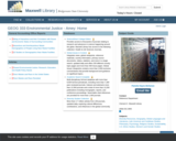
The BSU MaxGuide for GEOG 333 (Environmental Justice) includes documents of historical importance relevant to the history of the environmental racism - environmental justice movement, including the first GAO reports in pdf format, and will be updated to links to journal articles tracing the roots of environmental racism, the problems of identifying environmental racism, the geographic nature of environmental racism, the issues of scale and sampling, and its shift into the larger embrace of environmental/social justice.
Migration: An Empathy Exercise is a multi-step reflective exercise designed to build empathy and personal insight into processes of loss, change, and reconnection associated with the disruption of personal and cultural connections to landscape.
(Note: this resource was added to OER Commons as part of a batch upload of over 2,200 records. If you notice an issue with the quality of the metadata, please let us know by using the 'report' button and we will flag it for consideration.)
In this lesson students will learn about Minnesota's natural resources, particularly iron ore.
This is a version of the UN climate mock negotiations exercise developed by Shangrila Joshi Wynn.
(Note: this resource was added to OER Commons as part of a batch upload of over 2,200 records. If you notice an issue with the quality of the metadata, please let us know by using the 'report' button and we will flag it for consideration.)
One lecture for GEOG 265 – Introduction to GIS with video resources and edited auto-generated captions. Revised text has been published in these videos as new subtitles in English and Spanish.
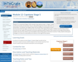
Module 12 is comprised of Stage 5 of the semester-long capstone project. In Stage 5, students compile, organize, summarize and synthesize the data and information they've collected through the semester about their assigned food region into a final website or presentation. As outlined in the diagram below, the final website (or presentation) should summarize the physical and human environment of the food region and assess the current status of the regional food system. Students must then discuss future scenarios for their region for temperature and human population growth. Based on their research on the regional food systems, students will assess the resilience and vulnerabilities of the exiting systems to the future scenarios. Finally, students will propose strategies to increase the sustainability and resilience of the regional food systems.
(Note: this resource was added to OER Commons as part of a batch upload of over 2,200 records. If you notice an issue with the quality of the metadata, please let us know by using the 'report' button and we will flag it for consideration.)
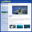
Of all the animals in the oceans, the hammerhead shark may be one of the strangest looking. The exact purpose of the wide, flat head is a mystery, but several theories abound. In this video, we travel to the shark-infested waters of the Galapagos in Ecuador and to a research station in Hawaii to learn about the unusual habits of these sinister-looking sharks. Jonathan swims in schools of hundreds of hammerheads, and yet the sharks ignore him. What are the sharks up to? Please see the accompanying study guide for educational objectives and discussion points.
This inquiry focuses on the relationship between national parks and Americans. In this inquiry, students will learn about the need and the formation of National Parks. Lastly, students will form their own thoughts on what national parks mean to the United States. Resource created by Katelyn Bonifas, West Holt Public Schools, as part of the Nebraska ESUCC Social Studies Special Projects 2023 - Inquiry Design Model (IDM).
Students are introduced to our planet's structure and its dynamic system of natural forces through an examination of the natural hazards of earthquakes, volcanoes, landslides, tsunamis, floods and tornados, as well as avalanches, fires, hurricanes and thunderstorms. They see how these natural events become disasters when they impact people, and how engineers help to make people safe from them. Students begin by learning about the structure of the Earth; they create clay models showing the Earth's layers, see a continental drift demo, calculate drift over time, and make fault models. They learn how earthquakes happen; they investigate the integrity of structural designs using model seismographs. Using toothpicks and mini-marshmallows, they create and test structures in a simulated earthquake on a tray of Jell-O. Students learn about the causes, composition and types of volcanoes, and watch and measure a class mock eruption demo, observing the phases that change a mountain's shape. Students learn that the different types of landslides are all are the result of gravity, friction and the materials involved. Using a small-scale model of a debris chute, they explore how landslides start in response to variables in material, slope and water content. Students learn about tsunamis, discovering what causes them and makes them so dangerous. Using a table-top-sized tsunami generator, they test how model structures of different material types fare in devastating waves. Students learn about the causes of floods, their benefits and potential for disaster. Using riverbed models made of clay in baking pans, students simulate the impact of different river volumes, floodplain terrain and levee designs in experimental trials. They learn about the basic characteristics, damage and occurrence of tornadoes, examining them closely by creating water vortices in soda bottles. They complete mock engineering analyses of tornado damage, analyze and graph US tornado damage data, and draw and present structure designs intended to withstand high winds.
This inquiry leads students through an investigation of natural disasters and why people live in areas that are consistently affected by natural disasters. Resource created by Matt Myers, Nebraska City Public Schools, as part of the Nebraska ESUCC Social Studies Special Projects 2023 - Inquiry Design Model (IDM).

An Open Geospatial Textbook
Short Description:
The purpose of this text is to promote understanding of the Geographic Information Science and Technology enterprise (GIS&T, also known as "geospatial").
Long Description:
The purpose of this text is to promote understanding of the Geographic Information Science and Technology enterprise (GIS&T, also known as “geospatial”).
Word Count: 102175
(Note: This resource's metadata has been created automatically by reformatting and/or combining the information that the author initially provided as part of a bulk import process.)
This lesson unit provides an insight into the navigational methods of the Bronze Age Mediterranean peoples. The students explore the link between history and astronomical knowledge. Besides an overview of ancient seafaring in the Mediterranean, the students use activities to explore early navigational skills using the stars and constellations and their apparent nightly movement across the sky. In the course of the activities, they become familiar with the stellar constellations and how they are distributed across the northern and southern sky.
Will Nebraska's environment sustain today's farmers and ranchers? This inquiry leads students through an investigation of the physical geography of Nebraska and its impact on farming and ranching in the state. Resource created by Jessica Christensen, Creek Valley Public Schools, as part of the Nebraska ESUCC Social Studies Special Projects 2024 - Inquiry Design Model (IDM).