Updating search results...

Search Resources

216 Results

View
Selected filters:
  • tectonics
Surface Processes and Landscape Evolution
Conditional Remix & Share Permitted
CC BY-NC-SA
Rating
0.0 stars

The course offers an introduction to quantitative analysis of geomorphic processes, and examines the interaction of climate, tectonics, and surface processes in the sculpting of Earth’s surface.

Subject:
Atmospheric Science
Physical Science
Material Type:
Full Course
Provider Set:
MIT OpenCourseWare
Author:
Crosby, Ben
Whipple, Kelin
Date Added:
09/01/2004
Sustainable Design and Technology Research Workshop
Conditional Remix & Share Permitted
CC BY-NC-SA
Rating
0.0 stars

This workshop investigates the current state of sustainability in regards to architecture, from the level of the tectonic detail to the urban environment. Current research and case studies will be investigated, and students will propose their own solutions as part of the final project.

Subject:
Applied Science
Architecture and Design
Atmospheric Science
Physical Science
Social Science
Material Type:
Full Course
Provider Set:
MIT OpenCourseWare
Author:
Glicksman, Leon
Scott, Andrew
Date Added:
02/01/2004
Tectonic Plates Life Cycle Drag and Drop
Conditional Remix & Share Permitted
CC BY-NC-SA
Rating
0.0 stars

This activity will allow students to manipulate Google slide textboxes to explore different features of tectonic plates and their interactions.


Provenance: Beverly Owens, Cleveland Early College High School
Reuse: This item is offered under a Creative Commons Attribution-NonCommercial-ShareAlike license http://creativecommons.org/licenses/by-nc-sa/3.0/ You may reuse this item for non-commercial purposes as long as you provide attribution and offer any derivative works under a similar license.

(Note: this resource was added to OER Commons as part of a batch upload of over 2,200 records. If you notice an issue with the quality of the metadata, please let us know by using the 'report' button and we will flag it for consideration.)

Subject:
Biology
Life Science
Material Type:
Activity/Lab
Provider:
Science Education Resource Center (SERC) at Carleton College
Provider Set:
Teach the Earth
Author:
Beverly Owens
Molly Ludwick
Date Added:
09/26/2022
Tectonics of Fiction
Conditional Remix & Share Permitted
CC BY-NC-SA
Rating
0.0 stars

This writing project of our Tectonics course is assigned at the start of the semester and due near the end. It is a group project that encourages creativity, cooperation, and synthesis of an entire curriculum's worth of concepts. Students create a tectonic history, with evidence, of a fictional world from a published map in a work of fiction.

(Note: this resource was added to OER Commons as part of a batch upload of over 2,200 records. If you notice an issue with the quality of the metadata, please let us know by using the 'report' button and we will flag it for consideration.)
Subject:
Applied Science
Biology
Environmental Science
Life Science
Material Type:
Homework/Assignment
Lesson Plan
Provider:
Science Education Resource Center (SERC) at Carleton College
Provider Set:
Teach the Earth
Author:
Kyle Fredrick
Date Added:
09/01/2020
Tension gashes with Jell-O
Conditional Remix & Share Permitted
CC BY-NC-SA
Rating
0.0 stars

The purpose of this activity is to help students visualize how tensions gashes form.

(Note: this resource was added to OER Commons as part of a batch upload of over 2,200 records. If you notice an issue with the quality of the metadata, please let us know by using the 'report' button and we will flag it for consideration.)
Subject:
Biology
Life Science
Material Type:
Activity/Lab
Provider:
Science Education Resource Center (SERC) at Carleton College
Provider Set:
Teach the Earth
Author:
Emily Peterman
Date Added:
09/01/2019
Testing plate tectonics in the Gulf of California
Conditional Remix & Share Permitted
CC BY-NC-SA
Rating
0.0 stars

This is a simple exercise to use real-world data from recent large earthquakes so that students can "test" for themselves if plate tectonics "works" in the Gulf of California.

(Note: this resource was added to OER Commons as part of a batch upload of over 2,200 records. If you notice an issue with the quality of the metadata, please let us know by using the 'report' button and we will flag it for consideration.)
Subject:
Biology
Geoscience
Life Science
Physical Science
Material Type:
Activity/Lab
Provider:
Science Education Resource Center (SERC) at Carleton College
Provider Set:
Teach the Earth
Author:
Paul Umhoefer
Date Added:
11/15/2016
Testing the Fixed-hotspot-moving-plate model
Conditional Remix & Share Permitted
CC BY-NC-SA
Rating
0.0 stars

Students have read about Earth's magnetism, magnetic inclination, and how remnant magnetism can be used to reconstruct plate motions and they have completed a quiz on these topics. This activity presents them with data from Tarduno et al., 2003, published in Science (vol 301, p 1064-1069) and asks them to examine the fixed-hotspot model in light of these data. The activity asks them to interpret magnetic inclination data (and coral data) and reconstruct a plate motion/hotspot motion scenario that agrees with the evidence.

(Note: this resource was added to OER Commons as part of a batch upload of over 2,200 records. If you notice an issue with the quality of the metadata, please let us know by using the 'report' button and we will flag it for consideration.)
Subject:
Biology
Life Science
Material Type:
Activity/Lab
Provider:
Science Education Resource Center (SERC) at Carleton College
Provider Set:
Teach the Earth
Author:
Sara Harris
Date Added:
08/29/2020
Thermal Exhumation Model
Conditional Remix & Share Permitted
CC BY-NC-SA
Rating
0.0 stars

One of the means investigators use to determine uplift rates in mountain building areas is the heat flow measurements. Heat flow is determined by the geotherm in the area which is often assumed to be linear, another way of describing that is conductive. Of course because the mountains are actively uplifting, then the heat flow has an advective component that must be taken into account that causes the geotherm to be non-linear (banana shaped). Students construct a simple one stock model that calculates the conductive heat flow out of an uplifting parcel of rock and graph the temperature vs. depth for vairous uplift rates and parcel sizes.

(Note: this resource was added to OER Commons as part of a batch upload of over 2,200 records. If you notice an issue with the quality of the metadata, please let us know by using the 'report' button and we will flag it for consideration.)
Subject:
Biology
Life Science
Physical Science
Physics
Material Type:
Activity/Lab
Provider:
Science Education Resource Center (SERC) at Carleton College
Provider Set:
Teach the Earth
Author:
Steve Hurst
Date Added:
08/25/2019
Thermobarometry Problem Set
Conditional Remix & Share Permitted
CC BY-NC-SA
Rating
0.0 stars

This homework assignment gives students first-hand experience with thermobarometric calculations. Because many of my students are math challenged, I give them a choice of solving the equations by hand or with Excel. They must first look at mineral compositions and make predictions regarding relative pressures, then calculate conditions for two sets of compositions, and finally use the P-T results to evaluate a tectonic hypothesis. The "thinking" questions are very open ended and can involve discussion of diffusion, heat flow, and tectonic settings.

(Note: this resource was added to OER Commons as part of a batch upload of over 2,200 records. If you notice an issue with the quality of the metadata, please let us know by using the 'report' button and we will flag it for consideration.)
Subject:
Biology
Life Science
Mathematics
Measurement and Data
Physical Science
Physics
Statistics and Probability
Material Type:
Activity/Lab
Data Set
Interactive
Lesson Plan
Provider:
Science Education Resource Center (SERC) at Carleton College
Provider Set:
Teach the Earth
Author:
Jane Selverstone
Date Added:
08/11/2019
Timing of mineralization in the palm of your hand: Cross-cutting relations, copper minerals and ore-forming hydrothermal fluid evolution
Conditional Remix & Share Permitted
CC BY-NC-SA
Rating
0.0 stars

This lab is designed to familiarize students with the geologic history of an ore-deposit, deciphered in the palm of your hand. By determining cross cutting relations of veins and mineralogy, students decipher the evolution of mineralizing fluids that formed the minerals of a copper ore deposit.

This lab accompanies lectures/classes in economic geology and ore mineralogy, either in a mineralogy or petrology course. It can also accompany studies of fluid rock interactions, fracture flow, fluid evolution, or geochemistry; or these topics be woven together using this lab as a base. This lab exercise also integrates previously learned material: cross-cutting relationships (Introductory Geology),with determination of mineralogy (Mineralogy), review of idochromatic elements producing color and their use in mineral identification (Mineralogy),chemistry of the fluids (Geochemistry), and changes in fluids with time during hydrothermal alteration events (Economic Geology). It also demonstrates the linkage between fluid composition, igneous petrology, ore geology and mineralogy.

(Note: this resource was added to OER Commons as part of a batch upload of over 2,200 records. If you notice an issue with the quality of the metadata, please let us know by using the 'report' button and we will flag it for consideration.)
Subject:
Biology
Chemistry
Life Science
Physical Science
Physics
Material Type:
Activity/Lab
Provider:
Science Education Resource Center (SERC) at Carleton College
Provider Set:
Teach the Earth
Author:
Barb Dutrow
Date Added:
09/08/2020
Topographic differencing: Earthquake along the Wasatch fault
Conditional Remix & Share Permitted
CC BY-NC-SA
Rating
0.0 stars

After a big earthquake happens people ask, 'Where did the earthquake occur? How big was it? What type of fault was activated?' We designed an undergraduate laboratory exercise in which students learn how geologists and geodesists use topography data acquired using airborne laser scanning (a.k.a lidar -- light detection and ranging) to answer these questions for a *make-believe*, but realistic earthquake scenario along the Wasatch Fault in Salt Lake City, Utah.

During a large earthquake, tectonic plates shift past each other. Rapid slippage generates seismic waves that propagate away and cause significant damage to buildings, roads, and critical infrastructure. The movement of faults at depth permanently displaces the Earth's surface in a way that depends on the magnitude of the earthquake, the amount and sense of slip, and the fault's geometry. Immediately following an earthquake, geologists play a critical role in assessing damage, measuring the geometry of the activated fault, and estimating the likelihood of an upcoming earthquake on nearby faults.Â

In this assignment, students pretend that they are geologists working for the United States Geological Survey (USGS) and must respond to a recent earthquake along the Wasatch Fault. They aid in the response by mapping the surface rupture and calculating the surface displacement, coseismic slip, and earthquake magnitude from high resolution lidar topographic imagery acquired before and after the earthquake.Â

Lidar point cloud data are a set of (x, y, z) measurements that represent the elevation and are sometimes associated with the color of the Earth's surface. The irregular-spaced individual elevation measurements within a topography dataset are often gridded into a digital elevation model (DEM) raster where the data are represented with rows and columns of pixels each with a height value. DEM's are often visualized as topographic hillshades, which mimic how the elevation would appear from above. Topographic differencing is a technique used to estimate 3D surface displacements from high-resolution topographic imagery acquired before and after an earthquake. The exercise includes pre- earthquake imagery acquired by the state of Utah in 2013-2014. The "post-earthquake" mimics the lidar imagery that would be acquired in the days to weeks following a major earthquake.Â

****** The earthquake in this exercise represents a hypothetical event. The 'post' event high resolution topography was synthetically displaced, in a way that simulates a possible earthquake along the Wasatch fault given mapped fault geometry and earthquake scaling laws. An event similar to the hypothetical earthquake here is possible: Since 1847 when pioneers settled in Salt Lake City, there have been over 16 earthquakes with magnitude greater than 5.5. Geologic studies show repeated large earthquakes occurred prior to European settlement in the region. Recently (March 18, 2020), the Salt Lake Valley was shaken by the M5.7 Magna earthquake. This recent reminder further motivates our exercise.******
Â
Keywords: Earthquakes, active tectonics, structural geology, geodesy, lidar, remote sensing


Provenance: Chelsea Scott, Arizona State University at the Tempe Campus
Reuse: This item is offered under a Creative Commons Attribution-NonCommercial-ShareAlike license http://creativecommons.org/licenses/by-nc-sa/3.0/ You may reuse this item for non-commercial purposes as long as you provide attribution and offer any derivative works under a similar license.

(Note: this resource was added to OER Commons as part of a batch upload of over 2,200 records. If you notice an issue with the quality of the metadata, please let us know by using the 'report' button and we will flag it for consideration.)
Subject:
Biology
Life Science
Material Type:
Activity/Lab
Provider:
Science Education Resource Center (SERC) at Carleton College
Provider Set:
Teach the Earth
Author:
Chelsea Scott
Date Added:
02/02/2022
Tracking Tectonic Plates Using Two Independent Methods
Conditional Remix & Share Permitted
CC BY-NC-SA
Rating
0.0 stars

Students come to this activity familiar with the basic assumptions of plate tectonics. Using a Google Earth platform showing commonly accepted lithospheric plate boundaries as well as locations of GPS stations, students form a hypothesis about motions expected across a particular boundary. They then set about testing their hypotheses by plotting motion vectors using two independent methods.

METHOD 1: LONG-TERM "MODEL" RATES OF PLATE MOTION
Students use a "Plate Motion Calculator" to determine "model" rates of plate motion averaged over millions of years.

METHOD 2: GPS MEASUREMENTS INTERPRETED IN TERMS OF PLATE MOTION
Students interpret GPS data as near real-time rates of plate motion. RESULTS Students find that in general, plate tectonic theory holds up. However, they also discover sophisticated detail -- rates are not constant, internal deformation of plates does occur and some boundaries are "wider" than others. Student evaluations of the activity demonstrate that they feel engaged and empowered as they work with authentic data, and gain a sophisticated understanding of a fundamental theory as well as the process of doing science.

(Note: this resource was added to OER Commons as part of a batch upload of over 2,200 records. If you notice an issue with the quality of the metadata, please let us know by using the 'report' button and we will flag it for consideration.)
Subject:
Biology
Life Science
Mathematics
Measurement and Data
Statistics and Probability
Material Type:
Activity/Lab
Provider:
Science Education Resource Center (SERC) at Carleton College
Provider Set:
Teach the Earth
Author:
Laurel Goodell
Date Added:
08/29/2019
Uncovering Plate Tectonics
Conditional Remix & Share Permitted
CC BY-NC-SA
Rating
0.0 stars

This activity is a guided investigation into the process of plate tectonics and resulting features. It's a look at the resulting effects which we see as volcanoes, earthquakes, and mountains.

Subject:
Geology
Physical Science
Material Type:
Activity/Lab
Provider:
Science Education Resource Center (SERC) at Carleton College
Provider Set:
Pedagogy in Action
Author:
Richard Busse
Date Added:
08/10/2012
Understanding Geologic Maps
Conditional Remix & Share Permitted
CC BY-NC-SA
Rating
0.0 stars

This is an exercise in which students are reintroduced to geologic maps and encouraged to "deconstruct" the map into constituent elements in order to understand the geologic history of the area. The preceding lectures in the course have recapitulated material that the students have covered in Introduction to Physical Geology. During class, the students work through the maps that were part of lab exercises in the Intro level course, so that basic concepts are recalled (superposition, cross-cutting relationships, basic faults and folds). The final product is a geologic history of this map area.

(Note: this resource was added to OER Commons as part of a batch upload of over 2,200 records. If you notice an issue with the quality of the metadata, please let us know by using the 'report' button and we will flag it for consideration.)
Subject:
Biology
Geology
Life Science
Physical Science
Material Type:
Activity/Lab
Provider:
Science Education Resource Center (SERC) at Carleton College
Provider Set:
Teach the Earth
Author:
Cara Burberry
Date Added:
08/19/2019
Unit 1: Earthquake!
Conditional Remix & Share Permitted
CC BY-NC-SA
Rating
0.0 stars

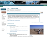
In this opening unit, students develop the societal context for understanding earthquake hazards using as a case study the 2011 Tohoku, Japan, earthquake. It starts with a short homework "scavenger hunt" in which students find a compelling video and information about the earthquake. In class, they share some of what they have found and then engage in a series of think-pair-share exercises to investigate both the societal and scientific data about the earthquake.

Show more about Online Teaching suggestions
Hide
Online-ready: This opening class discussion about earthquakes and societal impacts could easily be converted to an online discussion format.

(Note: this resource was added to OER Commons as part of a batch upload of over 2,200 records. If you notice an issue with the quality of the metadata, please let us know by using the 'report' button and we will flag it for consideration.)
Subject:
Biology
Career and Technical Education
Economics
Environmental Studies
Geology
Life Science
Physical Science
Social Science
Material Type:
Activity/Lab
Case Study
Module
Provider:
Science Education Resource Center (SERC) at Carleton College
Provider Set:
Teach the Earth
Author:
Vince Cronin, Baylor University (Vince_Cronin@baylor.edu) Phil Resor, Wesleyan University (presor@wesleyan.edu)
Date Added:
02/02/2022
Unit 1: Hazards at Transform Plate Boundaries
Conditional Remix & Share Permitted
CC BY-NC-SA
Rating
0.0 stars

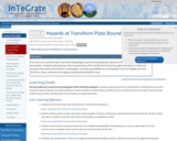
This unit uses scientific data to quantify the geologic hazard that earthquakes represent along transform plate boundaries. Students will document the characteristics of the Pacific/North American plate boundary in California, analyze information about historic earthquakes, calculate probabilities for earthquakes in the Los Angeles and San Francisco areas, and assess the regional earthquake probability map.

(Note: this resource was added to OER Commons as part of a batch upload of over 2,200 records. If you notice an issue with the quality of the metadata, please let us know by using the 'report' button and we will flag it for consideration.)
Subject:
Biology
Life Science
Mathematics
Measurement and Data
Statistics and Probability
Material Type:
Activity/Lab
Module
Provider:
Science Education Resource Center (SERC) at Carleton College
Provider Set:
Teach the Earth
Author:
Laurel Goodell
Peter Selkin
Rachel Teasdale
Date Added:
09/28/2022
Unit 1: "If an earthquake happens in the desert..."
Conditional Remix & Share Permitted
CC BY-NC-SA
Rating
0.0 stars

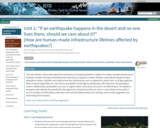
This unit initiates a discussion about the importance of recognizing faults in relation to modern societal infrastructure. Students consider the types of infrastructure necessary to support a modern lifestyle, especially for people living in population centers. Students also explore how key infrastructure such as aqueducts, power lines, or oil/gas pipelines, which traverse large distances, may also be susceptible to damage by earthquakes well away from the population centers. Additionally, earthquakes can occur in regions where none have occurred in recorded history. The ability to recognize and evaluate the potential for damage to key infrastructure that are near or cross a fault can be used, in turn, to classify and ultimately predict the most and least likely locations for damage, and to make suggestions for minimizing future impacts.

Show more about Online Teaching suggestions
Hide
Online-ready: The exercise is electronic and could be done individually or in small online groups (using the Google Earth rather than printable files). Lecture can be done in synchronous or asynchronous online format, although synchronous would allow better discussions of societal impacts of earthquakes.

(Note: this resource was added to OER Commons as part of a batch upload of over 2,200 records. If you notice an issue with the quality of the metadata, please let us know by using the 'report' button and we will flag it for consideration.)
Subject:
Applied Science
Biology
Career and Technical Education
Engineering
Environmental Studies
Geology
Life Science
Mathematics
Measurement and Data
Physical Science
Material Type:
Activity/Lab
Module
Provider:
Science Education Resource Center (SERC) at Carleton College
Provider Set:
Teach the Earth
Author:
Bruce Douglas
Gareth Funning
Date Added:
09/26/2022
Unit 1: Slip-sliding away: case study landslides in Italy and Peru
Conditional Remix & Share Permitted
CC BY-NC-SA
Rating
0.0 stars

How have mass-wasting events affected communities, and what lessons have we learned from these natural disasters that might help us mitigate future hazards? In this unit, students answer these questions by being introduced to the landscape and societal characteristics that contributed to loss of property and life during the 1970 Nevado HuascarÃn (Peru) and 2010 San Fratello (Sicily, Italy) events.

Show more about Online Teaching suggestions
Hide
Online-ready: This opening class discussion about landslides and societal impacts could easily be converted to an online discussion format.

(Note: this resource was added to OER Commons as part of a batch upload of over 2,200 records. If you notice an issue with the quality of the metadata, please let us know by using the 'report' button and we will flag it for consideration.)
Subject:
Biology
Life Science
Material Type:
Activity/Lab
Case Study
Module
Provider:
Science Education Resource Center (SERC) at Carleton College
Provider Set:
Teach the Earth
Author:
Becca Walker
Sarah Hall
Date Added:
02/02/2022
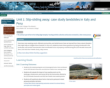
Unit 2: Identifying faulting styles, rates and histories through analysis of geomorphic characteristics (Lidar)
Conditional Remix & Share Permitted
CC BY-NC-SA
Rating
0.0 stars

Can active faults be identified remotely, based upon their appearance in the landscape? How can the geomorphic features associated with active faults be used to classify and quantify fault movement? In this unit, students will analyze lidar data and remote sensing imagery, with the aim of discovering how different styles and timescales of faulting are recorded in the landscape. Concepts pertinent to earthquake hazard and infrastructure risk -- such as average slip per event, earthquake recurrence, and fault slip rate -- will be investigated.

Show more about Online Teaching suggestions
Hide
Online-ready: The exercise is electronic and could be done individually or in small online groups (using the Google Earth rather than printable files). Lecture can be done in synchronous or asynchronous online format.

(Note: this resource was added to OER Commons as part of a batch upload of over 2,200 records. If you notice an issue with the quality of the metadata, please let us know by using the 'report' button and we will flag it for consideration.)
Subject:
Biology
Career and Technical Education
Environmental Studies
Geology
Life Science
Mathematics
Measurement and Data
Physical Science
Material Type:
Activity/Lab
Module
Provider:
Science Education Resource Center (SERC) at Carleton College
Provider Set:
Teach the Earth
Author:
Bruce Douglas
Gareth Funning
Date Added:
09/26/2022
Unit 2: Risk at Transform Plate Boundaries
Conditional Remix & Share Permitted
CC BY-NC-SA
Rating
0.0 stars

This unit builds on what students have learned about transform fault hazards to introduce the idea of risk. Students examine earthquake risk along the San Andreas Fault in San Francisco by examining public school sites around the city. Students calculate relative risk (risk = hazard probability x vulnerability x value) due to earthquake hazards at five sites, analyze different seismic hazard scenarios, communicate risks to stakeholders, and evaluate possible responses to seismic hazards. Students conclude with a summative assessment in which they reflect on the value of earthquake forecasts and warnings in mitigating risk.

(Note: this resource was added to OER Commons as part of a batch upload of over 2,200 records. If you notice an issue with the quality of the metadata, please let us know by using the 'report' button and we will flag it for consideration.)
Subject:
Biology
Life Science
Mathematics
Measurement and Data
Statistics and Probability
Material Type:
Activity/Lab
Module
Provider:
Science Education Resource Center (SERC) at Carleton College
Provider Set:
Teach the Earth
Author:
Laurel Goodell
Peter Selkin
Rachel Teasdale
Date Added:
01/04/2022