
General Biology for Majors I Mohave College Lab Manual
- Subject:
- Biology
- Material Type:
- Activity/Lab
- Homework/Assignment
- Lesson
- Author:
- Tonya Jackson
- Date Added:
- 07/01/2024

General Biology for Majors I Mohave College Lab Manual

The Open for Antiracism (OFAR) Program – co-led by CCCOER and College of the Canyons – emerged as a response to the growing awareness of structural racism in our educational systems and the realization that adoption of open educational resources (OER) and open pedagogy could be transformative at institutions seeking to improve. The program is designed to give participants a workshop experience where they can better understand anti-racist teaching and how the use of OER and open pedagogy can empower them to involve students in the co-creation of an anti-racist classroom. The capstone project involves developing an action plan for incorporating OER and open pedagogy into a course being taught in the spring semester. OFAR participants are invited to remix this template to design and share their projects and plans for moving this work forward.
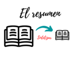
Lección sencilla para orientar a estudiantes de maestría en artes, para la elaboración del Resumen de su Informe Final de tesis o trabajo de graduación.
This is a great handout to complete in class with your students as an in-class activity or assign as out-of-class work. This handout helps students generate speech topics.
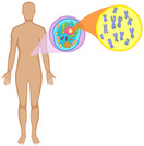
Students will use effective research skills to find and select appropriate information to create a "poster" to inform others about a genetic disorder. They will use their research to create a single PowerPoint slide to be used as a poster or fact sheet that presents information about the genetic disorder they select. The slide will be graded on the information presented, neatness, and legibility. Students will then share their research in a Gallery Walk to learn about the genetic disorders researched by their classmates. As they read/listen to the information presented for each project, they will take notes and provide comments.

this was a flipped classroom assignment for a Biology class. It has a few starter questions and a video to watch. The students will watch the video and take Cornell Style notes.
This fully digital Common Core Standards aligned middle and high school curriculum can be used with GeoGebra tools for interactive and engaging instruction. You can monitor all student progress in real time for in person, remote, or hybrid settings.
Students view the documentary "Taking Root: the Vision of Wangari Maathai." They also are required to read Dr. Maathai's "The Greenbelt Movement: Sharing the Approach and Experience." The students must write an essay describing the geo-politics inherent within the Greenbelt Movement, specifically as it relates to environmental security. The students must next examine the potential for a similar social movement to be effective in Myanmar.
Students geocode the locations of the "big box stores" Walmart and Target from addresses that they download. They then compare the spatial distribution of stores at the state level by performing a spatial join with a shapefile of US states, and comparing the distribution of stores with the population of each state. Finally, they write a report of their results as a recommendation for future action, either by an environmental group or a development group.
The Keystone Pipeline is a complex project that raises important environmental, economic, and international policy issues. Tar sands from Alberta Canada will be mined and processed and transported on a ~1700 mile pipeline to refineries in the United States. How should decisions be made responsibly and ethically to balance societal energy needs with anticipated environmental impacts related to mining and processing the tar sands and the ultimate impacts on climate change.
(Note: this resource was added to OER Commons as part of a batch upload of over 2,200 records. If you notice an issue with the quality of the metadata, please let us know by using the 'report' button and we will flag it for consideration.)

Basic physical, cultural and economic elements and their integration on a world and regional basis.

This Urbanisation lesson uses a range of resources such as:powerpoint presentationswritten textsactivitiesYoutube videos images

Geography Remote Sensing Class Activities
GEOG 286 : REMOTE SENSING
DESCRIPTION
Introduces students to the theory and methods of remote sensing through use of satellite imagery. Practical exercises involve use of SPOT, LANDSAT and Quickbird images with ArcGIS/Imagine Analysis software. Digital analysis is discussed and performed including preprocessing, image classification and image evaluation. Intended for students enrolled in the second year of GIS or UAS programs, or similar academic preparation (see program director for details).
LEARNING OUTCOMES
1. Demonstrate knowledge and apply skills essential to the discipline.
2. Apply GIS skills necessary to provide geospatial and thematic data.
3. Apply critical thinking and problem solving skill that reflect best practice.
4. Coordinate and manage the delivery of reliable, valid, GIS data including analysis and specialized user needs products.
5. Communicate effectively and appropriately within a professional setting in both written and oral form.
For this assignment, students will use a graphic organizer to think about how the geography and environment of a place have shaped the economy, culture, society, and politics of Mesopotamia, Mesoamerican, Andean societies as well as a society of their choice.
Latin America covers part of North America, South America, and the West Indies. It stretches from lifeless Atacama desert to rugged highlands and Alpine glaciers of the Andes mountains. The fertile plains of the Pampas are one of the world's richest agricultural regions. The Amazon Basin is the largest and wettest lowland in the world. Culturally, Latin America is a great mixture of European, indigenous and African cultures.
In this course, we will examine the peoples and places of Latin America from a geographical perspective. We will explore the geographical dimensions of economic, cultural, political, and physical forces influencing Latin America as a region. We will have a mixture of thematic and regional approaches to study the concepts and look into various physical and historical processes that have shaped dynamic and diverse cultural landscapes. We will study contemporary environmental and developmental issues, trends in migration, agricultural change, and globalization to understand Latin America's position in the global economy.
COURSE LEVEL LEARNING OUTCOMES
Define Latin America as a world region.
Identify the main physical and cultural features and characteristics of Latin America.
Interpret maps, graphs, and visuals as tools for analyzing the distribution patterns of phenomena and understanding their importance in the context of Latin America.
Explain the impacts of European colonialism in Latin America.
Evaluate how changing cultural, social, political, and economic characteristics of Latin American countries influence internal strife and external intervention.
Explain the complexities that contributed to the social inequality, political conflict, and environmental concerns prevalent in some Latin American countries.
Discuss the changing political and economic relationships between the United States and countries in Latin America.
This exercise is designed to simulate how a basic geological investigation of a site takes place. A basic geological investigation includes familiarizing yourself with the unconsolidated sediments, rocks, structural geology, and groundwater present at your site. As part of this exercise you will have to properly identify a variety of rock types and sediments, create maps that represent data you collected at each location, and complete a basic report of your findings (optional). Once completed, this exercise should give students a basic understanding of how the various concepts used throughout the semester are applied in the real world in the form of a geological investigation.
(Note: this resource was added to OER Commons as part of a batch upload of over 2,200 records. If you notice an issue with the quality of the metadata, please let us know by using the 'report' button and we will flag it for consideration.)
Half way through the second semester of our year-long integrated Sed/Strat and Structure course we travel to Sheep Mountain, Wyoming where the students spend 5 days describing and measuring section and the constructing geologic and structural maps. The field data gathered then form the basis for a paper titled: "Geologic History of the Sheep Mountain Region". In addition to simply making geologic maps, stratigraphic sections and structural cross-sections, the students have to put the local geology into the broader contexts of the Big Horn Basin and sequences of western orogenies.
(Note: this resource was added to OER Commons as part of a batch upload of over 2,200 records. If you notice an issue with the quality of the metadata, please let us know by using the 'report' button and we will flag it for consideration.)
Each student in the Geological Oceanography class writes a series of one-page papers for topics throughout the semester, presents one topic as a 3 to 5 minute oral presentation, and revises all papers as a portfolio for submission at the end of the semester. The eight topics are objects in the solar system, minerals, rocks, hydrothermal vents, volcanoes & earthquakes, marine sediments, hurricanes & typhoons, and tides.
This is a short writing assignment given in the second semester of an introductory geology course. Students are encouraged to come up with ideas for places around the world that they wish to investigate with respect to geology. The instructor cross-compares lists and assigns locations maximizing global spread of the places covered. Students must review not only the geological history of the location but how society in that place is influenced by the underlying landscape (e.g., mining for resources, natural hazards, etc). Goals include a) encouraging their curiosity about geology with respect to places that may have meaning to them, b) strengthening research and writing skills, and c) using this assignment as a way to synthesize concepts learned in class as related to a particular location around the world.
This Google Slides presentation is a great resource on a review day for various geometric constructions. Links embedded in the presentation allow students to work through constructions at their own pace and in their own order.